Wet Microburst Produces Damages In Carlsbad, NM - July 4th, 2022.
Carlsbad, New Mexico.
Courtesy Of Stormy Jeannine Blankenship.
Via The 411 For Carlsbad, NM Facebook Page.
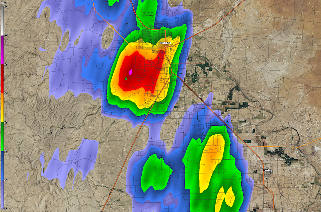
NWS Midland Dual Pol Doppler Radar Snapshot.
NWS Midland Dual Pol Doppler Radar Snapshot.
(2:09 PM MDT July 4th, 2022).
A pulse-type thunderstorm developed just south of Carlsbad on the 4th of July. This storm formed quickly and dissipated quickly. As it rolled over the southern end of town and into central Carlsbad it produced very heavy rainfall. From the reports that I could find storm totals were around a half of an inch of rain in about 15-20 minutes. This caused minor street flooding in parts of Carlsbad. This is the second wet microburst to produce damage in Carlsbad this summer. See my blog post for more information via this link.
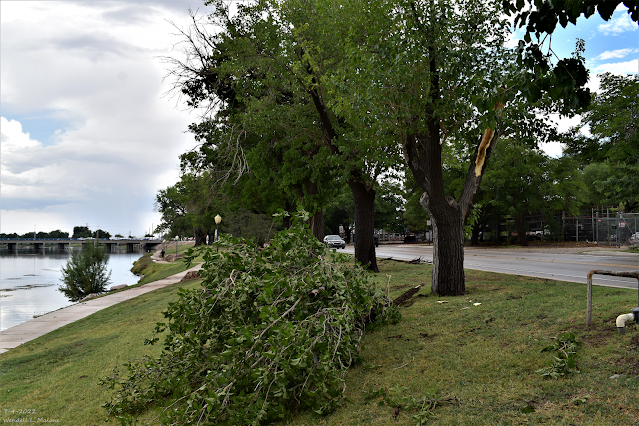
This thunderstorm briefly became severe and produced a wet microburst which downed numerous tree limbs in parts of southern and central Carlsbad as well as the beach area. It also snapped a power pole and blew off a metal roof in southern Carlsbad according to Facebook reports from the public. A single-wide small mobile home (not tied down) was also blown over.
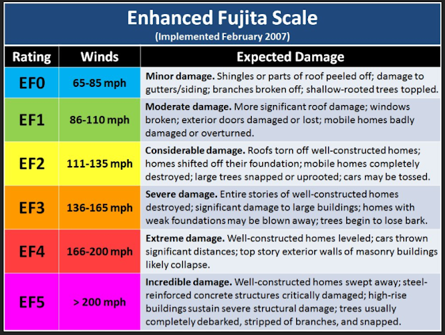
Wet microbursts during thunderstorms are not unheard of in New Mexico. At times during our annual summer monsoon, they can occur frequently from time to time. Wind gusts during these strong/severe thunderstorms wind gusts can and often do exceed 75-100 mph. The damage they produce can equal that of a weak tornado (F0 to F1 in strength). Many people mistake the damage caused by these storms for tornadoes and such was the case in Carlsbad Monday.
There Are None So Blind As Those Who "Will - Not" To See...107.


Comments
Post a Comment
Your comments, questions, and feedback on this post/web page are welcome.