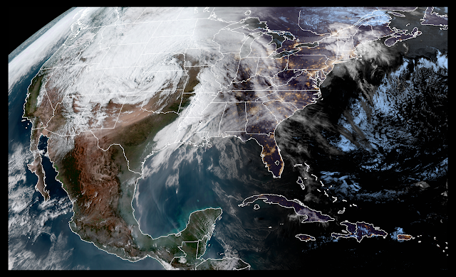
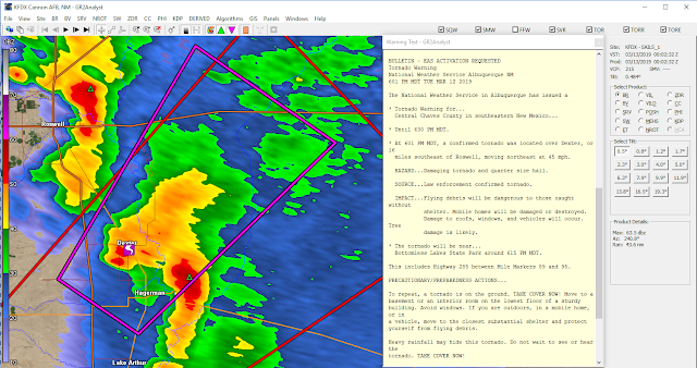
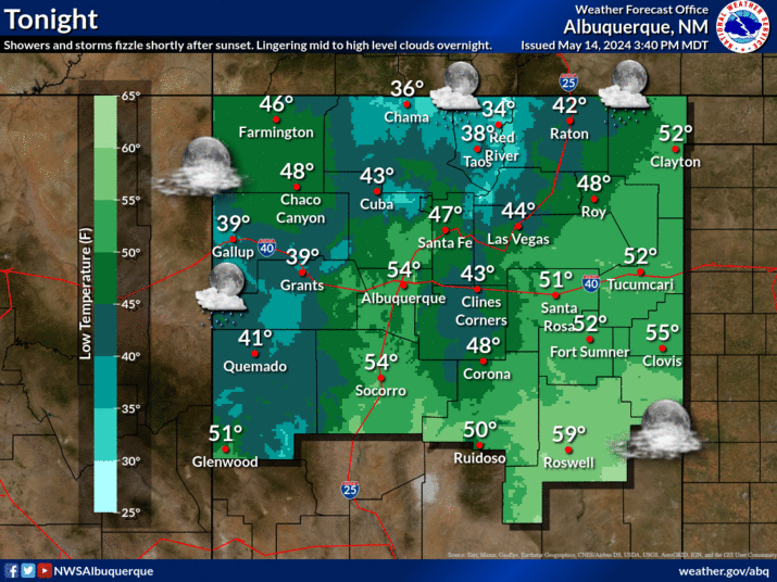
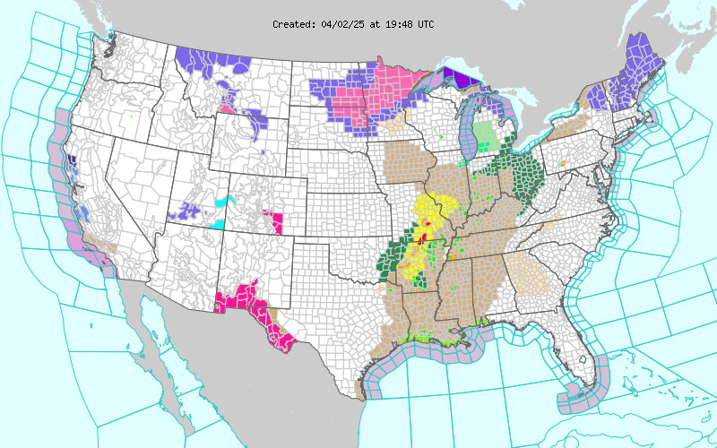
Current National Weather Service Watches/Warnings In Effect.

My Current Weather

Ruidoso Live Web Cam

Cloudcroft Live Web Cam

Sunday, March 31, 2019

A Light Freeze This Morning - Another One Monday Morning.


March 15th, 2019.
Looking Southwest From Just East Of San Augustin Pass, East Of Las Cruces, New Mexico At The Organ Mountains. Snow Covers The Higher Elevations.

A Light Freeze This Morning.


Most of the local area experienced a light freeze this Sunday Monday and will do so again Monday morning. The coldest low temperatures observed this morning were noted in the higher valleys of the Sacramento Mountains where readings in the teens were recorded.

Typically the Pecos Valley of Southeastern New Mexico on average experiences its last freeze of the spring during the first week of April. 

Average Last Spring Freeze-

Roswell-  April 8th.
Artesia-  April 14th.
Carlsbad-  April 2nd.
Hobbs- April 4th.
Cloudcroft-  May 21st.

Chilly Again Today.


Another Light Freeze Tonight.

NWS NDFD Forecast Low Temps Monday Morning.


NWS NDFD Forecast Snowfall Totals Tonight Into Monday.


As a weak upper level disturbance moves southeastward across the state tonight into tomorrow midday it is forecast to produce light snow showers across the Sacramento and Guadalupe Mountains. Current forecasts call for an inch or less of accumulations across the higher elevations by noon Monday. Northern Lea County may see a mix of light rain and light snow showers late tonight into early Monday morning but no accumulations are expected. Its possible that the rest of Southeastern New Mexico could see a few light rain or snow showers but no accumulations are currently forecast for the area.


After a chilly start to the upcoming work week on Monday we quickly rebound temperature-wise climbing back up into the upper 70's to near 80 by Tuesday. The rest of the week looks uneventful. 

The Truth Is Stranger Than Fiction - And Sometimes It Hurts!

Friday, March 29, 2019

Mid To Upper 80's Today - Light Snow & Another Freeze By Monday Morning.


 March 16th, 2019.
Corrales, New Mexico.


I almost made it up to 90ºF today...89.4ºF. 


At 3:45 PM MDT Friday, March 29th, 2019.

Regional Temperatures.


At 3:45 PM MDT Friday, March 29th, 2019.


Valid At 6 AM MDT Saturday, March 30th, 2019.

As of 4 PM MDT this Friday afternoon a cold front was oozing into the northern Texas Panhandle. Regional temperatures at 4 PM ranged from the mid to upper 80's across Southeastern New Mexico and parts of West Texas ahead of the cold front to the upper 30's to the mid 40's behind the front in the Oklahoma Panhandle, southeastern Colorado, and southwestern Kansas. That colder air mass will arrive here locally by around sunrise Saturday morning.


An upper level storm is forecast to move southeastward from the Four Corners across the state Sunday into Sunday night. Light snow is forecast to fall across the Sacramento Mountains where and inch or so of snow may accumulate. Light rain may also change over to light snow Sunday night across parts of the Southeastern Plains. At this time no significant accumulations are expected. 


Valid Tonight Through Monday At Noon MDT.

This quick moving storm is currently forecast to only produce light rainfall totals locally with most totals remaining below a tenth of an inch.

Turning Colder - A Freeze Sunday Night.


Saturday.


Depending upon upon how fast the cold front moves southward late tonight into Saturday morning will help to determine how much colder Saturday's daytime highs will be compared to today's readings. For now expect our highs tomorrow to range from the mid to upper 40's in the Clovis and Portales areas and northern Lea County to near 60 in the Carlsbad area. These readings will be some 15 to 20-degrees below normal to date.

Sunday.


Sunday's highs will be a little colder than Saturdays readings with highs ranging from the mid 40's to the mid 50's. These readings could even turn out to be a little lower if cloud cover devolves early enough which will be some 20-degrees below normal to date.

Another Freeze By Monday Morning.


By sunrise Monday Monday morning a freeze will have settled in across the area. Should the skies clear early Sunday night the forecast low temps above may be even a little colder.

The Truth Is Stranger Than Fiction - And Sometimes It Hurts!

Friday, March 22, 2019

High Wind Event March 13th 2019.


March 13th, 2019.

A massive dust storm developed in response to Wednesday's high winds. This huge cloud of blowing dust stretched northeastward from northern Mexico across southern and southeastern New Mexico, West Texas, and into Oklahoma and Kansas.

March 14th, 2019.
Courtesy Of Jason Laney 
Cloudcroft, New Mexico.


 @JasonLaney2 Mar 14
Thanks to Fire Dept for helping with our damage survey. Here is one of the firefighters putting the drone in the air.

March 17th, 2019
Near Cloudcroft, New Mexico.

Quote- "Sunday was a productive day for line crews working on the outage. The Sac Peak line was re-energized restoring service to 90% of Timberon, along with Aspen Meadows, Aspen Groove, Bug Scuffle, Benson Ridge, Alamo Peak and Sunspot.
If you still do not have electricity, please report the outage by calling 1-800-548-4660.
After working 16 hour days since the wind storm, crews are exhausted but will return Monday morning to finish making repairs to lines feeding those still without service in Cloudcroft, Timberon and Long Ridge."

March 13th, 2019.
Roswell, New Mexico.

(March 13th, 2019).

High Wind Event March 12-13th, 2019 National Weather Service Midland/Odessa Despite West Texas and Southeast New Mexico being known for their breezy conditions in late-winter/early-spring, an anomalous wind event transpired across the Southern High Plains during the evening March 12th , and through the morning and afternoon of March 13th, 2019. The setup was historical in many facets with areas over the Central High Plains experiencing wide spread blizzard conditions, severe weather, high wind damage, and multiple site surface low pressure records broken over the storms life cycle. 

What Happened? A strong storm system over the Western US strengthened over the course of a few days, leading to one of the highest impact weather events across the Central and Southern Plains in recorded history. High winds were common for a large chunk of the Rockies and the Southern Plains with severe blizzard conditions over Eastern Colorado, Wyoming, and the Dakotas. In West Texas and Southeast New Mexico, winds were the story, with persistent wind gusts in excess of 60 mph in many locations the night of March 12th , and throughout the day of March 13th . 

High Wind Warnings were issued in anticipation of this significant high wind event. Winds easily reached these significant thresholds across the region. For more on the meteorological evolution of the historical storm system, please refer to the Meteorological Synopsis below. Meteorological Synopsis: On the morning of March 13th, a potent, negatively tilted upper-trough was traversing the Central Rockies with a rapidly developing surface cyclone over the lee side of the Continental Divide in Southeastern Colorado. 

At the base of the trough, a very strong 300mb jet streak extended back across the Four Corners region and into the West Texas, Southeast NM High Plains. Through the course of the day, the surface low over Southeastern Colorado exhibited rapid surface cyclogenesis with intense pressure falls of more than 2mb/hr for several hours between 12z March 13th and 0z March 14th. The combination of the intense pressure falls and a coupled jet streak over the Southern Plains culminated in a very tight pressure gradient with deep mixing potential for strong winds to the surface. 

Strong wind gusts began from west to east with Southeast NM and the adjacent Guadalupe Mountains across Texas experiencing a sharp increase in surface wind gusts just after 14z March 13th. As the day unfolded, deep mixing with ample sunshine led to winds mixing efficiently to 700mb where 60 to 70 knot winds were positioned through the course of the afternoon. Damaging wind gusts of 60-80 mph were observed across the Southeast NM Plains and the Permian Basin with gusts of 90+ mph across the Guadalupe Mountains. The strongest recorded wind gust of 103 mph was measured at Pine Springs, TX from the local Guadalupe National Park Mesonet at 1:09 pm CDT. Winds slowly decayed around sunset, but windy conditions prevailed for several hours after as the local pressure gradient was slow to lift while the storm progressed to the northeast across Kansas and Nebraska.

Wind Reports: Below is a bulleted list of local wind reports/observations taken during the course of the event on March 12th - 13th.*

  62 mph – Presidio, TX Presidio County; Presidio ASOS (8:35 pm CDT 3/12) 
 63 mph – Panther Junction, TX Brewster County; Panther Junction RAWS (12:38 am CDT) 
 64 mph – Carlsbad, NM Eddy County ; 
Carlsbad ASOS (10:56 am CDT) 
 70 mph – 17 W Orla, TX Culberson County; Trained Spotter (11:51 am CDT)
  77 mph – Pine Springs, TX Culberson County; Guadalupe Pass ASOS (11:51 am CDT) 
 63 mph – Midland, TX Midland County; Midland ASOS (12:18 pm CDT)  60 mph – Tarzan, TX Martin County; 2 WNW Tarzan Mesonet (12:56 pm CDT) 
103 mph – Pine Springs, TX Culberson County; Pine Springs Mesonet (1:09 pm CDT) 
 66 mph – Artesia, NM Eddy County; Artesia AWOS (1:55 pm CDT)
  60 mph – Lamesa, TX Dawson County; Lamesa AWOS (2:15 pm CDT)  65 mph – Seagraves, TX Gaines County; 1 SW Seagraves Mesonet (2:35 pm CDT)
  58 mph – Snyder, TX Scurry County; Snyder AWOS (2:55 pm CDT) 
 66 mph – Welch, TX Dawson County; Welch Mesonet (3:21 pm CDT) 
 74 mph – 7 NW Maljamar, NM Eddy County; Caprock RAWS (3:40 pm CDT)
  73 mph – Tatum, NM Lea County; 2 SW Tatum Mesonet (3:40 pm CDT)
  66 mph – Andrews, TX Andrews County; 2 E Andrews Mesonet (4:20 pm CDT) 
 98 mph – 3 NNW Pine Springs, TX Culberson County; Guadalupe Bowl RAWS (5:38 pm CDT) 
 67 mph – Hobbs, NM Lea County; Hobbs AWOS (6:50 pm CDT) 

* Wind events listed in chronological order of occurrence Summary: Strong winds were experienced over a large portion of the NWS Midland forecast areas with winds over 60 mph observed for several locales. The storm itself was a true testament to the power of rapidly developing surface cyclones with impacts from this system stretching across the Rockies and the entire Central US. The 103 mph observed wind at Pine Springs Mesonet is in the top reported wind gust from anywhere in the United States during the storms life cycle. This event will go down as one of the top non-thunderstorm wind events in the West Texas, Southeast New Mexico corridor. 

(March 13th, 2019).


Overview… Strong westerly winds developed just after sunrise across the higher terrain of the Sacramento Mountains in Otero county. Sustained winds from the west of 60 to 70 mph with much higher gusts persisted through most of the day. By 11 AM the Village of Cloudcroft lost all power and would remain without power for more than 24 hours. Hundreds of ponderosa pines were either uprooted or snapped within the Village of Cloudcroft resulting in damage to 30 structures, 10 vehicles, and completely blocking 15 roads. Across the entire area surrounding Cloudcroft it is estimated that more than 1000 trees were either snapped or uprooted.

Location 1: 11:10 AM Estimated Max Wind Speed: 107 MPH A total of three large trees fell on this property. The largest measured approximately 4 feet in diameter at it’s base. The estimated wind gust of 107 MPH snapped this tree completely at it’s base, with the tree falling onto the home. Shortly thereafter another large tree across the street was uprooted and also fell into the home. Finally, a third tree in the yard next door was uprooted and fell on a car parked next to the home. In addition, several power lines came down as a nearby utility pole was also snapped (likely by a falling tree).

Location 2: 11:40 AM Estimated Max Wind Speed: 90 MPH A nearly 100’ tall ponderosa pine with a trunk measuring a little more than 2 feet in diameter was uprooted in the back yard of this home, falling directly on the roof. Upon impact, the trunk of the tree snapped in half with the top portion of the tree landing in the front yard. 

Location 3: 11:52 AM Estimated Max Wind Speed: 94 MPH Two separate trees came crashing down on this residence in southern parts of Cloudcroft. One tree was uprooted, falling across the front deck of the home and crushing a red Porsche parked in front of the home. A second tree, approximately 2 feet in diameter snapped in half, falling on a truck that was parked next to the house.

 Location 4: 11:53 AM Estimated Max Wind Speed: 101 MPH A very tall ponderosa pine with a trunk diameter of almost 3 feet completely snapped just above its base, allowing the entire tree to fall onto the front of a two-story house. The max wind gust here was estimated to be around 101 MPH. This house is actually located just next door to location 2 where a tree was uprooted by a 90 MPH wind gust less than 15 minutes earlier.

Location 5: 3:20 PM Estimated Max Wind Speed: 94 MPH Two trees fell on this property just south of Highway 82. The first was uprooted and fell across the front yard, narrowly missing this house. However, a second tree from the next-door neighbors back yard also was uprooted and fell directly on the home, puncturing a hole in the bedroom ceiling.

Survey Summary… This damage survey was conducted in the Village of Cloudcroft in Otero county following public reports of over 100 MPH wind gusts and reports of extensive damage within Cloudcroft and nearby areas. Extensive tree damage was observed including both uprooted ponderosa pines as well as pines snapped either at their bases or midsections. The Cloudcroft Fire Department escorted three meteorologists from NWS El Paso to multiple locations where both tree and property damage were located. Wind speed estimates based on the damage done to these hardwood trees suggested an extended period of stress due to sustained winds of near 70 MPH. The most significant tree damage appeared to have been caused by wind gusts exceeding 90 MPH with the highest estimated wind speed estimated to be around 107 MPH. Meteorological conditions at the time included very strong gradient winds (blowing primarily from the west) across the area extending from the surface to well above mountain top levels. Light to moderate frozen precipitation combined with the strong winds led to excessive rime ice build up on the windward side of the exposed trees. This ice accumulation likely caused the trees to become top-heavy, thus increasing their vulnerability to the strong wind.

The majority of the significant damage surveyed was located on a north to south exposed ridge line on the windward side of the mountain. Most of the damage also appeared to be located at the edge of canyons, where funneling of up-canyon winds resulted in the higher wind gusts that were ultimately responsible for the most extensive damage.

Report Courtesy: Jason Laney – Warning Coordination Meteorologist (NWS El Paso) Greg Lundeen – Science and Operations Officer (NWS El Paso) Jordan Pegram – Meteorologist (NWS El Paso).

(March 13th, 2019).


New Mexico Reported Peak Wind Gusts.
(March 13th, 2019).


The Truth Is Stranger Than Fiction - And Sometimes It Hurts!

Thursday, March 21, 2019

Dexter, NM Tornado March 12th, 2019.


GR2Analyst Radar Snapshot.

Captured At 6:03 PM MDT Tuesday, March 12th, 2019.

Public Information Statement
National Weather Service Albuquerque, NM
712 PM MDT Wed Mar 13 2019

...NWS DAMAGE SURVEY FOR 3/12/2019 TORNADO EVENT...

.OVERVIEW...
Just before 6 pm MDT on Tuesday, March 12th a tornado touched down in
Chaves county, about 15 miles south southeast of Dexter. The tornado
moved north northeast for approximately 15 minutes, and eventually
dissipated about one half mile northeast of the community of Dexter.
Six people suffered minor injuries, and six homes were substantially
damaged or completely destroyed. An additional dozen homes and
structures also sustained minor to moderate damage.

.DEXTER TORNADO...

RATING:                 EF-2
ESTIMATED PEAK WIND:    111 - 135 mph
PATH LENGTH /STATUTE/:  15 miles
PATH WIDTH /MAXIMUM/:   150 - 350 yards
FATALITIES:             0
INJURIES:               6

START DATE:             Mar 12 2019
START TIME:             0555 PM MDT
START LOCATION:         15 SSE Dexter / Chaves County / NM
START LAT/LON:          33.0010 / -104.4402

END DATE:               Mar 12 2019
END TIME:               0610 PM MDT
END LOCATION:           0.5 NE Dexter / Chaves County / NM
END_LAT/LON:            33.2104 / -104.3603

SURVEY_SUMMARY: A damage survey was completed today in Chaves county.
This was the first March tornado documented in Chaves county since
1959, and the earliest known EF1 or stronger tornado in the state of
New Mexico. The last EF2 tornado in New Mexico occurred on May 23,
2012.

EF Scale: The enhanced Fujita Scale classifies tornadoes into
the following categories.

EF0...Weak......65 TO 85 mph
EF1...Weak......86 TO 110 mph
EF2...Strong....111 TO 135 mph
EF3...Strong....136 TO 165 mph
EF4...Violent...166 TO 200 mph
EF5...Violent...>200 mph

NOTE:
The information in this statement is preliminary and subject to
change pending final review of the event and publication in
NWS Storm Data.


The Truth Is Stranger Than Fiction - And Sometimes It Hurts!

Tuesday, March 19, 2019

Malaga Tornado March 12th, 2019.


March 12th, 2019.

Malaga tornado west of US Hwy 285 courtesy of Nicole Simonton shared on FaceBook by Tina Kitchens.

Tornado Watch #17.


Tornado Watch #17 was issued for Southeastern New Mexico and parts of West Texas on Tuesday, March 12th, 2019 at 3:30 PM MDT by the Storm Prediction Center (SPC) and was in effect until 10 PM MDT that evening. This watch meant that conditions were favorable for the development of severe thunderstorm capable of producing tornadoes in and close to the watch area during this time frame. 

Severe Thunderstorm Warning.


This GrLevel3 2.0 radar snapshot at 3:33 PM MDT showed the outline of the Tornado Watch (pink shaded box) as well as a Severe Thunderstorm Warning for Otero County which included the Alamogordo, Cloudcroft, and Mayhill areas. This rapidly developing squall line of severe thunderstorms was racing to the east at 55 mph.

Tornado Warning For South-Central Eddy County.


At 5:48 PM MDT a Tornado Warning remained in effect for south-central Eddy County including the Whites City, Black River Village, Loving, and Malaga areas. At 5:45 PM MDT a Park Ranger at the Carlsbad Caverns Visitors Center reported golf ball size hail covering the ground. Notice the strong hook echo showing up on radar wrapping back around into the Caverns Visitor Center. The main hail core was located east of Whites City along Creosote Rd and southward to the Black River. The severe thunderstorm producing the large hail and possible tornado was moving to the east at 50 mph.

GR2Analyst Radar Snapshot At 6:08 PM MDT..


Based on the Midland National Weather Service Survey Teams Assessment and radar data the Malaga tornado formed at 6:08 PM MDT southwest of the community. It lifted around 6:30 PM MDT or twenty two minutes later near State Highway 128 northeast of Malaga after being on the ground for 15 miles.


EF2 Tornado Near Malaga, New Mexico.

Another NWS survey team investigated a tornado that was spotted south of the community of Malaga in Eddy County New Mexico. A special thank you to Stacy Gifford for allowing us to use this image for the survey writeup. Based on radar imagery, the tornado appeared to develop just west of U.S. Highway 285, approximately 2-3 miles south of Malaga and progressed northeast, possibly for a number of miles. The exact path could not be determined during the survey due to the tornado’s containment within private lands, without roads to access the potential path. With insufficient ground information, the wooden electric power poles along Highway 285 were the only damage indicators available to assess tornado intensity.

Based on radar information, it appears the Malaga tornado formed at approximately 6:08 pm MDT, just southwest of the power poles on Highway 285 and lifted around 6:30 pm MDT (nearly crossing NM Highway 128, 3 miles east of junction with NM Highway 31) covering a distance of 15 miles.

Damaged power poles (image to the right, provided by Malaga Volunteer Fire Dept.) along Highway 285 were located slightly further south than was indicated on radar, 3.75 miles to 4.05 miles south of Malaga. This was used as a starting point. With the tornado crossing the power poles at approximately a 45- degree angle, the width of the tornado was estimated at 1/5 mile. Approximately 10 power poles that were damaged to some degree as the tornado crossed Highway 285. Poles on the north and south limits were snapped at 1/2 to 2/3 height from the ground, while near the center-line of the tornado's path, poles were snapped close to ground level. The observed damage is consistent with damage of an EF2 tornado, with winds estimated at approximately 112 mph.

In addition to tornado and straight-line wind damage, there were several reports of large hail. These reports included…

 • 2.75-inch hail (baseball size) 6-7 miles north of Pecos, 
TX. • 1.75-inch hail (golfball size) in Loving, NM and at Carlsbad Caverns.
 • 1.25-inch hail (half dollar size) in eastern Loving County, TX. 
• 1 inch hail was also reported in various locations across southeastern NM and West TX. 
• Hail damage also occurred in Malaga, NM although it is unknown how large this hail was at the time. 


Malaga Tornado March 12th, 2019.

Malaga Tornado March 12th, 2019.
Courtesy Of Live Storm Chasers - Russ D. Contreras.

Malaga Tornado March 12th, 2019.

Malaga Tornado March 12th, 2019.
Courtesy Of Live Storm Media.

Scored a tornado today in Malaga, Nm.3.12.19

. pic.twitter.com/fTTlRGWgxl— Russ D.Contreras (@Stormtrek1) March 13, 2019


Footage of a Tornado in Loving, NM
This is moving east at 30mph quickly along 128 through Eddy County. 
Folks in the path of this storm need to take cover.

Tornado - Malaga, NM

 Viewer/Follower Submitted

Tornadoes In Eddy County New Mexico.

Our last reported tornado in Eddy County prior to the Malaga tornado on March 12th, 2019 was an EF0 tornado that was reported 17 miles north-northeast of Carlsbad on September 17th, 2016 at 3:50 PM MST. It was estimated to be 200 yards wide and was on the ground for 0.92 miles. It touched down in open fields and no damages were reported. 

Our last reported EF2 tornado occured in downtown Carlsbad on June 7th, 1992 at 8:10 PM MST. Six people were injured in this tornado. It was estimated to have been 73 yards wide and was on the ground for one half of a mile. The damage path was down Church street to the beach area then northeastward into La Huerta. Damages were estimated at $250,000.

See more of my blog posts on tornadoes in Southeastern New Mexico by going to my home page on my weather web page and clicking on the titles and links (Local Tornadoes) in the right hand sidebar.

The Truth Is Stranger Than Fiction - And Sometimes It Hurts!

NWS Midland Forecast

NWS Midland Forecast

NWS Albuquerque Forecast

NWS Albuquerque Forecast

NWS Albuquerque Forecast

NWS Albuquerque Forecast

NWS El Paso Forecast

NWS El Paso Forecast

NWS Lubbock Forecast

NWS Lubbock Forecast

NWS Lubbock Forecast

Average Daily High/Low Temperatures & Rainfall/Snowfall