My Current Weather

Monday, December 31, 2018

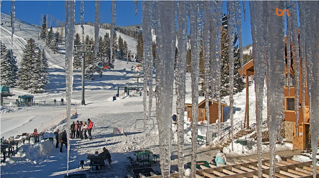
Major Winter Storm Ushers In The New Year Across New Mexico.

Blog Updated At 4:15 PM MST New Years Eve.

December 30th, 2018.
Looking West At Sierra Blanca Peak.
Courtesy Of My Wife Diane J. Malone.


3rd Winter Storm Headed To New Mexico.

(As Of 11 AM MST).

Click On The Link Above For The Latest Updated Information.
Then Click Anywhere On The Map That Your Are Interested In.
You Will Then Be Redirected To The Local National Weather Service Office.

Winter Storm Warnings, Winter Weather Advisories, Special Weather Statements, and Wind Chill Advisories are in effect for New Mexico and surrounding areas as of 11 AM MST this New Years Morning. 


Valid At 5 AM MST This New Years Eve Morning. 

Yet another very deep/strong (538dm at 18,000') and cold (-36ºC/-33ºF) upper level closed low is getting ready to wreck its havoc upon the Land of Enchantment today into at least Wednesday. Near sunrise this morning it was located over northern Utah. This upper level storm is colder than its two predecessors but (as of this morning) has less moisture to work with than our winter storm had a couple of days ago that buried parts of the state with heavy snow. 

US GFS 500 Millibar (18,000') Forecast.

Valid At 5 PM MST Wednesday, January 2nd, 2019.

Canadian (GEM) 500 Millibar (18,000') Forecast.

Valid At 5 PM MST Wednesday, January 2nd, 2019.

European (ECMWF) 500 Millibar (18,000') Forecast.

Valid At 5 PM MST Wednesday, January 2nd, 2019.

Like our most recent storm this one will be another slower mover too. Slowing moving or stationary closed or cutoff (cutoff from the jet stream) upper level lows are problems child's in the world of weather. They are notoriously hard to forecast and often present very challenging forecasting problems to those who are trying to forecast their associated weather.

Our last winter storm that unloaded heavy snow on parts of New Mexico a couple of days ago was one of these difficult storms. It was a very slow mover and for about twenty four hours just sat stationary near the Flagstaff, Arizona area. By the time begin to move far enough south to impact our weather here in far Southeastern New Mexico and parts of West Texas it had pretty much spent its best energy and moisture. That is also why some of our mountain communities like the Ruidoso and Cloudcroft areas got buried as well as other parts of the state.

All three of the long range forecast computer models (US GFS, the Canadian, and the European) are pretty close with their forecast locations and strength of this very cold closed low by sunset Wednesday. The medium range NAM model pretty much follows suit also. Last nights run of the European model had the center of the storm near Ruidoso at this time, the Canadian near Las Cruces, and the US model the GFS near Silver City.

Again as I often talk about its all about timing, location, track, and speed of these closed or cutoff upper level lows that play a major role in how our winter storms unfold across the state and nearby areas. This inbound storm is the coldest of the three so its likely to be the strongest. But as of this morning it does not have the mid-level to feed off of like our storm a couple of days ago did. This will play a role in limiting the overall snowfall totals. But...there always has to be a but in there somewhere right? But if this storm slows down, stalls, or ends up picking up more moisture then the snowfall from it could be heavier in some areas. If it heads further south than is currently forecast it would be in a better position to produce measurable snowfall here in Southeastern New Mexico.

Winter Storm Forecasts & Impacts.


Valid At 11 PM MST New Years Eve Night.

Since this storm is so cold at the mid and upper levels of the atmosphere this is also being reflected at the surface. A strong arctic cold front is forecast to move into Eastern New Mexico this afternoon and push southward and westward into Southeastern New Mexico and nearby West Texas by around sunset. It will back up against the central mountain chain and spill over into valleys to the west of the mountains tomorrow. Note the teens and single digit temperatures at 10 AM MST across Northeastern Colorado and Southeastern Wyoming. That's coming south.


Once the arctic air mass arrives tonight we are going to see some pretty cold high temps for New Years Day. Locally here in Southeastern New Mexico the 20's to near 30ºF. Much of the state is expected to see the coldest temperatures of the season associated with this arctic air mass over the next couple of days. 

NWS NDFD Forecast High Temp Anomalies New Years Day.


Our highs on New Years Day across the eastern one half of the state will be some 25º to 35º below normal. Wind chill values across Northeastern New Mexico will be below zero late tonight into New Years morning and across Eastern New Mexico and parts of Southeastern New Mexico single digits and teens are forecast.


Depending upon just how much snow falls and where and how long this next winter storm sticks around will play a huge role in just cold we get when its all over with in a couple of days. Given the fact that many parts of the state has snow on the ground now this will factor in too. So in short don't be suprised if you end up getting colder than what is shown on this map. Its not entirely out of the question to think that we could at least see some lows locally near 10º or even a few single digit readings. Come Thursday morning parts of New Mexico may have some of the coldest temperatures in the nation.


WPC Worst Case Scenario Storm Total Snowfall Forecast..


Valid Today Through 5 PM MST Wednesday, January 2nd, 2019.


So the bottom line is be prepared for the possibility of some changes in the forecasts across the local area and state. There may be additional watches or warnings issued on this storm by our local National Weather Service Offices. 

This is going to be another Major Winter Storm that is going to disrupt travel again in many areas of the state. Like the last storm a couple of days ago this one is going to produce some heavy to very heavy snowfall in some locations. Some of us in the state may end up getting more snow than is currently forecast (as of 11 AM MST this New Years Eve) and some of us may get less. This will highly dependent upon the exact track that this incoming Major Winter Storm takes, and or if it stalls, and or even speeds up some. 

There will likely be some road closures in those areas that get hit with the heavy snow, blowing snow, and drifting snow. With the bitter cold and brutal wind chills combining with the heavy to very heavy snowfall you may be taking your life in your hands and those traveling with you should you venture out on our open highways and roadways during the height of this winter storm! In these areas it might be a good idea to travel only if absolutely necessary. 

Impacts On Southeastern New Mexico & The Mountains.

Click On The Links For The Latest Updated Info.

South Central Mountains
Eastern Lincoln County
Tularosa Valley.

Winter Weather Advisories are in effect for late tonight into Midnight Tuesday for-
(Including The Ruidoso, Capitan, Carrizo, Tularosa, and Hondo Areas).

2" to 5" of new snow.
6" to 10" of new snow above 9,000'.

Southern Sacramento Mountains.

Winter Weather Advisories are in effect for late tonight into late Wednesday afternon.
(Including The Allamogordo, Tularosa, Cloudcroft, Mescalero, Sacramento/Weed, Timberon, Pinon, Mayhill, and High Rolls Areas).

3" to 5" of new snow.
Wind Chills down to -10ºF.

Eddy & Lea Counties.

A Special Weather Statement is in effect now into Wednesday. A wintry mix of freezing rain and snow will be possible across the local area New Years Day into Wednesday. Travel may be impacted across the Southeastern Plains. Additional watches or warnings may be issued later today, tonight, or New Years Day. 

Check back for later updates as this is an ongoing and fluid situation.


The Truth Is Stranger Than Fiction - And Sometimes It Hurts!

Sunday, December 30, 2018

Baby It Was Cold In NM This Morning!


Davis WeatherLink Personal Weather Stations.
Selected Low Temperatures This Sunday Morning.


Selected NM Lowest Temps This Morning.

Sandavol County.

Hidden Valley DRI (8,470') -39
Headquarters VHVC (8,673') -22
San Antonio DRI (8,523) -21

Colfax County.

Angel Fire Airport ASOS (8,330') -30

Cibola County.

Ramah Raws (7604') -20
Malpais Lava Flow Raws (7514') -18

NWS Albuquerque Storm Total Snowfall Forecast.

Valid New Years Eve - New Years Day.


Valid At 5 AM MST Wednesday, January 2, 2019.


New Years Day.

NWS NDFD Forecast Low Temperatures.


Keep in mind that this is an early temperature forecast and snowfall forecast. These values will likely change over the next couple of days. With additional heavy snowfall now forecast over much of the state New Years Eve through New Years don't be surprised if our low temperatures Wednesday morning end up quite a bite colder than currently forecast in some locations. Especially where deep snow cover currently exists. 

The Truth Is Stranger Than Fiction - And Sometimes It Hurts!

Saturday, December 29, 2018

2 Snow Storms Bury NM Since Dec 26th - 3rd Arrives In Time For New Years!


Blog Updated At 4:45 AM MST Sunday, December 30, 2018.

12-29-2018.
Our Home This Morning In Carlsbad, NM.

Well here in Carlsbad we pretty much got left in the cold with this snow storm. Light snow flurries fell off and on all day Friday but didn't amount to anything. Further north in the Artesia and Roswell areas they picked up 1" to 3" of snow on Friday. This morning Hope reported 5" on the ground and at 9 AM I had 3/4 of an inch on the ground at our home. Next Time.


Snapshot Captured At 6:54 AM MST This Saturday Morning.

Ski Apache (base at 9,600' west of Ruidoso, NM) reported a storm total of 42" of snowfall this morning. This brings their seasonal total up to 50" now. Reminds me of our winters in the 1960's, 1970's, 1980's, and 1990's. WOW!

Birds Eye View Of New Mexico Snow Cover.

 Captured At 11:47 AM MST Saturday, Dec 29, 2018.

Yellow shades are low clouds, pink shades are high clouds, and white is snow.

Thirty nine years ago I was stationed aboard the USS Dwight D. Eisenhower (CVN-69) in the U.S. Navy during Christmas 1979. We had just received emergency orders to immediately set sail from Norfolk, Virginia (Pier 12) and head to the Gulf of Oman and the Persian Gulf off the coast of Iran. We were ordered to arrive on station and provide backup air support for the USS Nimitz (CVN-68) who was monitoring the hostage crisis and prepping for a rescue attempt of our fifty two American diplomatists who had been taken hostage by Iranian college students who called themselves "Muslim Student Followers of the Iman's Line." 

What in the world does this have to do with our latest winter storm to impact New Mexico?

Isn't that a beautiful satellite image (above) of the snow covering New Mexico this morning? I would set for hours on end in the Ike's weather office with a headset on listening to the pinging of the a satellite desperately hoping to be able to fine tune my signal and hone in on it in order to track it for our latest satellite pass. More often than not we failed. That was extremely tedious hard work and it took hours to get ready to manually position our satellite equipment on the Carrier to track the satellite as it zipped by overhead some 20,000 plus miles overhead. We only had minutes to lock onto the signal from the satellite and download its data for a printout. 

The Carrier was constantly moving and changing course to accommodate the Air Boss and Captain for launch and recovery missions. We flew and recovered our jets day and night...always training and always on guard for Russian and Iranian patrols. I would sit at our satellite receiver with my headset on. Continuously adjusting two sets of dials simultaneously to correct our satellite receiver antennas for azimuth and elevation changes as the weather satellite zipped overhead from horizon to horizon. 

 First we had to plot the course of the satellite using latitude and longitude on this massive board in a broom closet that was about four feet wide by 10 feet long. This after downloading numerical data via teletype from Fleet Weather Central in Norfolk, Virginia. This whole process was a tedious and monotonous exercise that often led to failure. 

When we were lucky enough to get a good pass and print a satellite photo of the storms around us as seen from space they were often grainy and had nowhere near the resolution that we see in today's images. Too many times we ended up with just a black shinny piece of paper because of some unanticipated abrupt change in the ships direction trying to adjust to rough seas in order  to recover an F-14, EA-6B, or A7 Coasir Bombers. 

Now I'm able to download images like the one above from the internet within seconds at will. My how the world has changed since those days when I was 21 compared to today. I had to have a top secret security clearance in order to try and receive those satellite images and today anyone can see them which are 10,000 times better than what we used. What a world we live in!


Third time is a charm right? So yet another winter storm is set to take aim on New Mexico beginning New Years Eve continuing into New Years Night. Maybe those of us who have been left out of getting a decent snowfall by the two previous two storms will get lucky this time.

Yes Charlie Brown It Does Snow In New Mexico!


(Dec 26th - Dec 29th, 2018).


New Mexico 48-Hour Snowfall Map.


New Mexico 72-Hour Snowfall Map.


(As Of 8 AM MST This Morning).


New Mexico CoCoRaHS 3-Day Heavier Snowfall Totals.
(As Of 8 AM MST This Morning).


Public Information Statement Spotter Reports National Weather Service El Paso TX 1056 AM MST Sat Dec 29 2018 The following are unofficial observations taken during the storm that has been affecting our region. Appreciation is extended to Skywarn spotters, news media, and mesonet operators including West Texas Mesonet and the Dona Ana County Flood Commission. This summary also is available on our home page at weather.gov/ElPaso. ********************STORM TOTAL SNOWFALL******************** LOCATION STORM TOTAL TIME/DATE COMMENTS SNOWFALL OF /INCHES/ MEASUREMENT NEW MEXICO ...Dona Ana County... 9 ESE Las Cruces 4.0 700 AM 12/29 ELEV 5318 FT COCORAHS Chaparral 3.2 700 AM 12/29 ELEV 4035 FT COCORAHS 1 ESE Las Cruces 0.9 800 AM 12/29 ELEV 4261 FT COCORAHS 1 ESE Las Cruces 0.8 840 AM 12/29 ELEV 4232 FT COCORAHS 1 SW Las Cruces 0.8 700 AM 12/29 ELEV 4032 FT COCORAHS 2 ENE Las Cruces 0.6 700 AM 12/29 ELEV 4281 FT COCORAHS 2 E Mesilla Park 0.6 700 AM 12/29 ELEV 3865 FT COCORAHS 1 S Las Cruces 0.5 700 AM 12/29 ELEV 4052 FT COCORAHS 6 SSE Las Cruces 0.5 700 AM 12/29 ELEV 4031 FT COCORAHS 2 N Las Cruces 0.5 800 AM 12/29 ELEV 4258 FT COCORAHS 6 ESE Las Cruces 0.5 700 AM 12/29 ELEV 4522 FT COCORAHS 6 SSE Las Cruces 0.5 700 AM 12/29 ELEV 4104 FT COCORAHS 5 NW Santa Teresa 0.5 700 AM 12/29 ELEV 3829 FT COCORAHS 4 SSW Las Cruces 0.5 700 AM 12/29 ELEV 3878 FT COCORAHS 4 NNE Las Cruces 0.5 700 AM 12/29 ELEV 4373 FT COCORAHS ...Grant County... 5 W Silver City 9.3 700 AM 12/29 ELEV 6352 FT COCORAHS 4 N Silver City 9.1 700 AM 12/29 ELEV 6664 FT COCORAHS 3 NNW Silver City 9.0 700 AM 12/29 ELEV 6296 FT COCORAHS 1 WSW Silver City 8.7 900 AM 12/29 ELEV 6072 FT COCORAHS 5 NE Silver City 8.5 700 AM 12/29 ELEV 6591 FT COCORAHS 2 NNE Silver City 8.5 700 AM 12/29 ELEV 6273 FT COCORAHS 3 SW Silver City 8.0 530 AM 12/29 ELEV 5942 FT COCORAHS 4 NW Silver City 7.8 700 AM 12/29 ELEV 6371 FT COCORAHS Silver City 7.7 600 AM 12/29 ELEV 5997 FT COCORAHS 3 N Bayard 7.7 700 AM 12/29 ELEV 6329 FT COCORAHS 3 NNW Silver City 7.0 700 AM 12/29 ELEV 6184 FT COCORAHS 11 NNW Silver City 7.0 700 AM 12/29 ELEV 5919 FT COCORAHS 3 SE Silver City 6.0 700 AM 12/29 ELEV 5885 FT COCORAHS 6 NE Cliff 4.5 700 AM 12/29 ELEV 4682 FT COCORAHS Gila Hot Springs 4.0 700 AM 12/29 ELEV 5742 FT COCORAHS ...Hidalgo County... 2 NNW Cotton City 3.2 700 AM 12/29 ELEV 4228 FT COCORAHS 8 NW Lordsburg 2.5 700 AM 12/29 ELEV 4213 FT COCORAHS ...Luna County... 27 WNW Deming 3.0 800 AM 12/29 ELEV 5051 FT COCORAHS 4 SE Deming 0.5 700 AM 12/29 ELEV 4270 FT COCORAHS ...Otero County... 2 SW Cloudcroft 25.5 700 AM 12/29 ELEV 8970 FT COCORAHS Sunspot 23.0 800 AM 12/29 ELEV 9262 FT COCORAHS 2 S Cloudcroft 17.5 800 AM 12/29 ELEV 8723 FT COCORAHS 6 ENE La Luz 16.0 800 AM 12/29 ELEV 6106 FT COCORAHS 3 WNW Mayhill 10.3 700 AM 12/29 ELEV 7262 FT COCORAHS 2 NNE Alamogordo 4.0 700 AM 12/29 ELEV 4550 FT COCORAHS 1 E Tularosa 3.5 800 AM 12/29 ELEV 4573 FT COCORAHS 9 N Alamogordo 3.0 700 AM 12/29 ELEV 4528 FT COCORAHS ...Sierra County... Kingston 3.3 700 AM 12/29 ELEV 6277 FT COCORAHS Hillsboro 0.6 700 AM 12/29 ELEV 5273 FT COCORAHS TEXAS ...El Paso County... 3 NNE El Paso 2.0 700 AM 12/29 ELEV 3921 FT COCORAHS 6 N El Paso 1.8 700 AM 12/29 ELEV 4127 FT COCORAHS 1 ENE Anthony 1.7 700 AM 12/29 ELEV 3966 FT COCORAHS 1 WSW El Paso 1.4 700 AM 12/29 ELEV 4167 FT COCORAHS 5 NNE El Paso 1.2 700 AM 12/29 ELEV 3926 FT COCORAHS 11 ENE El Paso 0.5 700 AM 12/29 ELEV 4007 FT COCORAHS $$ GRZYWACZ

NWS Albuquerque 43-Hour Storm Total Snowfall Amounts.
(As Of This 11:49 AM MST Saturday Morning).

PUBLIC INFORMATION STATEMENT
NATIONAL WEATHER SERVICE ALBUQUERQUE NM
1149 AM MST SAT DEC 29 2018

PRELIMINARY SNOW REPORTS ACROSS NORTH AND CENTRAL NEW MEXICO
FOR THE LAST 43 HOURS.

...COUNTY...                     STORM TOTAL   TIME/DATE OF
   LOCATION                       /INCHES/      MEASUREMENT

...BERNALILLO COUNTY...
   SEDILLO 1 ESE                    21.0        915 AM 12/29
   SEDILLO 2 NW                     16.0        855 AM 12/28
   PONDEROSA PINES                  15.0        700 PM 12/28
   TIJERAS 1 SSW                    10.3        915 AM 12/29
   ALBUQUERQUE 7 NE                  8.0        754 AM 12/28
   EDGEWOOD 6 NW                     7.0        945 PM 12/27
   ALBUQUERQUE 9 SE                  6.5        915 AM 12/29
      - FOUR HILLS AREA.
   SANDIA PARK                       5.6       1113 PM 12/27
   SANDIA PARK 8 W                   5.5        915 AM 12/28
   ALBUQUERQUE 8 ESE                 5.0       1113 PM 12/27
      - LOMAS AND TRAMWAY
   ALBUQUERQUE 9 NE                  5.0       1000 AM 12/28
      - PASEO DEL NOTRE AND TRAMWAY.
   ALBUQUERQUE 7 E                   4.5        830 AM 12/28
      - COMANCHE AND TRAMWAY.
   CANONCITO 7 WNW                   4.5        915 AM 12/28
   ALBUQUERQUE 5 E                   4.0        915 AM 12/28
      - MENAUL AND MOON.
   ALBUQUERQUE 7 ESE                 4.0        915 AM 12/28
      - CONSTITUTION AND CHELWOOD PARK BLVD.
   ALBUQUERQUE 8 ENE                 4.0        915 AM 12/28
      - SPAIN AND IMPERATA.
   ALBUQUERQUE 8 ESE                 4.0       1002 AM 12/28
      - INDIAN SCHOOL AND TRAMWAY.
   TIJERAS 3 ENE                     4.0        922 PM 12/27
   ALBUQUERQUE 7 NE                  4.0        818 AM 12/28
   ALBUQUERQUE 7 E                   3.7        915 AM 12/28
      - INDIAN SCHOOL AND CHELWOOD PARK BLVD.
   ALBUQUERQUE 5 E                   3.6        915 AM 12/28
      - EUBANK AND COMANCHE
   ALBUQUERQUE 5 NE                  3.5        900 AM 12/28
      - NEAR WYOMING AND HARPER
   SEDILLO 1 WSW                     3.0        915 AM 12/29
   ALBUQUERQUE 4 NE                  3.0        950 PM 12/27
      - SAN ANTONIO AND LOUISIANA.
   ALBUQUERQUE 5 NE                  3.0        915 AM 12/29
      - SAN FRANCISCO AND BARSTOW.
   ALBUQUERQUE 5 ESE                 3.0        915 AM 12/28
      - WYOMING AND COPPER.
   ALBUQUERQUE 5 ESE                 3.0       1230 PM 12/28
   ALBUQUERQUE 4 ESE                 2.8        930 AM 12/28
      - INDIAN SCHOOL AND WYOMING.
   ALBUQUERQUE 2 SE                  2.7        915 AM 12/28
      - CONSTITUTION AND CARLISLE.
   ALBUQUERQUE 5 NE                  2.5        915 AM 12/28
      - SAN ANTONIO AND LOUISIANA.
   ALBUQUERQUE 3 ESE                 2.5       1018 PM 12/27
      - UPTOWN
   ALBUQUERQUE 5 S                   2.0       1053 PM 12/27
      - KABQ ASOS.
   ALBUQUERQUE 6 NE                  2.0        900 AM 12/28
      - ALAMEDA AND LOUISIANA
   ALBUQUERQUE 7 E                   2.0        900 AM 12/28
      - SOUTH OF I-40 NEAR TRAMWAY
   ALBUQUERQUE 5 SE                  2.0       1047 AM 12/28
      - GIBSON AND SAN PEDRO
   ALBUQUERQUE 2 E                   1.6        915 AM 12/28
      - AZTEC AND SAN MATEO.
   ALBUQUERQUE 4 SSE                 1.5        915 AM 12/28
      - ZUNI AND SAN MATEO.
   ALBUQUERQUE 4 SE                  1.5        915 AM 12/28
      - GIBSON AND CARLISLE.
   ALBUQUERQUE 5 S                   1.2       1100 PM 12/27
      - NWS OFFICE.
   ALBUQUERQUE 7 SW                  1.0        900 AM 12/28
      - NEAR CENTRAL AND 98TH
   ISLETA PUEBLO 4 NNW               0.8        915 AM 12/28
   ALBUQUERQUE 2 SSE                 0.8        915 AM 12/28
      - CONSTITUTION AND GIRARD.
   ALBUQUERQUE 6 NNW                 0.6        134 PM 12/28
      - IRVING AND GOLF COURSE.
   ALBUQUERQUE 6 WSW                 0.5        900 AM 12/28
      - UNSER AND MCCANNON
   ISLETA PUEBLO 3 NNW               0.5        300 AM 12/28
   ALBUQUERQUE 3 W                   0.1        915 AM 12/28
      - CANDELARIA AND RIO GRANDE.

...CATRON COUNTY...
   MOGOLLON 6 ESE                    7.0        800 AM 12/28
      - SILVER CREEK DIVIDE SNOTEL.
   RED HILL                          6.0       1100 AM 12/28
   PIETOWN                           5.0       1100 AM 12/28
   DATIL 2 W                         3.7        915 AM 12/29
   OMEGA 8 NNW                       2.3        915 AM 12/28
   GLENWOOD 3 S                      2.0        825 AM 12/28
   ARAGON                            2.0       1100 AM 12/28
   DATIL                             1.0       1100 AM 12/28
   RESERVE                           1.0       1100 AM 12/28

...CHAVES COUNTY...
   DUNKEN 15 N                      14.0        715 PM 12/28
   DUNKEN 15 N                      12.0       1127 AM 12/28
   MESA 5 SSW                        5.0        915 AM 12/29
   ROSWELL                           3.1        915 AM 12/29
   ROSWELL 10 W                      3.0        900 AM 12/28
   ROSWELL 2 NW                      2.5        915 AM 12/29
   ROSWELL 5 E                       0.5        915 AM 12/28

...CIBOLA COUNTY...
   BLUEWATER LAKE 11 WSW            10.0        100 PM 12/28
      - RICE PARK SNOTEL.
   CUBERO                            6.0       1030 AM 12/28
   FENCE LAKE                        5.5        900 AM 12/28
   LAGUNA PUEBLO                     5.0       1253 PM 12/28
   GRANTS                            2.0       1030 AM 12/28
   GRANTS 1 W                        1.3        915 AM 12/28

...COLFAX COUNTY...
   ANGEL FIRE 1 SW                  14.0       1003 AM 12/28
   BLACK LAKE 5 ESE                  5.2        915 AM 12/29
   ANGEL FIRE 3 ESE                  5.0        700 AM 12/28
      - ANGEL FIRE SKI AREA.
   BLACK LAKE 5 ESE                  4.3        644 AM 12/28
   EAGLE NEST 4 N                    4.0        957 AM 12/28
   RED RIVER 11 ENE                  3.0        800 AM 12/28
      - SHUREE SNOTEL.
   SUGARITE 6 WNW                    2.0       1100 AM 12/28
   ANGEL FIRE                        1.7        915 AM 12/29
   SPRINGER                          1.0       1100 AM 12/28

...CURRY COUNTY...
   BROADVIEW                         4.0        340 PM 12/28
   RANCHVALE 2 N                     3.0        346 PM 12/28
   MELROSE 2 W                       3.0        352 PM 12/28
   CLOVIS 1 NE                       2.1        915 AM 12/29
   SAINT VRAIN 9 N                   2.0        348 PM 12/28
   CLOVIS                            2.0        900 AM 12/28

...DE BACA COUNTY...
   FORT SUMNER 2 E                   6.0        500 PM 12/28
   FORT SUMNER 5 W                   5.0       1145 AM 12/28
   YESO 5 ENE                        4.0       1100 AM 12/28
   FORT SUMNER 1 SW                  4.0        240 PM 12/28
   TAIBAN 21 S                       3.0       1200 PM 12/28
   FORT SUMNER 1 SSW                 3.0        915 AM 12/28
   TAIBAN 10 NNW                     2.0       1100 AM 12/28

...GUADALUPE COUNTY...
   VAUGHN                           12.0       1229 PM 12/28
   DILIA 1 SSE                       9.0       1257 PM 12/28
   CUERVO 7 SE                       2.5       1123 AM 12/28

...HARDING COUNTY...
   MOSQUERO 2 NNE                    5.0       1209 PM 12/28
   ROSEBUD 6 NW                      5.0       1215 PM 12/28
   YATES 2 NNE                       1.5       1224 PM 12/28

...LINCOLN COUNTY...
   RUIDOSO 1 W                      30.0        745 PM 12/28
   BONITO LAKE 3 NE                 25.0        915 AM 12/29
   RUIDOSO 2 W                      22.5        141 PM 12/28
   ALTO                             22.0        208 PM 12/28
   RUIDOSO 1 NNE                    21.0        325 PM 12/28
   ALTO 2 SE                        20.0        406 PM 12/28
   ALTO 1 SE                        19.0        637 PM 12/28
   NOGAL 6 WNW                      17.0        915 AM 12/29
   RUIDOSO                          17.0       1145 AM 12/28
   ANGUS 2 W                        16.0        915 AM 12/29
   ALTO 2 SSW                       16.0       1230 PM 12/28
   ALTO 2 NNE                       15.5        500 PM 12/28
   NOGAL                            14.0        332 PM 12/28
   CORONA 15 ESE                    12.0        711 AM 12/28
   BONITO LAKE 6 WSW                12.0        700 AM 12/28
      - SKI APACHE.
   ALTO                             10.0        900 AM 12/28
   FORT STANTON 6 SW                10.0        953 AM 12/28
   ANCHO 1 S                         8.0       1125 AM 12/28
   ARABELA 2 SSE                     7.0        620 AM 12/29
   CLAUNCH 12 ENE                    7.0       1135 AM 12/28
   ARABELA 6 ENE                     7.0        420 PM 12/28
   ARABELA 2 SSW                     6.5        915 AM 12/29
   CARRIZOZO                         6.0        331 PM 12/28
   ARABELA                           5.0        900 AM 12/28
   RUIDOSO 1 N                       3.4        915 AM 12/28

...LOS ALAMOS COUNTY...
   LOS ALAMOS 6 W                   15.0        700 AM 12/28
      - PAJARITO SKI AREA.
   LOS ALAMOS 5 WNW                  8.0        800 AM 12/28
      - QUEMAZON SNOTEL.
   LOS ALAMOS 1 WSW                  7.5        915 AM 12/28
   WHITE ROCK 1 WNW                  5.7        915 AM 12/29
   LOS ALAMOS 3 E                    5.5        915 AM 12/29
   LOS ALAMOS                        5.0        900 AM 12/28
   WHITE ROCK                        3.0        815 AM 12/28

...MCKINLEY COUNTY...
   VANDERWAGEN                       6.0       1130 AM 12/28
   GALLUP 1 SSE                      4.5        915 AM 12/28
   GALLUP 2 ENE                      4.5        800 AM 12/28
   GALLUP                            4.0       1130 AM 12/28
   FORT WINGATE 5 E                  4.0       1020 AM 12/28
   CROWNPOINT                        3.0       1057 AM 12/28
   GALLUP                            1.5        725 PM 12/27

...MORA COUNTY...
   OJO FELIZ                         6.0       1100 AM 12/28
   OCATE 1 NW                        5.0        500 PM 12/28
   WAGON MOUND                       4.0       1100 AM 12/28

...QUAY COUNTY...
   TUCUMCARI 3 ENE                   5.0        915 AM 12/29
   TUCUMCARI                         4.5        900 AM 12/28
   HOUSE 5 N                         4.5        359 PM 12/28
   LOGAN 3 W                         3.0        915 AM 12/29
   HOUSE 7 W                         2.5        357 PM 12/28

...RIO ARRIBA COUNTY...
   CHAMA                             7.5        349 PM 12/28
   CUBA 9 E                          7.0        800 AM 12/28
      - VACAS LOCAS SNOTEL.
   CHAMA 2 N                         4.0        110 PM 12/28
   CANON PLAZA 11 NNW                4.0        800 AM 12/28
      - HOPEWELL SNOTEL.
   MEDANALES 1 NW                    3.5        915 AM 12/28
   CHAMA 5 NW                        3.0        800 AM 12/28
      - CHAMITA SNOTEL.
   EL VADO                           3.0       1130 AM 12/28
   TRES PIEDRAS                      3.0        900 AM 12/28
   DULCE                             2.0       1032 AM 12/28
   CHAMA                             1.0       1016 PM 12/27
   ESPANOLA 6 WNW                    0.5        915 AM 12/29
   TRUCHAS 1 ESE                     0.3        915 AM 12/28

...ROOSEVELT COUNTY...
   TOLAR 5 E                         3.5        350 PM 12/28
   ELIDA 7 NW                        3.5        354 PM 12/28
   PORTALES 3 SW                     1.0        915 AM 12/28
   KENNA 7 ESE                       0.2        915 AM 12/28

...SAN JUAN COUNTY...
   FARMINGTON 3 NE                   7.0        915 AM 12/29
   FARMINGTON 3 NE                   6.0       1150 AM 12/28
   LA PLATA 4 N                      5.0       1001 AM 12/28
   FARMINGTON 3 SW                   4.0        501 PM 12/28
   AZTEC                             4.0       1025 AM 12/28
   AZTEC 2 WSW                       3.5        915 AM 12/29
   FARMINGTON 1 WSW                  3.2        915 AM 12/29
   SHIPROCK 1 SW                     3.0        207 PM 12/28
   TOADLENA 5 SSW                    3.0        100 PM 12/28
      - NAVAJO WHISKEY CREEK SNOTEL.
   FARMINGTON 3 S                    3.0        915 AM 12/29
   FRUITLAND                         2.5        900 AM 12/28
   AZTEC                             2.0        900 AM 12/28

...SAN MIGUEL COUNTY...
   SAN PABLO 2 E                    13.5        915 AM 12/29
   CONCHAS 2 WNW                    11.0       1150 AM 12/28
   SAN JOSE                          8.0        931 AM 12/28
   ROCIADA 8 SW                      7.0        800 AM 12/28
      - WESNER SPRINGS SNOTEL.
   MAES 10 ESE                       7.0       1127 AM 12/28
   LAS VEGAS                         6.0        900 AM 12/28
   MINERAL HILL                      6.0       1027 PM 12/27
   CONCHAS                           5.5        730 AM 12/28
   BELL RANCH 11 ENE                 5.5        915 AM 12/29
   ROWE 2 NNE                        1.2        915 AM 12/29

...SANDOVAL COUNTY...
   JEMEZ SPRINGS 12 ENE             16.0       1100 AM 12/28
   PLACITAS 2 NE                     7.2        915 AM 12/29
   CUBA 13 ESE                       6.0        500 PM 12/28
   CUBA 7 ESE                        6.0        800 AM 12/28
      - SENORITA DIVIDE SNOTEL.
   CORRALES 1 NNE                    5.0        915 AM 12/29
   JEMEZ SPRINGS 11 N                5.0        900 AM 12/28
   RIO RANCHO 3 NE                   4.5        930 AM 12/28
      - HWY 528 AND IRIS
   RIO RANCHO 3 W                    4.0        915 AM 12/29
      - PINE ROAD AND 10TH STREET.
   CANONES 1 N                       4.0        915 AM 12/28
   COUNSELOR 12 SE                   3.5       1038 AM 12/28
   RIO RANCHO 1 ENE                  3.0        915 AM 12/28
      - KIM AND IDALIA.
   RIO RANCHO 4 NE                   3.0        900 AM 12/28
      - ENCHANTED HILLS
   RIO RANCHO 1 ENE                  2.8       1139 AM 12/28
      - NORTHERN AND ROCKAWAY.
   CUBA                              2.0       1038 AM 12/28
   RIO RANCHO 1 ESE                  2.0        826 AM 12/28
      - NORTHERN AND ROCKAWAY
   RIO RANCHO 6 NE                   1.7        915 AM 12/28
      - HIGHWAY 550 AND HIGHWAY 528.
   RIO RANCHO 3 SW                   1.0        920 AM 12/28
      - SOUTHERN AND UNSER
   RIO RANCHO 4 WSW                  0.9        915 AM 12/28
      - IDALIA AND RAINBOW.
   RIO RANCHO 2 WSW                  0.5        915 AM 12/29
      - ABRAZO AND UNSER.

...SANTA FE COUNTY...
   EDGEWOOD 2 NW                    16.3        915 AM 12/29
   EDGEWOOD 2 WSW                   16.0        237 PM 12/28
   EDGEWOOD 2 N                     10.3        915 AM 12/28
   EDGEWOOD                         10.0        700 AM 12/28
   CHUPADERO 7 ESE                   9.0        700 AM 12/28
      - SKI SANTA FE.
   GLORIETA 2 E                      9.0        915 AM 12/29
   EDGEWOOD 2 NNW                    6.9        915 AM 12/29
   LOS CERRILLOS 5 ENE               6.5        915 AM 12/29
   EDGEWOOD 2 NNW                    6.5        230 AM 12/28
   GLORIETA 8 NNW                    6.0        800 AM 12/28
      - ELK CABIN SNOTEL.
   TERERRO 6 WNW                     6.0        800 AM 12/28
      - SANTA FE SNOTEL.
   LOS CERRILLOS 3 NNE               5.8        915 AM 12/28
   SANTA FE 2 SW                     5.8        915 AM 12/28
   SANTA FE 6 SSE                    5.5        915 AM 12/28
   LAMY 5 NW                         5.2        915 AM 12/29
   LAMY 4 NNW                        5.0        915 AM 12/28
   SANTA FE                          5.0        900 AM 12/28
   LAMY 4 NW                         4.8        510 AM 12/28
   SANTA FE 11 S                     4.5       1050 PM 12/27
   SANTA FE 7 ENE                    4.0        510 AM 12/28
   AGUA FRIA 2 SW                    3.5        915 AM 12/28
   SANTA FE 1 S                      3.0        915 AM 12/28
   EL RANCHO 1 WNW                   3.0        915 AM 12/28
   AGUA FRIA 2 SW                      T        900 PM 12/27

...SOCORRO COUNTY...
   MAGDALENA 7 S                     8.0       1230 PM 12/28
   SOCORRO                           8.0        900 AM 12/28
   SOCORRO 1 N                       7.5        915 AM 12/29
   SOCORRO 12 N                      7.0       1220 PM 12/28
   CHAMIZAL 1 SSW                    6.0        915 AM 12/28
   SOCORRO 10 N                      5.0        900 AM 12/28
   BINGHAM 2 NE                      3.5        102 PM 12/28
   ALAMO                             2.0       1100 AM 12/28

...TAOS COUNTY...
   TRES RITOS 3 NW                   4.0        700 AM 12/28
      - SIPAPU SKI AREA.
   RED RIVER 8 SSW                   4.0        700 AM 12/28
      - TAOS SKI AREA.
   TAOS                              3.5        444 AM 12/28
   LLANO LARGO 5 SSE                 3.0        800 AM 12/28
      - RIO SANTA BARBARA SNOTEL.
   TRES RITOS                        3.0        800 AM 12/28
      - TRES RITOS SNOTEL.
   VALDEZ 2 W                        2.1        915 AM 12/28
   TRES RITOS 4 NNW                  2.0        800 AM 12/28
      - GALLEGOS PEAK SNOTEL.
   RED RIVER                         2.0        700 AM 12/28
      - RED RIVER SKI AREA.
   PILAR 5 NE                        1.0        900 AM 12/28
   PILAR                             1.0        900 AM 12/28
   LOS CORDOVAS 2 SSW                0.7        915 AM 12/29
   TAOS 2 ENE                        0.4        915 AM 12/29
   TAOS 13 NW                        0.1        915 AM 12/29

...TORRANCE COUNTY...
   TAJIQUE 6 NE                     18.0       1204 PM 12/28
   MANZANO 2 SE                     18.0        700 AM 12/28
   MOUNTAINAIR 2 N                  18.0        915 AM 12/29
   EDGEWOOD 3 S                     16.5        813 AM 12/28
   MCINTOSH 8 W                     15.9        915 AM 12/29
   CLINES CORNERS                   12.0       1205 PM 12/28
   WILLARD 8 WNW                    10.0        825 AM 12/28
   CLINES CORNERS 16 E              10.0       1201 PM 12/28
   ENCINO 3 SSW                      8.0       1230 PM 12/28
   MORIARTY 1 N                      4.3        700 AM 12/28

...UNION COUNTY...
   SEDAN                             1.5        148 PM 12/28
   CAPULIN                           0.5        600 PM 12/28

...VALENCIA COUNTY...
   BELEN                             8.0        719 AM 12/28
   MEADOW LAKE                       8.0       1203 PM 12/28
   BELEN 2 ESE                       5.0        915 AM 12/29
   RIO COMMUNITIES                   4.7        915 AM 12/29
   BELEN                             4.0        915 AM 12/28
   LOS LUNAS                         3.5        900 AM 12/28
   PERALTA 1 S                       3.0        915 AM 12/28
   VALENCIA 1 E                      2.8        915 AM 12/28
   PERALTA 2 SSE                     2.0        915 AM 12/28
   RIO COMMUNITIES 6 SE              1.5        915 AM 12/29
   BOSQUE FARMS 1 N                  1.5        915 AM 12/28
   LOS LUNAS 2 SE                    1.0        749 AM 12/28

PRELIMINARY PEAK NON-THUNDERSTORM WIND GUST REPORTS ACROSS NORTH AND CENTRAL NEW
MEXICO FOR THE LAST 43 HOURS.

...COUNTY...                      PEAK GUST    TIME/DATE OF
   LOCATION                         /MPH/       MEASUREMENT

...BERNALILLO COUNTY...
   CARNUEL 3 NNW                      58        659 AM 12/28
   ALBUQUERQUE 5 S                    45        545 AM 12/28
      - KABQ ASOS.
   ALBUQUERQUE 7 NE                   40        754 AM 12/28

$$

CHJ

The Truth Is Stranger Than Fiction - And Sometimes It Hurts!

NWS Albuquerque Burn Scar Matrix Forecast

Current NWS Watches/Warnings In Effect

New Mexico

Eddy County

Chaves County Plains & Mtn's

Culberson County

Lea County

Lincoln County

Otero County

Current US Temps

Current US Wind Chill/Heat Index Temperatures

NWS Midland Forecast

NWS Albuquerque Forecast

NWS Albuquerque Forecast

NWS El Paso Forecast

NWS Lubbock Forecast

NWS Lubbock Forecast

Average Daily High/Low Temperatures & Rainfall

Average Daily High/Low Temperatures & Rainfall