Unseasonably Warm Today With More To Come.
SE Plains & Guadalupe Mtn's Forecasts
Sacramento Mtn's Forecasts
My Current Weather
My Daily Climate Summary
Tuesday, January 31, 2017
Sunday, January 29, 2017
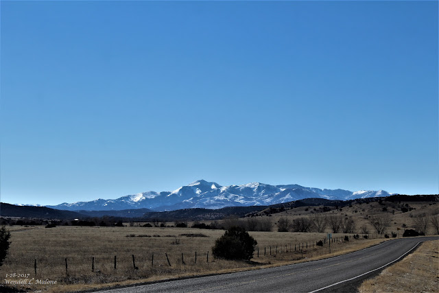
Sierra Blanca Peak - Ruidoso, NM. 1-28-2017.
Ski Apache located west of Ruidoso with a base altitude of 9,600' has received 59" of snowfall so far this season. They currently have a 61" base. Their seasonal average is 180". Sierra Blanca Peak rises up to 12.003' and can be seen from more than 100 miles on a clear day.
The Truth Is Stranger Than Fiction!
Friday, January 27, 2017
Snow Showers Obscuring The Guadalupe Mtn's.
Snow showers were obscuring the Guadalupe Mountains of Southeastern New Mexico and Texas this afternoon. The last two photos above were shot in Whites City, looking south down U.S. Highway 62/180 (The El Paso Highway). The snow never made it as far north as Carlsbad.
The Truth Is Stranger Than Fiction!
Wednesday, January 25, 2017
Monday, January 23, 2017
Wind Machine Cranks Tonight Into Tuesday!
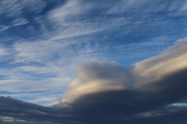
Wondering The Folks On That Jet Had A Rough Ride...Note The Contrail Passing Through The Lenticular Cloud.
January 23rd, 2017.
Altocumulus Standing Lenticular Clouds South - Southeast Of Carlsbad, NM.
Wind Machine Cranks Up Tonight & Howls Again Tuesday.
Sunday, January 22, 2017
NM Storm Total Snowfall Amounts & NM & W TX Peak Wind Gusts.
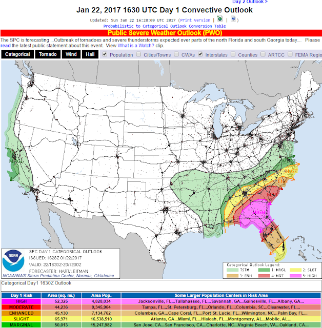
Numerous Tornadoes today, several of which will be of the intense, long track nature in the areas highlighted in pink and red on the map above!.
Yesterday Was Windy - Tuesday Will be Windy Once More!
Saturday, January 21, 2017
Significant High Wind Event Today - Heavy Snow In the Sac's.
Blog Updated @ 10:09 AM MST.
Blog Updated @ 1:35 PM MST.
1-19-2017.
Altocumulus Standing Lenticular Clouds 30 Miles South Of Carlsbad, NM.
Significant High Wind Event Today!
Monday, January 16, 2017
Sunday, January 15, 2017
NM WX Past 24 Hrs - SVR T-Storms-Hail/Heavy Rain-Localized Flooding/Freezing Rain-Sleet/Heavy Mtn Snow/Dense Fog
Blog Updated @ 4:25 PM MST.
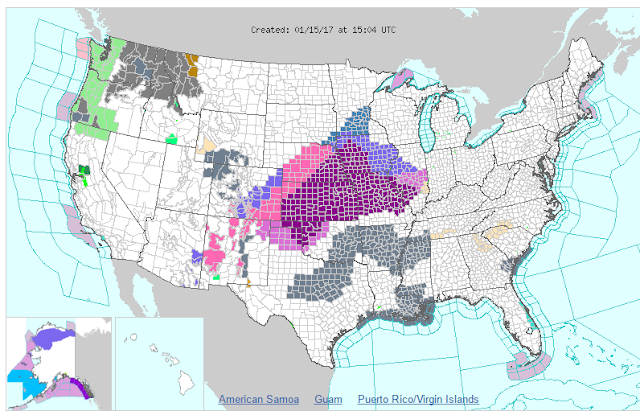
NWS Watches & Warnings In Effect.
Severe T-Storms - Heavy Rains - Heavy Mountain Snows Today!
Saturday, January 14, 2017
Severe T-Storms - Heavy Rain - Heavy Mtn Snows To Hammer NM.
Complicated & Very Strong Winter Storm To Hammer New Mexico!
Thursday, January 12, 2017
Weekend Winter Storm Headed To NM.
January 11, 2017.
(CCSL) Cirocumulus Standing Lenticular Clouds.
Southwest Of Carlsbad Over The Guadalupe Mtn's.
Next Major Winter Storm Impacts NM Friday - Sunday.
Monday, January 9, 2017
Very Warm Day Across SE NM & W TX.
The Carlsbad Airport recorded a high temperature of 81ºF this afternoon. This should be a record for the date surpassing the previous high of 78ºF set in 2002. The record high temperature for the Carlsbad Climate Station is 84ºF set in 1909. The Roswell Airport recorded a high this afternoon of 81ºF and this should tie the old record of 81ºF set back in 1909.
The Truth Is Stranger Than Fiction!
Sunday, January 8, 2017
Saturday, January 7, 2017
Coldest Morning Of The Winter For Most Of SE NM.
Valid @7 AM MST This Morning.
Blog Updated @ 3:25 PM MST.
Coldest Morning Of The Winter For Most-
Thursday, January 5, 2017
Wednesday, January 4, 2017
Dangerous Winter Storm Taking Aim At New Mexico!
Altocumulus Standing Lenticular Clouds.
(East & Southeast Of The Guadalupe Mtn's).
Monday, January 2, 2017
Sunday, January 1, 2017
Heavy Snow For The Sac's & T-Storms For SE NM Tonight!
Happy New Year Everyone!!!
As of Noontime today the Sierra Blanca Snotel (Automated Weather Station) located near Ski Apache, west of Ruidoso, had picked up 3" of new snow.
Subscribe to:
Posts (Atom)