My Current Weather

Sunday, December 31, 2017

Jack Frost Rings In The New Year!
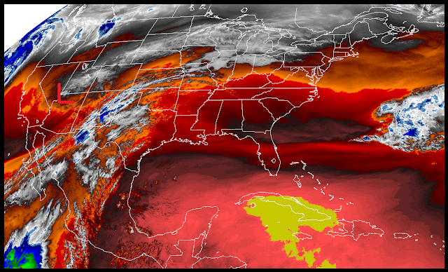

Snapshot Taken At 9:57 AM MST This New Years Eve.

Arctic air surged back westward into the Pecos Valley and the rest of Southeastern New Mexico overnight into this morning. Low clouds and freezing fog with pockets of freezing drizzle also covering the area as indicated above in this visible satellite image.


Notice how many states and counties that are under a Wind Chill Advisory (light blue shades) and Wind Chill Warnings (light purple shades) as of 9 AM MST this morning. Parts of Southeastern New Mexico including Eddy and Lea Counties are under a Winter Weather Advisory this afternoon into New Years Day morning. This also includes much of West Texas eastward to the Northeastern Texas. Areas of freezing fog, light freezing drizzle, light freezing rain, light sleet, and light snow will be possible here in Southeastern New Mexico and West Texas.

(As Of 9 AM MST This Morning).


Subzero low temperatures this morning from the central plains northward into the Yukon and Northern Canada where -40ºF to -50ºF readings were recorded.

(As Of 9 AM MST This Morning).


Wind Chills At 9 AM MST.


Given the shallow nature of the arctic air mass notice how it is warmer (mostly in the 40's) across the Sacramento Mountains than it is in the Southeastern Plains eastward into West Texas. Cloudcroft located at 8,750' in the southern Sacramento Mountains is forecast to reach an afternoon high of 48ºF this afternoon. While Hobbs located at 3,620' is only supposed to make it up to 20F today.


Today's forecast high temperatures may be a little too warm across the Pecos Valley and parts of the Southeastern Plains if current temperature trends continue. If the colder arctic air mass continues to back door in from the east we may not make it much above freezing. 

NWS NDFD Forecast Low Temps Tonight.


Temperatures At 5 AM MST New Years Morning.

Valid At 5 AM MST New Years Morning.

Once again the Canadian model continues to be coldest and persistently forecasts lows New Years morning in the single digits to the low teens locally. With highs on New Years Day only in the 20's.

Valid At 5 PM MST New Years Afternoon.

Wind chill temperatures are forecast to drop down to around 0ºF to 10ºF later tonight into New Years morning across the Eastern and Southeastern Plains of New Mexico. Wind chills in the Clovis and Portales areas will drop down to -7ºF, and the Roswell area will see values near 0ºF

Some spots may see values below zero with wind chills in the Guadalupe Mountains dropping down to -5ºF to -15ºF as will also be the case across parts of West Texas. Areas north of Lubbock will see wind chills drop down to -15ºF to -20ºF. Bundle up tonight if you are out and about ringing in the New Year and don't forget about your pets either. 

Wind Chills Tonight Into New Years Morning.


The Truth Is Stranger Than Fiction!

Friday, December 29, 2017

Warming Up Saturday But Turning Much Colder Sunday.


Temperatures across the Yukon of far Northwestern Canada as of 3 PM MST this Friday afternoon and ranging from -30ºF to -42ºF. Wind chill values across Northwestern Canada from the U.S. border northward are ranging from -30ºF to -51ºF. This is the long awaited arctic air mass that is already moving into the northern plains this afternoon. This will be the source of our cold New Years weather locally. Fear not this air mass will not be anywhere near that cold by the time it arrives here. 

Cities Circled Are In Danger Of Breaking Their Daily Low Maximum Temperatures.


Sunday.


New Years Day.


Arctic Front Arrives Saturday Afternoon.


Saturday.


Saturday afternoon will be interesting as the first surge of the modified arctic air mass arrives locally. Current forecast warm Southeastern New Mexico and parts of West Texas up into the low 70's ahead of the southward moving cold front. These readings will be some 10ºF to 20ºF above normal for the date. Notice the temperature contrast between the Pecos Valley and West Texas just east of the state line. Should the front arrive quicker than forecast then we won't get this warm. A slower front will mean slightly warmer temps. 

Sunday.


Sunday could prove to be equally as interesting depending upon the timing of the arrival of the stronger and colder surge of arctic air backdooring into the local area. We could see high temps in the 50's if this second surge is slower than forecast or only the 20's and 30's if its faster than forecast.Sundays high temps will be some 6ºF to nearly 30ºF below normal for the local area.

New Years Day Low Temperatures.


New Years Day High Temperatures.


New Years Day High Temperature Anomalies.


New Years 2018 starts of cold with current forecast low temperatures ranging from the single digits near the state line to the teens locally. Wind chill values likely will be in the 0ºF to -5ºF range across Southeastern New Mexico to -5ºF to -15ºF across parts of West Texas east of the state line. If this air mass is colder than forecast then our wind chill values Sunday night into New Years Day morning will also be colder. 

High temperatures New Years day are forecast to be in the 20's and 30's across the local area...with a biting wind chill to boot. These readings will be some 20ºF to 35ºF degrees below normal for the date.

Canadian GEM Has Coldest New Years Forecast.


This mornings run of the Canadian model is the coldest of the three (GFS, ECMWF, GEM) and its brings single digit lows along the state line. 

Forecast Temperatures At 5 PM MST.


It forecasts widespread 20's for highs on New Years.

Normal Highs & Lows For New Years.
(And Record Low Max Temps & Record Lows).


Normal High 53
Normal Low 25
Record Low High 17 In 1979
Record Low -2 In 1979
Max Snow Depth 7" In 2016


Normal High 56
Normal Low 22
Record Low High 19 In 2015
Record Low -2 In 1970
Max Snow Depth 9" In 1983


Normal High 56
Normal Low 27
Record Low High 19 In 2015
Record Low 6 In 1979
Max Snow Depth 5" In 1983


Normal High 56
Normal Low 29
Record Low High 23 In 1979
Record Low 9 In 1928
Max Snow Depth 9" In 1983


Normal High 53
Normal Low 22
Record Low High 18 In 2015
Record Low 5 In 1979
Max Snow Depth 2" In 2016


Normal High 41
Normal Low 18
Record Low High 25 In 2011
Record Low -1 in 2011
Max Snow Depth 25" In 2011

So be prepared for three days of below freezing temperatures starting Sunday lasting into Tuesday. 

The Truth Is Stranger Than Fiction!

Tuesday, December 26, 2017

Colder Tonight Into Wednesday With A Chance Of Light Freezing Drizzle.


Arctic air has moved into Northeastern New Mexico and the Texas Panhandle this morning. The cold front had sagged south into Southeastern New Mexico as of sunrise. As of 10 AM MST the temperature in Clayton was 10ºF with a wind chill of -3ºF. Amarillo was reporting a temp of 13ºF with a wind chill of -3ºF. Cannon Air Force Base at Clovis was reporting a temp of 26ºF and a wind chill of 15ºF. Low clouds were reported at all three locations. Meanwhile it was 36ºF in Roswell and Hobbs and 47ºF in Carlsbad.  


Today.


The colder air associated with the front is forecast to mix out of Southeastern New Mexico this afternoon with forecast highs in the low 60's. This colder airmass will then work its way back into the area tonight sticking around through Thursday morning.

Wednesday.


With forecast highs in the upper 30's to the mid 40's tomorrow these readings will be some 10 to 16 degrees below normal locally. Low temperatures Wednesday morning are forecast to range from the low to upper 20's. Low clouds and areas of light drizzle and light freezing drizzle are also forecast to develop which could cause a few slick spots on area roads and bridges. This will come to an end Thursday morning with clearing skies and warming temps...back up into the 60's.

Thursday.


Highs on Thursday are forecast to be in the low to mid 60's which will be 8 to 10 degrees above normal for the date. 

New Years Day Forecast.


GFS Forecast Low Temperature Anomalies At 5 AM MST.


GFS Forecast Wind Chill's At 5 AM MST.


Given the recent poor history of the models to forecast accurately more than a couple of days in advance I urge you to use caution with the above GFS model forecast for New Years Day. What seems certain is that bitterly cold (in some cases record cold) arctic air is set to invade the heart of the nation east of the Rockies by this weekend going into New Years. note that low temperatures forecast by this model run will be some 50-degrees below normal across parts of Nebraska and Kansas come New Years morning if it verifies. What the models haven't resolved yet is just how cold this air mass will be and how widespread its clutches will be. 

Of concern will be the very cold temps...below zero from the Texas Panhandle eastward into much of Oklahoma New Years Day morning by around sunrise. If the GFS model is on the right track we may even see subzero readings in parts of Northeastern and Eastern New Mexico. If the below zero readings weren't bad enough note the wind chill values of -20ºF to -30ºF from the Texas Panhandle eastward into most of Oklahoma! 

Historically arctic air masses that are this cold have proven to be extremely difficult for the models to forecast. Locally these arctic outbreaks tend to be colder than forecast, arrive earlier than model forecasts, and tend to hang around longer than forecast. Anyway this will need to be watched going into this weekend. 

The Truth Is Stranger Than Fiction!

Thursday, December 21, 2017

Cold Front Approaching - No White Christmas For SE NM This Year!


Valid At 11:07 AM MST This Morning.

At noon today our next winter storm was located over far northwestern Arizona and continues sinking slowly southward. 


Valid At 5 PM MST This Afternoon.

Meanwhile at the surface a Pacific cold front was moving eastward through the western part of New Mexico while a modified arctic cold front was entering northeastern New Mexico headed south. These two cold fronts will merge and sweep eastward and southward out of southeastern New Mexico late tonight into early Friday morning.

Temperatures & Wind Chill Values At Noon MST Today.


Our long awaited change to colder weather will commence locally tonight with a second cold front invading the Eastern Plains Sunday.  


Valid At 5 AM MST This Morning.

Valid At 5 PM MST This Afternoon.

Valid At 5 AM MST Friday Morning.

Valid At 5 PM MST Friday Evening.

So much for another historic or even decent winter storm for the Christmas Holidays for our local area. What a wild ride the computer forecast models went on over the past week to ten days. Nothing short of a mess with lots of confusion in their forecasts. Unless our little storm approaching from northwestern Arizona does something totally unexpected we are out of luck this year as far as a White Christmas goes. 

Instead of seeing high temperatures below freezing Christmas Eve and Christmas Day as the models had been forecasting at times, we will see highs on Christmas Eve in the 40's to near 50 and on Christmas Day the 60's. 

The Canadian model seems to be the most robust with this storm and drags it slowly southeastward across the state this evening into Friday evening. There isn't a lot of moisture associated with it so snowfall totals overall will be light. And the modified arctic airmass accompanying it will not be nearly as cold as the models were forecasting over the past week. 

Temperature & Wind Chill Forecasts.

As of 1 PM MST today our local temperatures have climbed up into the low to mid 70's across the Southeastern Plains with the 40's and 50's in the Guadalupe, Sacramento, and Capitan mountains. These readings will drop by some 20 to 30-degrees or so on Friday behind the approaching cold fronts.

Southwesterly to westerly winds have been gusting up into the 25 to 40 mph range today across the Southeastern Plains. Across the mountains it has been windier with gusts of 68 mph reported at the Bowl north of Guadalupe Pass, 64 mph at the Sierra Blanca Regional Airport, 57 mph at the Carrizozo Airport, 55 mph at the Dunken Raws, and 54 mph in Pine Springs in the Guadalupe Mountains National Park. 


Lows Tonight & Friday Morning.


Forecast Wind Chill Values Tonight & Friday Morning.


Forecast Highs Friday.


Saturday.


Christmas Eve.


Christmas Day.


Canadian (GEM).

Valid At 5 PM MST Friday.

U.S. GFS.

Valid At 5 PM MST Friday.


Valid At 5 PM MST Friday.


Valid This Afternoon Through 5 PM MST Friday.

Light snow or mostly snow flurries will be possible mainly across the mountains and Northeastern and Eastern New Mexico as well as parts of West Texas tomorrow morning ending tomorrow afternoon...maybe! 

The Truth Is Stranger Than Fiction!

NWS Albuquerque Burn Scar Matrix Forecast

Current NWS Watches/Warnings In Effect

New Mexico

Eddy County

Chaves County Plains & Mtn's

Culberson County

Lea County

Lincoln County

Otero County

Current US Temps

Current US Wind Chill/Heat Index Temperatures

NWS Midland Forecast

NWS Albuquerque Forecast

NWS Albuquerque Forecast

NWS El Paso Forecast

NWS Lubbock Forecast

NWS Lubbock Forecast

Average Daily High/Low Temperatures & Rainfall

Average Daily High/Low Temperatures & Rainfall