Posts

Showing posts from May, 2023

Severe T-Storms Return Wednesday & Thursday.

Image
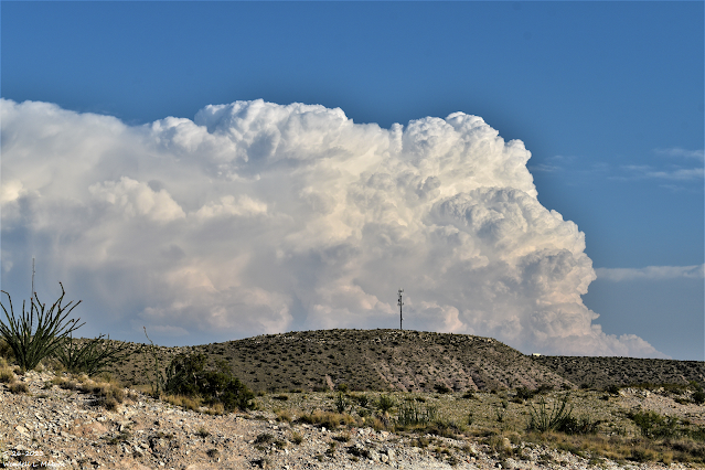
May 28, 2023. Looking At Guadalupe Peak. From Near The NM/TX State Line. Severe T-Storms Return Wednesday & Thursday. NWS Albuquerque Severe Weather Outlooks. Storm Prediction Center (SPC) Day 2 Outlook. (Wednesday, May 31, 2023). NWS Albuquerque 7-Day Forecast  High Temps & Precipitation Chances. Some locations in southeastern New Mexico and parts of West Texas may reach the century mark this afternoon, for the first time this year. In contrast highs across the southeastern plains look to only be in the 80's Saturday, Sunday, and next Monday.  Thunderstorms return to the eastern half of New Mexico Wednesday and Thursday. Some of these will become severe especially on Wednesday. Large hail, damaging thunderstorm wind gusts, an isolated tornado or two, deadly cloud to ground lightning, and locally heavy rainfall that may cause localized flash flooding will all be possible. The areas with the highest chances of seeing severe weather will be those highlighted in the "Slig

This Weeks Storm Summary - Another Round Of Severe T-Storms Today Into Tonight!

Image
Friday, May 26, 2023. Looking South From 7 Miles Southwest Of Lakewood, NM At A Severe Thunderstorm Just East Of Guadalupe Pass, TX. Another Round Of Severe T-Storms Today! Scattered thunderstorms are once again forecast to develop along the east slopes of the northern-central-south-central mountains then move east and southeast across the northeastern, eastern, and southeastern plains of New Mexico. Large hail, damaging thunderstorm wind gusts in excess of 58 mph, locally heavy rainfall and flash flooding, and deadly cloud to ground lightning will all be possible with the stronger thunderstorms (supercells). A few tornadoes will also be possible.  A Flood Watch remains in effect through this evening for parts of northeast and east-central New Mexico.  NWS Midland. Storm Prediction Center (SPC) Day 1 Severe Weather Outlook. Day 1 Convective Outlook NWS Storm Prediction Center Norman OK 0742 AM CDT Sat May 27 2023 Valid 271300Z - 281200Z ...THERE IS A SLIGHT RISK OF S

Dangerous Severe Weather Threat Today Into Tonight!

Image
Friday, May 19, 2023. Looking East - Hail Shaft. Northeast Of Artesia, New Mexico. Blog Updated At 9:50 AM MDT Friday, May 26, 2023. Dangerous Severe Weather Threat Today Into Tonight! A potentially dangerous day ahead severe weather-wise for parts of eastern and especially southeastern New Mexico. As well as nearby West Texas. Make sure you stay alert and pay attention to the weather. Have multiple ways to receive severe weather information.  Heads up southeastern New Mexico! Today will be one of those days that you must be weather-aware, especially this afternoon into tonight. The Storm Prediction Center has placed much of eastern and southeastern New Mexico in the "Enhanced" severe weather threat category. This does not happen very often but when it does we usually get clobbered with severe thunderstorms.  Scattered thunderstorms will dot the landscape today into tonight. Some of these will become severe and be capable of producing: Tornadoes! Large To Very Large Hail - Ap

May Has Been Wet For Some - Severe T-Storms Today.

Image
Friday, May 19, 2023. North Of Artesia, New Mexico. Severe T-Storms This Afternoon & Evening! Widely scattered to scattered thunderstorms are forecast to fire along and east of the dryline this afternoon, evening, and tonight. Generally along and near a line roughly from Carlsbad-Roswell-Tucumcari. Some of these will be severe and  capable  of producing large to very large hail  (baseball size or larger). A few isolated tornadoes will also be possible with the stronger supercell thunderstorms. Damaging thunderstorm wind gusts in excess of 60 mph, locally heavy rainfall, and localized flash flooding will also be possible.      May Has  Been Wet For Some. May Rainfall Totals To Date. (May 1st - May 22, 2023). HRAP 30_Day Rainfall Totals. (April 22 - May 22, 2023). New Mexico May 2023 CoCoRaHS May 2023 Rainfall Totals. (May 1st - May 22, 2023). Weather Underground May, 2023 Rainfall Totals. (May 1st - May 2, 2023). There Are None So Blind As Those Who "Will - Not" To See...1

Current Watches In Effect

Storm Prediction Center (SPC) Day 1 Severe Weather Outlook

SPC Mesoscale Discussions

Current NWS National Watches/Warnings In Effect

Current NWS National Watches/Warnings In Effect
Click On The Map For The Latest Updates

New Mexico

NWS Regional Radar

NWS Regional Radar

GOES-East - Sector view: Southern Rockies - GEOColor

Current US Temps

Current US Wind Chill/Heat Index Temperatures

NWS Midland Radar

NWS Midland Regional Forecast

NWS Midland Regional Forecast

NWS Midland Regional Forecast

Cannon AFB Radar

NWS Albuquerque Radar

NWS Albuquerque Regional Forecast

NWS Albuquerque Regional Forecast

NWS Albuquerque Regional Forecast

NWS Albuquerque Regional Forecast

Holloman AFB Radar

NWS El Paso Radar

NWS El Paso Regional Forecast

NWS Lubbock Radar

NWS Lubbock Regional Forecast.

NWS Lubbock Regional Forecast

NWS Lubbock Regional Forecasts

NWS Lubbock Regional Forecast

NWS Forecast High Temps Today

NWS Forecast Low Temps Tonight

24-Hour Minimum Wind Chill Forecast

NWS Albuquerque Storm Total Snowfall Forecast

NWS Albuquerque Storm Total Rainfall Forecast

NWS Midland Storm Total Rainfall Forecast

NWS El Paso Storm Total Rainfall Forecast

Average Daily High/Low Temperatures & Rainfall

Average Daily High/Low Temperatures & Rainfall