

May Has Been Wet For Some - Severe T-Storms Today.

North Of Artesia, New Mexico.


Widely scattered to scattered thunderstorms are forecast to fire along and east of the dryline this afternoon, evening, and tonight. Generally along and near a line roughly from Carlsbad-Roswell-Tucumcari. Some of these will be severe and capable of producing large to very large hail (baseball size or larger). A few isolated tornadoes will also be possible with the stronger supercell thunderstorms. Damaging thunderstorm wind gusts in excess of 60 mph, locally heavy rainfall, and localized flash flooding will also be possible.
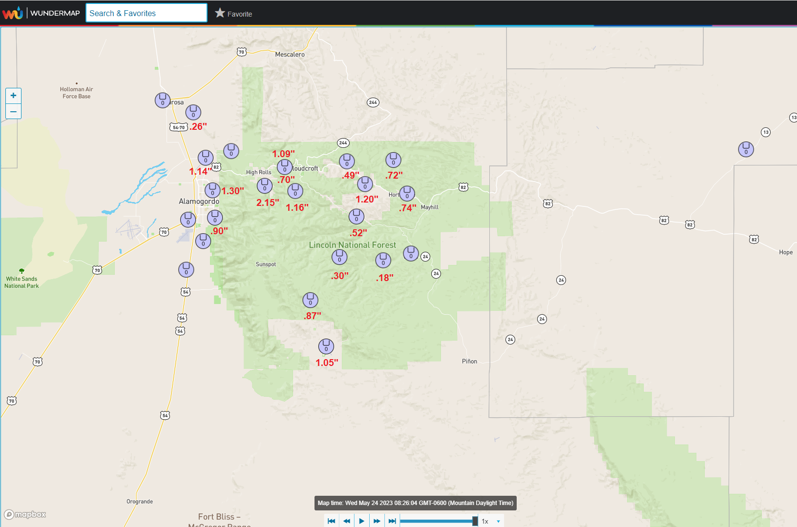
May Has Been Wet For Some.
May Rainfall Totals To Date.
(May 1st - May 22, 2023).
HRAP 30_Day Rainfall Totals.
(April 22 - May 22, 2023).


(May 1st - May 22, 2023).


(May 1st - May 2, 2023).

There Are None So Blind As Those Who "Will - Not" To See...107.


Comments
Post a Comment
Your comments, questions, and feedback on this post/web page are welcome.