Finally A Break - Scattered T-Storms Return.
West of Artesia, NM.
High Based - Low Topped T-Storm.
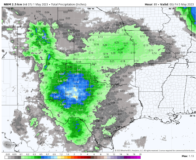
Scattered T-Storms Return Tuesday Into Wednesday.
Here in southeastern New Mexico our spring severe weather season runs from mid April through the end of June. Just how many severe thunderstorms we get each year is highly variable. Some years we don't see many at all and some years we have numerous occurrences. Whenever we have these cooler than normal springs such as this year we tend to have more severe thunderstorms than normal but later. I think that this may be the case this year.
A slow moving cut off mid/upper-level low is forecast by the models to be located roughly west of Los Angeles, California by sunset Wednesday. This low will kick out several short waves that will traverse the region Tuesday into Thursday. Thus providing the lift and instability needed for thunderstorm development.
Meanwhile low-level southeasterly upslope flow from the Gulf of Mexico will return to the local area tonight into Thursday. This low-level moisture will help fuel thunderstorm development.
Forecast models are that excited about the wind shear and instability that will be in place over the next couple of days. Thus a widespread severe weather outbreak is not currently anticipated for Southeastern New Mexico and West Texas.
A few isolated rain showers are possible over the Guadalupe and Sacramento mountains and southeastern plains later tonight but our chances for measurable rainfall is low. We will see an uptick in activity Tuesday into Wednesday night. As thunderstorms become more widespread. Our chances for seeing measurable rainfall Tuesday through Wednesday night across the local area will generally be in the 30% to 60% range.
Storm total rainfall amounts don't look all that impressive in the model forecasts but I think they may be underestimating them in places. Between Tuesday afternoon and Wednesday night parts of the local area could see rainfall totals .25" to 1.00" range. Any strong to marginally severe thunderstorm that develops could produce isolated higher rainfall totals.
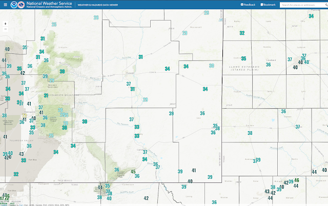
Saturday morning dawned rather cold for this time of the year. A few locations in the Sacramento mountains dropped down into the mid 20's. Artesia recorded a low of 33 at the AG Science Center which was one degree from tying the record of 32 set back in 2015.
The Carlsbad Airport fell to 34 which beat their record low for the date of 36 set in 2015. The Carlsbad Climate Co-Op Station closed at the end of January, 2021 so we no longer have records available from that station. But their record for the date (1900 - 2021) was 36 set in 2015. The Mesonet station located in Dexter recorded a low of 31.
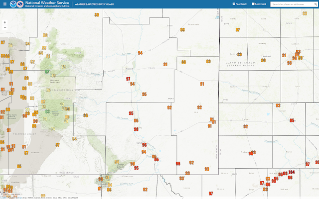
New Mexico MesoWest High Temperatures Reported Sunday Afternoon.
Then Sunday afternoon we got our first real taste of summer time temperatures will all of the valley locations soaring up into the 90's. The Roswell Airport set a new daily record high of 97 which beat the previous reading of 96 set in 2002, and 2013.
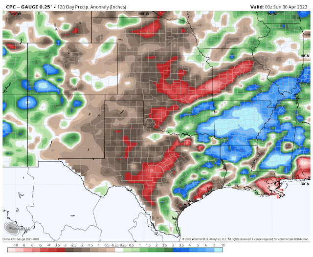
It's Been A Dry Spring So Far.
(January 1st - April 30, 2023).
(January 1st - April 30, 2023).
There Are None So Blind As Those Who "Will - Not" To See...107.


Comments
Post a Comment
Your comments, questions, and feedback on this post/web page are welcome.