My Current Weather

Saturday, March 28, 2020

Peak Wind Gusts Reported Friday, March 27, 2020.


An automated weather station located in San Augustine Pass on US Hwy 70 east of Las Cruces reported a peak wind gust of 88 mph Friday afternoon. Guadalupe Pass southwest of Carlsbad reported a peak gust of 84 mph.

The Truth Is Stranger Than Fiction - And Sometimes It Hurts!

Friday, March 27, 2020

Windy & Dusty Today Into Tonight.


My Davis Vantage Pro2 Home Weather Station reached 90º for the first time this year yesterday afternoon. This is the first 90º reading since September 29th last fall.


Spring has sprung and right on cue, strong southwesterly winds are forecast to rake the state today. Locally southwesterly winds are forecast to increase to sustained speeds of 30 to 40 mph with gusts to around 50 to 60 mph.

Across the Guadalupe Mountains of Southeastern New Mexico and West Texas these winds are forecast to become sustained at around 40 to 50 mph with gusts near 65 mph.

Similar speeds and gusts are forecast for the Sacramento and Capitan Mountains.

Local areas of blowing dust may develop this afternoon into tonight. Sudden drops in the visibility down to near zero will be possible. Especially in normally dust prone areas such as freshly plowed or exposed/open farmlands and fields, construction sites, and open lots.

Highs today are forecast to be in the upper 70's to near 80 today across the Southeastern Plains and parts of West Texas. Highs in the Sacramento Mountains are forecast to be in the 40's and 50's with the 60's in the Guadalupe's. 

The Truth Is Stranger Than Fiction - And Sometimes It Hurts!

Wednesday, March 18, 2020

Severe Thunderstorms This Afternoon Into Tonight.


Severe Thunderstorms Today Into Tonight.

Southeastern New Mexico is currently in the Marginal Risk Area this afternoon for severe thunderstorms. A few Marginally severe thunderstorms are forecast across SE NM. Large hail, damaging thunderstorm wind gusts, and frequent deadly cloud to ground lightning will be possible in this area this afternoon. Locally heavy rainfall and localized flash flooding will be possible with any strong to severe thunderstorm that develops.

Scattered severe thunderstorms are forecast close to the NM/TX State line in the Jal area northward to Hobbs and then eastward into West Texas. Large hail, damaging thunderstorm wind gusts, frequent deadly cloud to ground lightning, locally heavy rainfall and localized flash flooding will be possible in these areas this afternoon and evening. A few tornadoes are also possible.

A Note Of Caution-

Any subtle shift in the surface and upper air pattern today into this evening could impact our local forecasts. Should the dryline stall further westward than is currently forecast then our chances for a more widespread severe weather outbreak in SE could occur this afternoon into this evening. If the dryline is mixes out faster and further to the east than is currently forecast then less severe weather may occur. Please keep abreast of our local weather conditions and forecast today into tonight.


Two Pacific cold fronts will sweep eastward through New Mexico and West Texas. The first cold front will move from west to east into Southeastern New Mexico this afternoon. The second cold front will do the same and arrive in Southeastern New Mexico around sunrise Thursday.

The dryline will mix eastward today into West Texas. Rich low-level Gulf of Mexico moisture at the surface is entrenched over the area and will aide in the development of thunderstorms today into tonight. Some of these will become severe.


Valid At Midnight Tuesday Night.

A strong mid-upper level closed low off of the southwestern California Coast this morning. Several short waves are forecast to eject northeastward out of this low today into Thursday. The atmosphere over the local area is forecast to become unstable this afternoon into tonight ahead of the approaching cold fronts. Therefore the stage is set for a Severe Weather Outbreak today into tonight.


NWS Snowfall Forecasts.


Snow levels across the Sacramento Mountains today will remain between 9,000' and 10,000'. Late this afternoon and early evening the snow level will lower down to around 7,000' as the first cold front sweeps eastward through the area. Snowfall totals of 2" to 4" will be possible 7,000' and above. 3" to 5" will be possible above 9,000'.

Winter Weather Advisories and Winter Storm Warnings are in effect this evening through Thursday for parts of western and northern New Mexico. Up to a foot of new snow is forecast for the mountains of northern New Mexico above 7,500'.


Valid This Evening Through Thursday.

West winds are forecast to increase to sustained speeds of 30 to 50 mph with gusts near 70 mph this evening through Thursday in the Guadalupe Mountains of New Mexico and West Texas.

The Truth Is Stranger Than Fiction - And Sometimes It Hurts!

Saturday, March 14, 2020

Increasing Chance For T-Storms Late Tonight Into Sunday Morning.


Heavy rains have fallen the past several days across the Desert Southwest. Its pretty unusual to see this much rainfall in these areas in March. Which is pretty much our driest month of the year for many of us. And more to come tonight into mid-week. Image how beautiful the desert will be soon!


Valid At 6 PM MDT Sunday Afternoon.


Temperatures at 6:30 PM MDT ranger from the 70's across parts of SE NM & W TX to the 30's in the Oklahoma Panhandle behind the cold front. 

 (Overnight Into Early Sunday Morning).


Valid Late Tonight Into Sunday Afternoon.

Stormy Late Tonight Into Early Sunday Morning.

A stalled cold front to our northeast will backdoor to the south and southwest overnight tonight reaching the Southeastern Plains early Sunday morning. This slow-moving cold front combined with a couple of disturbances being ejected northeastward over the area will aide in destabilizing the atmosphere overnight.

Scattered thunderstorms are forecast to form late tonight into Sunday morning. A few of these may become Marginally Severe and produce large hail. These will be elevated supercell type thunderstorms. 

Low clouds and fog are forecast to develop behind the cold front as it slips into the local area early Sunday morning. Our chances for thunderstorms will increase later tonight into Sunday morning and generally will be in the 40% to 70% range.

Locally heavy rain will be possible especially across southern Lea County into West Texas and across parts of southern Eddy County. This could possibly lead to localized flash flooding especially since some of these locals have received heavy rain the past couple of days. 


Sunday will much colder with highs ranging from the 40's in the Clovis and Portales areas and the mountains, to the mid 50's to the low 60's across Chaves, Lea, and Eddy Counties.

The Truth Is Stranger Than Fiction - And Sometimes It Hurts!

Friday, March 13, 2020

Severe Thunderstorms Today - Large Hail/Damaging Winds/Isolated Tornadoes Possible!


Valid Today.


Valid Today.

Supercell Thunderstorms This Afternoon & Evening.


We are primed for Severe Thunderstorms this afternoon and evening. Scattered thunderstorms are in our forecast and these could occur at any time today including this morning. The main threat for Severe Thunderstorms will occur roughly from around noontime into the early evening hours for Southeastern New Mexico. And from the afternoon into the nighttime hours for West Texas.

Scattered Supercell Thunderstorms will be possible today into tonight across the local area. These stronger than normal types of thunderstorms will be capable of producing:

Large Hail - Possibly GoflBall Size Or Larger.
Damaging Thunderstorm Winds Gusts Of 60 MPH Or Higher.
Frequent Deadly Cloud To Ground Lightning.
A Few Isolated Tornadoes.

A Similar Setup One Year Ago Yesterday.

See My Blog Posts:

Dexter Tornado.

Malago Tornadoes.


The Truth Is Stranger Than Fiction - And Sometimes It Hurts!

Thursday, March 12, 2020

Heads Up - Severe Thunderstorms Possible Friday!


Friday.


Friday.


 Friday At 6:00 PM MDT.

Severe Thunderstorms On Friday.

An approaching strong shortwave on Friday combined with an approaching Pacific cold front from the west, and a stalled cold front draped across Southeastern New Mexico and West Texas, and the dryline extending south from a surface low near Clines Corners will all combine to set the stage for a Severe Weather Outbreak Friday afternoon and evening. All this as a strong jet stream lies overhead providing good directional and speed shear. Decent mixed layer cape values and instability will also add to the mix.

Southeastern New Mexico will be in the "triple point area" which a highly favored location for severe thunderstorms to form. Scattered thunderstorms are forecast to fire up Friday afternoon and quickly become severe. 

Large hail, locally heavy rainfall which may lead to localized flash flooding will be the primary severe weather threats. Along with a few tornadoes. Our severe weather season like last year is going to kick off early this year.

The Truth Is Stranger Than Fiction - And Sometimes It Hurts!

Saturday, March 7, 2020

March 4-5, 2020 Historic Rainfall Totals.

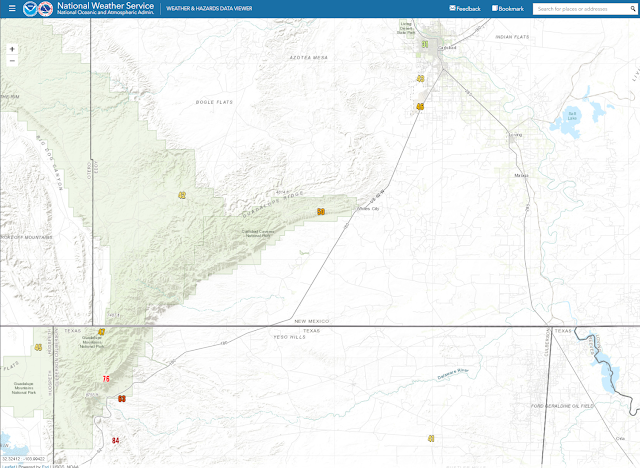
Blog Updated At 8:44 AM MDT Sunday, March 8, 2020.

March 5, 2020.
Looking West At The Snow-capped Guadalupe Mountains. On US Hwy 62/180 Just North Of The New Mexico/Texas State Line Southwest Of Carlsbad.


Snow covers the Sacramento and Guadalupe Mountains in the image above. Remarkably most of the snow missed the Capitan Mountains. In fact, the heaviest totals were in the Cloudcort area where snowfall totals of 12" to 16" were reported. The heaviest total was reported by the public in Sacramento with 18".

Historic Storm Total Rainfall Amounts.
(March 4-5, 2020)

Midland NWS Dual-Pol Radar.


(March 4-5, 2020).


This was one of those cases where what radar estimated to have fallen and what actually did fall was considerably less in some cases. So the maps above do not really do justice for the local area concerning storm total rainfall amounts.

Historical rainfall totals fell over Southeastern New Mexico and parts of West Texas this past Wednesday and Thursday. Many stations established new daily maximum 24-hour rainfall records for March 4th. Rainfall totals across Southeastern New Mexico including parts of the Sacramento and Guadalupe Mountains averaged between 1.50" and 4.00". Most of us got more rain in one day than in entire months past (March) going back to 1894. 

Long term average rainfall totals for Southeastern New Mexico during the month of March are only around .40". For most of us to get 1.50" to 4.00" in a day is pretty incredible for this time of the year. 

Artesia's greatest March monthly rainfall totals are listed below:

1919 4.57"
1958 2.67"
1941 2.56"

Carlsbad's greatest March monthly rainfall totals are listed below:

1919 4.39"
1941 4.27"
1905 3.31"

The Truth Is Stranger Than Fiction - And Sometimes It Hurts!

Tuesday, March 3, 2020

Highly Unusual Heavy Rain - Flash Flood Threat For SE NM & W TX Today Into Wednesday!


Valid Today Through 11 PM MST Thursday.


Thunderstorms - Heavy Rains - Flash Flooding!

A highly unusual weather event (for March) is setting up for today into Wednesday night locally. A strong, slow-moving, mid and upper-level storm will approach the area today into Wednesday. This storm will pass south of the local area on Wednesday. This potent storm is pulling abundant mid and higher level subtropical moisture into the area from off of the Eastern Pacific Ocean and will continue to do so into Wednesday.

Meanwhile a cold front located just north of us this morning will work slowly southward into SE NM and W TX today into tonight. A Pacific cold front will approach the area tonight from the west.

A few Marginally Severe Thunderstorms may occur on today into this evening (mainly across West Texas to our south) and will be capable of producing large hail (the size of quarters or larger) and damaging thunderstorm wind gusts in excess of 60 mph. Frequent deadly cloud to ground lightning will also accompany any thunderstorm.

REMEMBER: When Thunder Roars…Go Indoors! If you can hear thunder you are close enough to the storm to be struck by the lightning.

The combination of these factors combined with ample moisture at all levels of the atmosphere will set up a potential flash flood threat across Southeastern New Mexico and West Texas late today into Wednesday. Storm total rainfall totals during this time frame are forecast to generally be in the 1” to 3” range. Thunderstorms will drop heavy rain across the area as well and this could push storm total rainfall amounts by Wednesday into the 2” to 4” range. It's possible that a few isolated spots could even see higher totals than this.


These heavy rains will be capable of producing locally heavy rain in short periods of time which will lead to localized flash flooding in the many hundreds of “normally dry arroyos” in the local area. These arroyos will have the potential to flood rapidly with little to no advanced warning. 

Anyone traveling across the Southeastern New Mexico and West Texas today into Wednesday (especially in rural areas) needs to be “highly alert” for this possibility…especially this afternoon into Wednesday. 

Significant impacts are possible to the Oil Fields and related actives across Southeastern New Mexico and parts of West Texas from this developing storm. Thunderstorms, Heavy Rainfall, and Flash Flooding will be the primary threats today into Wednesday.

Remember: Turn Around - Don't Drown!

If you come upon a flooded arroyo, low water crossing, or any other flooded locations please do not attempt to drive through them. It only takes 12 to 18 inches of rapidly flowing water to float a normal size vehicle away…including trucks

Most flash flood deaths occur in vehicles with people trying to drive through flood arroyos, low water crossing, and other flood-prone locations. Most of these deaths occur at night also. Southeastern New Mexico and West Texas has a long history of flash flooding and flash flood deaths. This normally occurs later during the spring and summer months and sometimes in the fall. 
 

Flash Flood Watches and Warnings may be issued later today into Wednesday for the local area by our local National Weather Service Offices that serve our area including: The Midland Office, the Albuquerque Office, and the El Paso Office

Please visit my weather web page for additional information concerning this developing weather event via this link: Welcome To Southeastern New Mexico Weather.

Heavy Wet Snow For The Mountains!


Heavy wet snow is forecast for the Guadalupe, Sacramento, and Capitan Mountains today into Wednesday. Cloudcroft is looking at picking up 12" to 18". Sunspot could pick up 20".


Chaves County.


Lincoln County.


Otero County.


The Truth Is Stranger Than Fiction - And Sometimes It Hurts!

NWS Albuquerque Burn Scar Matrix Forecast

Current NWS Watches/Warnings In Effect

New Mexico

Eddy County

Chaves County Plains & Mtn's

Culberson County

Lea County

Lincoln County

Otero County

Current US Temps

Current US Wind Chill/Heat Index Temperatures

NWS Midland Forecast

NWS Albuquerque Forecast

NWS Albuquerque Forecast

NWS El Paso Forecast

NWS Lubbock Forecast

NWS Lubbock Forecast

Average Daily High/Low Temperatures & Rainfall

Average Daily High/Low Temperatures & Rainfall