Posts

Showing posts from November, 2017

Taking Some Time Off.

Image
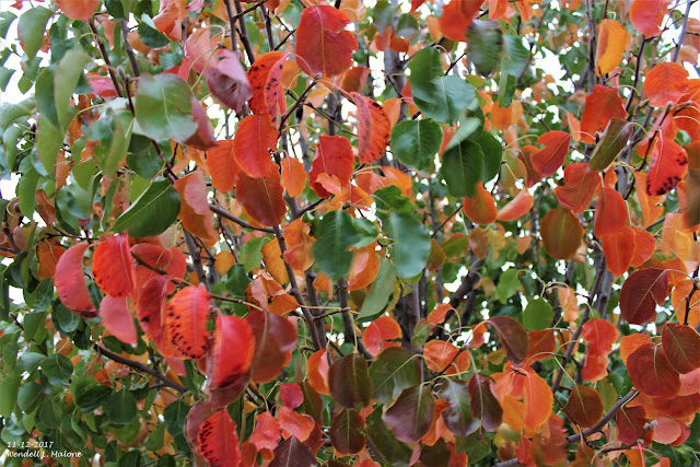
Sunday's Day Trip In The Southern Sacramento Mountains. My wife and I enjoyed yet another beautiful fall day trip up the Penasco River Valley in the southern Sacs yesterday. And of course we stopped at Runyan Ranches and visited with Tom, Pam, and Camille. Zipper the zebra was a little agitated that my wife Diane was feeding the other animals too but she had her share of treats.  Our mild start to the fall is doing funny things with the trees. Some have already lost their leaves, others are just starting to turn, and then there is the mixed bag of fully turned and totally brown or dropped. All in all another beautiful day topped off with a visit with our youngest daughter Kaytlyn, her husband Dylan, and our granddaughter Raeleigh Rose and grandson Bently in Alamogordo.  Taking Some Time Off. This will be my last blog post for awhile, maybe a couple of months. I was diagnosed with cancer recently and I'm undergoing surgery to have it remov

Back To The Soup.

Image
Our Pear Tree This Morning. Low Clouds & Fog Return. GOES-16 RAMMB/CIRA False Color Satellite Image. Captured At 5:47 AM MST This Sunday Morning. Surface Map At 2 AM MST This Sunday Morning. Temperatures At 6 AM MST. NWS NDFD Forecast High Temperatures & Departures From Normal. Today. Monday. Low clouds and fog are working their way southward into Southeastern New Mexico once again behind a cold front. Here at our home in northwest Carlsbad our sky just went overcast at 7 AM MST.  Local Observations At 7 AM MST indicate this also with the Roswell Airport reporting a broken layer of clouds 1,400' above the ground. The Artesia Airport was reporting an overcast layer at 1,300' and the Carlsbad Airport still reporting clear skies. The Hobbs Airport was reporting an overcast layer of stratus at 400' with a visibility of 2 miles in mist.  Today's highs are forecast to climb up into

Trapped In The Soup Bowl The Past Four Days.

Image
Friday's SSEC MODIS Satellite Images.    Dawn broke over Southeastern New Mexico this morning with our skies once again obscured by low clouds and fog. This makes the fourth day in a day row that we have been locked in the soup bowl here in the Pecos Valley and parts of the Southeastern Plains. Visibility's especially at night and early in the mornings have been dropping down to less than a quarter of a mile at times along with areas of light drizzle.  A cold front moved into the local area this past Tuesday and a moist low level upslope flow regime has persisted helping to produce the low clouds and fog. This is clearly seen in yesterday's MODIS satellite image of the area. Notice that the Guadalupe's, Sacramento's, and Capitan mountains are clear of the low clouds and fog as are the northern areas of the Southeastern Plains. Once again a temperature inversion and light winds aloft are responsible for keeping the Pecos Valley in the so

Fireplace Weather.

Image
Temperatures At 3 PM MST Today. Temperature Change Verses 24-Hours Ago. Regional Temperatures At 3 PM MST Today. Temperatures At 3:30 PM MST Today. Cold Front At 2 PM MST Today. NWS Midland Forecast Low & High Temps. Snowfall Forecast Courtesy Of NWS Albuquerque. South Plains Forecast Courtesy NWS Lubbock. NWS NDFD Forecast Highs Wednesday. NWS NDFD Temperature Anomalies Wednesday. NWS NDFD Forecast Rainfall Totals. NWS NDFD Forecast Snowfall Totals. Yesterday's highs ranged from the upper 70's to the low 80'sand these readings were some 10º to 15º above normal for this time of the year. A strong cold front eased into the northern sections of the local area this morning and by 2 PM this afternoon it had moved south of Carlsbad as it continues to push southward and westward. A colder airmass is settling in over the area under overcast skies (mostly mid and high l

Current Watches In Effect

Storm Prediction Center (SPC) Day 1 Severe Weather Outlook

SPC Mesoscale Discussions

Current NWS National Watches/Warnings In Effect

Current NWS National Watches/Warnings In Effect
Click On The Map For The Latest Updates

New Mexico

NWS Regional Radar

NWS Regional Radar

GOES-East - Sector view: Southern Rockies - GEOColor

Current US Temps

Current US Wind Chill/Heat Index Temperatures

NWS Midland Radar

NWS Midland Regional Forecast

NWS Midland Regional Forecast

NWS Midland Regional Forecast

Cannon AFB Radar

NWS Albuquerque Radar

NWS Albuquerque Regional Forecast

NWS Albuquerque Regional Forecast

NWS Albuquerque Regional Forecast

NWS Albuquerque Regional Forecast

Holloman AFB Radar

NWS El Paso Radar

NWS El Paso Regional Forecast

NWS Lubbock Radar

NWS Lubbock Regional Forecast.

NWS Lubbock Regional Forecast

NWS Lubbock Regional Forecasts

NWS Lubbock Regional Forecast

NWS Forecast High Temps Today

NWS Forecast Low Temps Tonight

24-Hour Minimum Wind Chill Forecast

NWS Albuquerque Storm Total Snowfall Forecast

NWS Albuquerque Storm Total Rainfall Forecast

NWS Midland Storm Total Rainfall Forecast

NWS El Paso Storm Total Rainfall Forecast

Average Daily High/Low Temperatures & Rainfall

Average Daily High/Low Temperatures & Rainfall