Fireplace Weather.
Temperature Change Verses 24-Hours Ago.
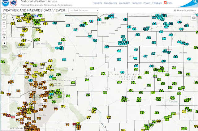
Regional Temperatures At 3 PM MST Today.
NWS NDFD Temperature Anomalies Wednesday.
NWS NDFD Forecast Snowfall Totals.
Yesterday's highs ranged from the upper 70's to the low 80'sand these readings were some 10º to 15º above normal for this time of the year. A strong cold front eased into the northern sections of the local area this morning and by 2 PM this afternoon it had moved south of Carlsbad as it continues to push southward and westward. A colder airmass is settling in over the area under overcast skies (mostly mid and high level clouds).
Lows tonight behind the front will range from the mid 30's to the low 40's. Most of the local area will not get out of the 40's to near 50ºF for daytime highs on Wednesday. These readings will average some 15º to 25º below normal.
Areas of low clouds, fog, light rain, and light drizzle are likely to develop tonight and continue most of the day tomorrow. A mix of light rain, light sleet, and light snow will be possible in the Portales and Clovis areas. Across the highest elevations of the Sacramento and Capitan Mountains some light snow may also generally above about 8,000' to 9,000'.
Thursday will see a recovery with warmer temps with highs back into the 60's and the 70's return Friday and Saturday.
(November 7th).
The Truth Is Stranger Than Fiction!


Comments
Post a Comment
Your comments, questions, and feedback on this post/web page are welcome.