My Current Weather

Saturday, October 27, 2018

Will Old Man Winter Take A Another Swing At Us Wednesday?


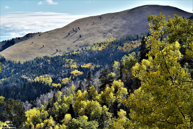
October 21st, 2018.
Looking southwest with Sierra Blanca Peak to my right.

Winter Takes Another Shot - First Freeze Next Week?


Valid At Noon MDT Next Wednesday.

As I publish this my thermometer tells me its a balmy 76º here in Carlsbad at 2:45 PM this beautiful Saturday afternoon. How about close to 80º for a high temp on Sunday, and perhaps a few low 80's on Monday. Enjoy because if this mornings run of the European forecast model is correct old man winter is going to take a another swing at us Wednesday.

There are significant differences between the U.S. GFS forecast model and the European (ECMWF) in this mornings runs. The Euro digs a closed low south into New Mexico centered near the Vaughn area by noontime Wednesday. The GFS has a fast moving long wave trough along the NM?TX state line at the same time. 

Whichever model forecast turns out to be correct will have huge implications upon how our weather turns out next week. The Euro would bring winter back with accumulating snowfall as far south as the Clovis area and the Sacramento Mountains. It brings a strong cold front into the SE Plains Wednesday morning born upon northerly winds gusting to 35-45 mph. Along with wind chills in the 20's and 30's and high temperatures in the 40's.

The GFS indicates none of this at this time. The Euro also forecasts colder temps with the possibility of some of the local area seeing our first freeze of the season Thursday morning. I tend to lean towards the European model forecast given our history this month of strong cold fronts plunging southward into the state. At least this has been the pattern so far. The jury is still out on this one and more on this in a day or two.

ECMWF Forecast High Temperatures.


Valid Next Wednesday At 6 PM MDT.

ECMWF Forecast Temperature Anomalies.

Valid At 6 PM MDT Next Wednesday.

ECMWF Peak Wind Gust Forecast.
(During The Previous 6-Hours).

Valid At 6 PM MDT Next Wednesday.

ECMWF Forecast Wind Chills.

Valid At Noon Next Wednesday.

ECMWF Forecast Precipitation Types.

Valid At Noon Next Wednesday.
Green is rain, blue is snow, and pink is a mix of both.

ECMWF Total Snowfall Forecast.

Valid At 6 AM MDT Next Thursday.

ECMWF Snow Depth Forecast.

Valid At 6 AM MDT Next Thursday.

ECMWF Forecast Low Temperatures.
(Next Thursday Morning.)


The Truth Is Stranger Than Fiction - And Sometimes It Hurts!

Unusually Cold For Mid-October!

Blog Updated At 11:35 AM MDT.

October 21st, 2018.
On the road to Ski Apache just before you enter the parking lot.

Unusual Cold For October.


Not only were a number of daily record cold high temperatures set on October 15th and 16th, but what makes this cold outbreak noteworthy is just how cold it was. Take a look below at some of our local temperature records that were broken and by how much. Suffice to say that this was the coldest outbreak for the middle of the month in 125 years or record keeping. 

Oct 15th- Tucumcari 44º Previous 46º In 2008. Coldest In 113 Years.
Oct 15th- Portales 41º Previous 49º In 1941. Coldest In 113 Years.

Oct 15th- Roswell 44º Previous 52º (WSO) In 1925. Coldest In 125 Years.
Oct 15th- Roswell 44º Previous 60º (Arpt)  In 1974. Coldest In 69 Years.

Oct 16th- Artesia 46º Previous 48º In 1970. Coldest In 113 Years.
Oct 16th- Hope 42º Previous 56º In 2013. Coldest In 99 Years.

Oct 15th- Carlsbad Arpt 45º Previous 56º In 1970. Coldest In 88 Years.
Oct 16th- Carlsbad 46º Previous 56º In 1919. Coldest In 117 Years.

Oct 16th- Picacho 39º Previous 59º In 2013. Coldest In 38 Years.

Oct 15th- Elk 37º Previous 51º In 1919. Coldest In 122 Years.
Oct 16th- Elk 36º Previous 44º In 1970. Coldest In 122 Years.

Oct 15th- Cloudcroft 44º Previous 47º In 1957,1994. Coldest In 117 Years.
Oct 16th- Cloudcroft 34º Previous 40º In 1970. Coldest In 117 Years.


(October 2018).


(Oct 1st - Oct 26th, 2018).


Maximum Temperature Anomalies.
(Oct 1st - Oct 26th, 2018).


Minimum Temperature Anomalies.
(Oct 1st - Oct 26th, 2018).


Overall in New Mexico and nearby states our first twenty six days of October are average below normal when you consider the daytime highs and nighttime lows averaged together. Note that our average daytime highs have been below to well below normal while our low temperatures are warmer than normal. 

The Truth Is Stranger Than Fiction - And Sometimes It Hurts!

Wednesday, October 24, 2018

Impressive Widespread Heavy Rainfall Overnight.


3:01 PM MDT 10-24-2018.
Talk about not being able to see across the street because of the fog...Whites City this afternoon.

2:47 PM MDT 10-24-2018.
Looking east just north of the NM/TX State line this afternoon.

2:48 PM MDT - 10-24-2018.
Looking northeast just north of the NM/TX State line this afternoon. Visibility at the state line was 1/8th of a mile and that's about as good as it got as I traveled north up US Hwy 62/180 to Whites City...16 miles to the northeast. In places (Whites City included) the visibility dropped down to 25 to 100 yards. 

Heavy Rains Fall Yesterday And Overnight.


(As Of 8 AM MDT This Wednesday Morning).


(Courtesy Of The El Paso NWS Office).

Open up the link to see more totals.

(Courtesy Of The Albuquerque NWS Office).

 • 15 SE CORONA - 2.75 in.
 •  null JEMEZ SPRINGS - 2.69 in.
 •  null ESTANCIA - 2.61 in.
 • 7 SSW EDGEWOOD - 2.48 in.
 • 5 NW SANDIA PARK - 2.47 in.
 • 4 NE SEDILLO - 2.42 in.
 • 8 WNW ALBUQUERQUE - 2.41 in.
 • 5 SE CARRIZOZO - 2.40 in.
 • 5 NW NOGAL - 2.39 in.
 • 2 SSW ARABELA - 2.38 in.
 • 4 NNW JEMEZ SPRINGS - 2.28 in.
 • 3 ENE PONDEROSA - 2.14 in.
 • 2 NNW NOGAL - 2.09 in.
 • 4 W RIO RANCHO - 2.08 in.
 • 1 ESE LINCOLN - 2.07 in.
 • 2 WSW NOGAL - 2.06 in.
 • 4 E SANDIA PARK - 2.06 in.
 • 2 WSW EDGEWOOD - 2.06 in.
 • 11 ENE JEMEZ SPRINGS - 2.03 in.
 • 4 WNW ALBUQUERQUE - 2.02 in.
 • 4 E SAN ANTONITO - 2.00 in.

 • 3 N SEDILLO - 1.96 in.
 • 2 NNW EDGEWOOD - 1.94 in.
 • 4 WNW ROSWELL - 1.92 in.
 • 5 SSW MESA - 1.90 in.
 • 3 E SAN ANTONITO - 1.90 in.
 • 1 ESE SEDILLO - 1.87 in.
 •  null ROSWELL - 1.86 in.
 • 2 NW ROSWELL - 1.82 in.
 • 6 ENE ALBUQUERQUE - 1.80 in.
 • 5 WNW MOUNTAINAIR - 1.79 in.
 •  null CAPITAN - 1.79 in.
 • 1 N CANONES - 1.79 in.
 • 1 W MOUNTAINAIR - 1.78 in.
 • 8 SE PLACITAS - 1.76 in.
 • 2 NW EDGEWOOD - 1.76 in.
 • 5 E ALBUQUERQUE - 1.76 in.
 • 4 NNE ROSWELL - 1.76 in.
 • 15 NNW BITTER LAKE WILDLIFE REF - 1.75 in.
 • 11 ENE JEMEZ SPRINGS - 1.75 in.
 • 4 SSE ROSWELL - 1.75 in.
 • 6 NE LAS VEGAS - 1.75 in.
 • 4 WSW RIO RANCHO - 1.74 in.
 • 4 WSW MILLS - 1.74 in.
 • 3 NE BONITO LAKE - 1.73 in.
 • 2 W MOUNTAINAIR - 1.73 in.
 • 2 SSE LA CUEVA - 1.72 in.
 • 10 SSW MESA - 1.71 in.
 • 8 SSW ALBUQUERQUE - 1.70 in.
 • 6 NE LAS VEGAS - 1.69 in.
 •  null SANTA FE - 1.67 in.
 • 1 WSW LOS ALAMOS - 1.66 in.
 • 6 WSW ESTANCIA - 1.66 in.
 • 6 NE ALBUQUERQUE - 1.62 in.
 • 8 W SANDIA PARK - 1.62 in.
 • 5 E LOWER COLONIAS - 1.62 in.
 • 4 W MOUNTAINAIR - 1.62 in.
 • 2 W ANGUS - 1.60 in.
 • 6 NW ALBUQUERQUE - 1.60 in.
 • 5 N ROSWELL - 1.60 in.
 •  null FRIJOLES - 1.59 in.
 • 1 SSW FORT SUMNER - 1.58 in.
 • 5 E SANTA FE - 1.57 in.
 • 19 SSE OLD HORSE SPRINGS - 1.57 in.
 • 2 ESE SANTA ROSA - 1.57 in.
 • 8 NW ALBUQUERQUE - 1.57 in.
 • 6 WNW NOGAL - 1.56 in.
 • 2 ESE CORRALES - 1.55 in.
 • 1 N LAMY - 1.55 in.
 • 1 WSW SEDILLO - 1.54 in.
 • 2 NE DUNKEN - 1.54 in.
 • 2 SW RIO RANCHO - 1.54 in.
 • 6 WNW ALBUQUERQUE - 1.53 in.
 • 2 WSW RIO RANCHO - 1.53 in.
 • 2 WNW CORRALES - 1.53 in.
 • 2 SSE ALBUQUERQUE - 1.52 in.
 • 5 NW MADRID - 1.51 in.
 • 1 ENE CORRALES - 1.51 in.

 • 1 SE SAN GERONIMO - 1.48 in.
 • 1 NNE LOS ALAMOS - 1.48 in.
 • 10 E CORONA - 1.47 in.
 • 15 NW CARRIZOZO - 1.47 in.
 • 1 WNW CARRIZOZO - 1.47 in.
 • 1 SE SAN ANTONIO - 1.46 in.
 • 2 ENE LOS ALAMOS - 1.46 in.
 • 3 NNW RUIDOSO - 1.45 in.
 • 2 WSW PONDEROSA - 1.45 in.
 • 2 SSW FORT STANTON - 1.45 in.
 • 9 SE ALBUQUERQUE - 1.44 in.
 • 7 E ALBUQUERQUE - 1.44 in.
 • 7 W OSCURO - 1.43 in.
 • 3 NNE LA CIENEGA - 1.43 in.
 • 8 NW ALBUQUERQUE - 1.43 in.
 • 3 NE ABO - 1.43 in.
 • 3 W ALBUQUERQUE - 1.43 in.
 • 7 ESE ALBUQUERQUE - 1.42 in.
 • 5 NNW CIMARRON - 1.41 in.
 • 1 NNW SANTA FE - 1.41 in.
 • 5 W ESTANCIA - 1.41 in.
 • 4 NNW LAMY - 1.41 in.
 • 2 SE ALBUQUERQUE - 1.40 in.
 • 8 ENE ALBUQUERQUE - 1.40 in.
 • 1 S MOUNTAINAIR - 1.40 in.
 •  null MOUNTAINAIR - 1.40 in.
 • 4 ESE ALBUQUERQUE - 1.39 in.
 • 6 SE SANTA FE - 1.38 in.
 • 2 NNW JACONA - 1.38 in.
 • 1 NNE CORRALES - 1.37 in.
 • 1 WNW GASCON - 1.37 in.
 • 2 SSE ALBUQUERQUE - 1.37 in.
 • 3 SE ALBUQUERQUE - 1.37 in.
 • 2 N CORRALES - 1.36 in.
 • 5 S ALBUQUERQUE - 1.36 in.
 • 2 ESE RIO RANCHO - 1.35 in.
 • 5 NE ALBUQUERQUE - 1.35 in.
 • 1 W CORONA - 1.35 in.
 • 2 E GLORIETA - 1.34 in.
 •  null TESUQUE - 1.34 in.
 • 3 NNE RUIDOSO - 1.34 in.
 • 9 SSE FORT SUMNER - 1.33 in.
 • 1 WNW LAMY - 1.33 in.
 • 2 E ALBUQUERQUE - 1.33 in.
 • 4 NW BANDELIER NATL MONUMENT - 1.32 in.
 • 1 SSE CORRALES - 1.32 in.
 • 1 ESE RIO RANCHO - 1.32 in.
 • 2 WNW LA JOYA - 1.32 in.
 • 17 WNW OSCURO - 1.31 in.
 • 28 SE BOSQUE DEL APACHE REFUGE - 1.31 in.
 • 6 WNW GLORIETA - 1.31 in.
 • 1 NNW PLACITAS - 1.31 in.
 • 5 SSE BELEN - 1.30 in.
 • 1 NNW ROMEROVILLE - 1.30 in.
 • 2 E LOS ALAMOS - 1.30 in.
 • 1 SSW CHAMIZAL - 1.30 in.
 • 1 W TESUQUE - 1.30 in.
 • 2 NE PLACITAS - 1.30 in.
 • 6 NNW ALBUQUERQUE - 1.29 in.
 • 3 WNW BERNALILLO - 1.29 in.
 • 5 E ALBUQUERQUE - 1.28 in.
 • 2 ENE RIO RANCHO - 1.28 in.
 • 3 SE ALBUQUERQUE - 1.28 in.
 • 6 NNE ALBUQUERQUE - 1.28 in.
 • 5 ESE ALBUQUERQUE - 1.27 in.
 • 18 WSW OSCURO - 1.27 in.
 • 1 ESE CORRALES - 1.27 in.
 • 1 NNW RUIDOSO - 1.26 in.
 • 5 S TERERRO - 1.26 in.
 • 3 N AGUA FRIA - 1.25 in.
 • 4 SE ALBUQUERQUE - 1.25 in.
 • 2 WNW CLOVIS - 1.25 in.

 • 33 NNE SOCORRO - 1.24 in.
 • 5 NW LAMY - 1.24 in.
 • 4 NW LAMY - 1.24 in.
 • 2 E SAN PABLO - 1.23 in.
 • 6 NNW LAMY - 1.22 in.
 • 8 ENE ALBUQUERQUE - 1.22 in.
 • 1 WSW BERNALILLO - 1.21 in.
 • 4 E ALBUQUERQUE - 1.21 in.
 • 3 W RIO RANCHO - 1.20 in.
 • 1 N RUIDOSO - 1.20 in.
 • 5 NNW LAMY - 1.20 in.
 • 7 W SANDIA PARK - 1.19 in.
 • 4 SSE ALBUQUERQUE - 1.18 in.
 • 1 E VALENCIA - 1.17 in.
 • 1 WNW EL RANCHO - 1.17 in.
 • 1 ESE CONTRERAS - 1.17 in.
 • 11 SE BOSQUE DEL APACHE REFUGE - 1.16 in.
 • 1 WSW LOS LUNAS - 1.16 in.
 • 3 WSW BELEN - 1.16 in.
 • 3 ESE MORIARTY - 1.16 in.
 • 14 NNE BITTER LAKE WILDLIFE REF - 1.16 in.
 • 4 NE ALBUQUERQUE - 1.15 in.
 • 13 SE TOLAR - 1.15 in.
 • 7 SSW COYOTE - 1.15 in.
 • 2 ESE BELEN - 1.15 in.
 • 3 NNE LOS CERRILLOS - 1.15 in.
 • 2 SE SOUTH SAN YSIDRO - 1.15 in.
 • 3 NNE ALBUQUERQUE - 1.14 in.
 • 7 E ALBUQUERQUE - 1.14 in.
 •  null ROWE - 1.14 in.
 • 3 E LOS ALAMOS - 1.14 in.
 • 16 SSE NATL RADIO ASTRONOMY OBS - 1.14 in.
 • 3 WNW ALBUQUERQUE - 1.13 in.
 • 3 SSW SANTA FE - 1.13 in.
 • 8 ESE ALBUQUERQUE - 1.13 in.
 • 3 WNW ALBUQUERQUE - 1.13 in.
 • 2 E ALBUQUERQUE - 1.12 in.
 • 13 SE TOLAR - 1.12 in.
 • 2 SW AGUA FRIA - 1.12 in.
 • 5 NW LAMY - 1.11 in.
 • 5 ENE LOS CERRILLOS - 1.11 in.
 • 8 SW ALBUQUERQUE - 1.11 in.
 •  null RIO COMMUNITIES - 1.10 in.
 • 2 W BERNALILLO - 1.10 in.
 • 3 WNW MADRID - 1.10 in.
 •  null WHITE ROCK - 1.09 in.
 • 7 WNW CANONCITO - 1.09 in.
 • 10 ESE TUCUMCARI - 1.08 in.
 • 3 ESE PORTALES - 1.08 in.
 • 7 NW LAMY - 1.07 in.
 • 7 SW ALBUQUERQUE - 1.07 in.
 • 1 SSE WHITE ROCK - 1.06 in.
 • 6 SE RIO COMMUNITIES - 1.06 in.
 • 1 NNE LEMITAR - 1.06 in.
 • 5 NE ALBUQUERQUE - 1.06 in.
 • 8 ESE ALBUQUERQUE - 1.05 in.
 • 6 NE PONDEROSA - 1.05 in.
 • 1 WSW MIAMI - 1.05 in.
 • 11 NW MESA - 1.05 in.
 • 5 SSW ALBUQUERQUE - 1.05 in.
 • 2 SSW SANTA ANA PUEBLO - 1.05 in.
 • 1 WNW WHITE ROCK - 1.04 in.
 • 3 N UTE PARK - 1.04 in.
 • 1 SSE CLINES CORNERS - 1.03 in.
 • 9 NE ALBUQUERQUE - 1.03 in.
 • 7 NNW AGUA FRIA - 1.03 in.
 • 5 N ALBUQUERQUE - 1.03 in.
 • 3 NNW TEXICO - 1.02 in.
 •  null OCATE - 1.02 in.
 •  null HOUSE - 1.02 in.
 • 11 ENE BELL RANCH - 1.01 in.
 • 5 WSW ALBUQUERQUE - 1.01 in.
 • 1 ENE RIO RANCHO - 1.00 in.
 • 3 NE TUCUMCARI - 1.00 in.
 • 1 S SANTA FE - 1.00 in.
 • 8 SSW ALBUQUERQUE - 1.00 in.


 • 20 WNW GRAN QUIVIRA - 0.99 in.
 • 22 SE BOSQUE DEL APACHE REFUGE - 0.99 in.
 • 1 WSW SANTA FE - 0.98 in.
 • 2 SSE PERALTA - 0.98 in.
 • 1 N SOCORRO - 0.96 in.
 • 4 SSW AGUA FRIA - 0.96 in.
 • 4 NE SANTA FE - 0.96 in.
 •  null RATON CREWS AIRPORT - 0.95 in.
 • 1 S PERALTA - 0.95 in.
 • 2 SW BERNALILLO - 0.95 in.
 • 3 WNW SANTA FE - 0.95 in.
 • 1 E SOCORRO - 0.94 in.
 • 5 N LAMY - 0.94 in.
 • 1 ESE POJOAQUE PUEBLO - 0.93 in.
 •  null GRADY - 0.93 in.
 • 2 S ESCONDIDA - 0.93 in.
 • 1 SSW TIJERAS - 0.93 in.
 • 34 ESE MOGOLLON - 0.92 in.
 • 4 WNW MCALISTER - 0.91 in.
 • 21 SE BOSQUE DEL APACHE REFUGE - 0.91 in.
 • 3 SW PORTALES - 0.90 in.
 • 3 SW PORTALES - 0.90 in.
 • 7 NNE MILNESAND - 0.90 in.
 • 3 SW AGUA FRIA - 0.90 in.
 •  null ALCALDE - 0.90 in.
 • 1 WNW WHITE ROCK - 0.89 in.
 • 5 ESE SANDIA PUEBLO - 0.89 in.
 •  null SOCORRO - 0.89 in.
 • 1 ENE SANTA FE - 0.88 in.
 • 1 W WHITE ROCK - 0.87 in.
 • 2 NNW SANTA FE - 0.87 in.
 • 4 NNW ISLETA PUEBLO - 0.86 in.
 • 7 ENE TUCUMCARI - 0.86 in.
 • 2 NNE CLOVIS - 0.86 in.
 • 6 SW TEXICO - 0.86 in.
 •  null BEAVERHEAD - 0.86 in.
 • 3 ENE TUCUMCARI - 0.85 in.
 • 10 SW BINGHAM - 0.85 in.
 • 2 W SANTA CRUZ - 0.84 in.
 • 3 E CLOVIS - 0.83 in.
 • 1 ESE MEDANALES - 0.83 in.
 • 2 S SOCORRO - 0.82 in.
 • 1 NE POJOAQUE PUEBLO - 0.82 in.
 • 2 NE CLOVIS - 0.82 in.
 • 14 E BOSQUE DEL APACHE REFUGE - 0.82 in.
 • 1 NW MEDANALES - 0.80 in.
 • 2 SW DORA - 0.80 in.
 • 6 WNW ESPANOLA - 0.79 in.
 • 6 W PLEASANT HILL - 0.79 in.
 • 3 N BROADVIEW - 0.79 in.
 • 1 NE CLOVIS - 0.78 in.
 • 6 S TEXICO - 0.78 in.
 • 1 SSW SAN ANTONIO - 0.75 in.
 • 3 W LOGAN - 0.73 in.
 • 5 N PLEASANT HILL - 0.72 in.
 • 1 WSW MOGOLLON - 0.70 in.
 • 3 ENE TRUCHAS - 0.70 in.
 • 3 WSW LOGAN - 0.68 in.
 • 7 WNW LAMA - 0.67 in.
 • 1 N CANNON AFB - 0.66 in.
 • 7 ESE KENNA - 0.66 in.
 • 2 W DATIL - 0.65 in.
 • 2 SSW RATON - 0.63 in.
 • 9 SW CUBA - 0.63 in.
 • 2 NW RIO LUCIO - 0.62 in.
 • 6 WSW TESUQUE - 0.62 in.
 • 1 N RATON - 0.58 in.
 • 8 ENE MOGOLLON - 0.58 in.
 • 4 E CANON PLAZA - 0.57 in.
 • 11 NNE DATIL - 0.57 in.
 • 3 NNE CAPULIN - 0.54 in.
 • 12 SSW EL VADO - 0.53 in.
 • 10 ESE MOGOLLON - 0.52 in.
 • 5 SSE RED RIVER - 0.52 in.


 •  null NARBONA PASS - 0.48 in.
 • 2 NW EL RITO - 0.48 in.
 • 4 NW LAMA - 0.48 in.
 • 2 SE EAGLE NEST - 0.47 in.
 • 4 NE ALCALDE - 0.47 in.
 • 6 SSW SAN MATEO - 0.47 in.
 • 19 N ALCALDE - 0.46 in.
 • 6 SSE NAGEEZI - 0.45 in.
 • 1 N NEW LAGUNA - 0.44 in.
 • 1 ESE FLORA VISTA - 0.44 in.
 • 2 NNE QUESTA - 0.43 in.
 • 2 S GRANTS - 0.43 in.
 •  null TRES PIEDRAS - 0.43 in.
 • 13 ENE BURNHAM - 0.43 in.
 • 1 N MILAN - 0.43 in.
 • 2 NNW ANGEL FIRE - 0.42 in.
 • 14 SE MOGOLLON - 0.42 in.
 • 12 S MONERO - 0.40 in.
 • 1 WSW LAMA - 0.39 in.
 • 8 SSW RED RIVER - 0.37 in.
 • 2 N MILAN - 0.37 in.
 • 5 S ARROYO HONDO - 0.35 in.
 • 2 N CHAMA - 0.35 in.
 • 9 SSW BLUEWATER LAKE - 0.34 in.
 •  null PIETOWN - 0.34 in.
 • 19 SW ACOMA PUEBLO - 0.34 in.
 • 2 SSW MILAN - 0.33 in.
 • 1 WNW RESERVE - 0.33 in.
 • 1 ESE TRUCHAS - 0.33 in.
 • 4 ENE SANTA FE - 0.33 in.
 • 1 SE TALPA - 0.33 in.
 • 13 NW TAOS - 0.32 in.
 • 1 WNW RESERVE - 0.32 in.
 • 12 N NAVAJO DAM - 0.31 in.
 • 11 SE RAMAH - 0.31 in.
 • 1 ENE LUNA - 0.30 in.
 • 14 SSE PINE HILL - 0.29 in.
 • 6 SSE QUEMADO LAKE - 0.28 in.
 • 9 NE AZTEC - 0.28 in.
 • 1 E ARROYO SECO - 0.28 in.
 • 11 ENE BELL RANCH - 0.28 in.
 • 2 NNE ROWE - 0.26 in.
 •  null DULCE - 0.26 in.
 •  null RAMAH - 0.25 in.
 • 2 ENE CLAYTON - 0.25 in.
 • 1 W CLAYTON - 0.22 in.
 • 3 WSW RIO RANCHO - 0.22 in.
 •  null RIO RANCHO - 0.21 in.
 • 3 NE FARMINGTON - 0.21 in.
 • 1 W GRANTS - 0.20 in.
 • 1 N RED HILL - 0.18 in.
 • 2 SSW LOS CORDOVAS - 0.17 in.
 •  null AZTEC - 0.17 in.
 •  null AZTEC - 0.17 in.
 • 7 SE PLACITAS - 0.17 in.
 • 8 NNW OMEGA - 0.17 in.
 • 3 WNW SENECA - 0.16 in.
 • 3 ENE FARMINGTON - 0.14 in.
 • 4 ESE CHACO CANYON - 0.14 in.
 • 7 NW ZUNI PUEBLO - 0.12 in.
 • 2 ENE TAOS - 0.11 in.

Some Of The Heavier Public Reported Local 24-Hour Rainfall Totals.

Public Report South Of Loving Near Tidwell Rd 3.60"

Curtis Wickenkamp - Sunnyview Carlsbad 2.60"
Carole Connell Edeal - Riverside Dr Carlsbad 2.50"
Judy Van Tol Dycus - SE Carlsbad 2.50"
Pam Durr - Buckboard Rd 2 S Carlsbad Arpt 2.50"
Carrie Greenwood - 3 NE Artesia 2.50"
Kathy Kein Wells - West Roswell 2.40"
Runyan Ranches Apple Barn - 52 W Of Artesia 2.40"
George Bari Harris - Near The Carlsbad Arpt 2.25"
Craig Schinnerer - Halfway 2.00"
Martha Singleton - Morris Rd Otis 2.00"

Carlsbad Climate Co-Op Station 1.73"
Our Home In NW Carlsbad 1.72"
NMSU SEBS 6 South Of Artesia 1.34"

The Truth Is Stranger Than Fiction - And Sometimes It Hurts!

NWS Albuquerque Burn Scar Matrix Forecast

Current NWS Watches/Warnings In Effect

New Mexico

Eddy County

Chaves County Plains & Mtn's

Culberson County

Lea County

Lincoln County

Otero County

Current US Temps

Current US Wind Chill/Heat Index Temperatures

NWS Midland Forecast

NWS Albuquerque Forecast

NWS Albuquerque Forecast

NWS El Paso Forecast

NWS Lubbock Forecast

NWS Lubbock Forecast

Average Daily High/Low Temperatures & Rainfall

Average Daily High/Low Temperatures & Rainfall