My Current Weather

Sunday, August 30, 2015

Mountain Trip 8-29-2015 & Super Moon.


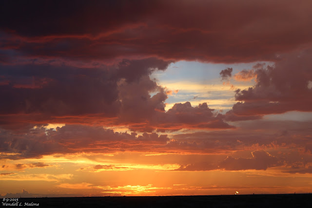
 We took a trip to Alamogordo, New Mexico yesterday to get a truck load of firewood. Time to get ready for winter. On our way back we pulled over just before the tunnel on US Hwy 82 during a thunderstorm. It was cool watching the rain curtains work their way down the canyons as the thunderstorm moved from northeast to southwest. Arrived back in Carlsbad just in time to grab a shot of the Super Moon and a couple of kids swimming in the river near the Flume. 

The Truth Is Stranger Than Fiction!

Saturday, August 29, 2015

Rains Miss Artesia & Carlsbad. Tropical Storm Erika Falls Apart.


As Of 6 AM MDT This Morning.

Thunderstorms erupted once again over eastern and southeastern New Mexico yesterday afternoon. Some of these continued well into the night as they moved southward dissipating just before sunrise. Some decent rainfall totals were noted in several locations but Artesia and Carlsbad got left out again.

Thursday, August 27, 2015

Tropical Storm Erika.


All eyes are on  poorly organized Tropical Storm Erika this morning as she continues moving to the west at 16 mph. As of 9 AM MDT she was located about 125 miles west of Guadeloupe with sustained winds of near 50 mph. Her central pressure was 1006 MB or 29.71". So where is she headed and how strong will she become?

Saturday, August 22, 2015

Hot Today With More T-Storms - Cold Front Cools Us Down Sunday.


A short line of thunderstorms developed just before sunset yesterday and moved southeastward into Eddy County. Finally we had a decent rain here at our home in NW Carlsbad with 1.01". Severe thunderstorms produced quarter size hail along US Hwy 82 13 miles ESE of Artesia at 9:30 PM. Severe thunderstorms also erupted in Lea County near Crossroads downing power poles. 

Additional thunderstorms are forecast for the area once again today into Sunday. Locally heavy rain will also be possible and a few thunderstorms may become strong to severe. Highs today will be near 100. A cold front will move southward into the area on Sunday knocking our highs back down into the 70's and 80's. 

Friday, August 21, 2015

Overnight T-Storms Produce Lots Of Lightning.


Thunderstorms erupted across the local area late yesterday afternoon as they marched off to the southeast. As of 5 AM this morning the heaviest known reported rainfall occurred at the Artesia Airport with .45" and at the Paduca Raws located southeast of the WIPP Site with .54". 

Wednesday, August 19, 2015

This Mornings Cold Front Drops Temps 15-30 Degrees.


RTMA 24-Hour Temperature Anomalies @ 3 PM MDT Today.


Temperatures at 3 PM MDT are running 15-30 degrees cooler today over the eastern one half of New Mexico, and across much of West Texas northeastward into Oklahoma compared with yesterday's readings. Thanks to the seasons fist strong cold front that entered the area early this morning.

The Truth Is Stranger Than Fiction!

Tuesday, August 18, 2015

Much Cooler Wednesday Behind A Strong Cold Front.


Just as was expected our thermometers are heating up here in southeastern New Mexico ahead of an unseasonably strong cold front. At 4 PM MDT temps ranged from 79°F in Clayton in northeastern New Mexico, where the front has just entered that area, to 101°F in Carlsbad, 99°F in Artesia, and 100°F in Roswell. Temperatures in South Dakota and northern Nebraska are in the 50's behind the front.

Monday, August 17, 2015

Unusually Hot Tuesday - Unusually Cool Wednesday!


Rather chilly across the northern plains this morning with readings in the 40's and 50's at 7 AM MDT behind the seasons first strong cold front. This cold front will bring much cooler weather to SE NM and W TX by Wednesday. 

New Daily Record High Temps Broken/Tied In NM Aug 1st - 15th, 2015.


Record heat gripped parts of the Land of Enchantment the first half of this month. Listed below are the new daily high temperature records that were established between the 1st and 15th.

Sunday, August 16, 2015

First Fall Like Cold Front Wednesday.


First fall-like upper level trough of low pressure and cold front will cool us down by Wednesday.

T-Storms Return.


Just East Of Cloudcroft, New Mexico 8-15-2015.

Waking up at 4 AM this morning to the sound of thunder and rain pelting down on our roof was a joyful experience. Especially after a week of temperatures that soared up to as high as 107°F. As of 9:15 AM this morning I've managed to collect .29" in our rain bucket. 

Some of the heavier 24 hour rainfall totals as of 8 AM this morning include:

Sacramento Peak Observatory 2.13"
Melrose Range Raws 2.04"
Personal Weather Station 26 Miles North Of Roswell 1.28"
Caprock Raws 1.05"

Saturday, August 15, 2015

First Half Of August 2015 Unusually Hot In SE NM.


Lea County New Mexico Sunset. 8-9-2015.

If you've been thinking that August has been unusually hot so far in southeastern New Mexico then you are correct. Carlsbad has recorded a high temperature at the airport of 107°F on three different days. Roswell has also topped out at the airport at 107°F. Artesia has topped out at 105°F at the SEBS AG Science Center. Tatum has reached 101°F and Hobbs has recorded a high of 99°F on five days. Cloudcroft in the southern Sacramento mountains at 8,751' has recorded a high temperature of 78°F twice now. Some of these readings are new daily high temperature records and I will post more on this in a couple of days.

Friday, August 14, 2015

More Blistering Heat Today With T-Storms Returning. Pattern Change Next Week?


Thursday was yet another day with high temperatures at or above 100°F in southeastern New Mexico and parts of West Texas. I topped out at 103°F here at our home in Carlsbad. The Carlsbad Airport checked in with 105°F, The Roswell Airport reported 104°F, the Artesia Airport reported 100°F, and the Hobbs Airport reported 97°F. Similar readings are forecast locally once again today. 


Thursday, August 13, 2015

125 Year Cooling Period Has Already Begun.


Published on Aug 10, 2015

David Dilley, former NOAA Meteorologist and current CEO and senior research scientist - Global Weather Oscillations, Inc., gives a presentation on Mind Your Own Business TV with Debi Davis. Mr. Dilley provides the viewer a full picture and understanding of climate change cycles and carbon dioxide cycles. Mr. Dilley combines his own research with peer reviewed research from other scientists and applies it to what is happening today, and to the likely dangerous climate change that will occur between the years 2019 to 2050. 

Visit David's website at:

www.GlobalWeatherCycles.com

Tuesday, August 11, 2015

Lightning. 8-9-2015.


I shot these Sunday night at the Red Hills Gas Plant, located 21 miles west-northwest of Jal, in Lea County New Mexico.

The Truth Is Stranger Than Fiction!

Monday, August 10, 2015

Flash Flooding In Alamogordo, NM This Afternoon.


El Paso NWS GRLevel3_2.00 Estimated Rainfall Totals.
Holloman AFB GRLevel3_2.00 Estimated Rainfall Totals.

As of 5 PM MDT this afternoon flash flooding was ongoing in the Alamogordo area in Otero County. Over 4 inches of rain had fallen over the eastern parts of the city in the past hour or so. Doppler radar is estimating that as much as 6 inches may have fallen on the foothills southeast of Alamogordo.

The Truth Is Stranger Than Fiction!

Thursday, August 6, 2015

Wednesday, August 5, 2015 - Hottest Day Of The Year So Far.


Courtesy Of Diane J. Malone.
Thousand Mile Canyon Hiking Trail.
 In The Southern Sacramento Mtn's Of New Mexico. 

Unfortunately the dog days of summer have set in with forecasts high temperatures in southeastern New Mexico and nearby West Texas to remain near or above 100°F into Sunday. Id rather be back on the trail above that we hiked this past weekend. 

Wednesday, August 5, 2015

The Truth About The Politics Driving The Climate Change Agenda.


Lord Christopher Monckton is interviewed on Canadian television about climate change hysteria and its implications. Originally broadcasted December 26, ... 

Tuesday, August 4, 2015

100-Degree Temps Today Into Sunday.


Today.


Looks like the rain machine has shut down for awhile here in the southeastern plains of New Mexico and most of West Texas. This mornings GFS model is forecasting our afternoon high temps to reach or climb above 100°F this afternoon into Sunday. 

Why The Push For Everyone To Accept The Climate Change Agenda?


Have you ever asked yourself why there is such a push for everyone to accept the Climate Change/Man Made Global Warming Agenda? Why is this subject so important to everyone from the President on down? We are bombarded daily with this stuff from the Liberal Media. And if you've been following closely you know now that even the Pope of Rome has thrown his support, as well as the Muslim Mullah's. Do you really think that mankind is capable of destroying the planets climate? Think about that for a little bit. Also ask yourself why those who support this agenda are so bent on destroying anyone who stands up and says no this isn't true.  What is really going on?

Sunday, August 2, 2015

SE NM Rainfall Totals - July, 2015 & YTD Totals.


July was a wet month rainfall-wise across the Land of Enchantment. Here at our home in Carlsbad I ended up with 2.36" for the month. This is above the long term average of 1.87" (1900 - 2015). Carlsbad's wettest July was in 1902 when the Climate Co-Op Station recorded 10.50". 

Saturday, August 1, 2015

SSRC- Government Climate Data Found Unreliable! (Press Release 6-29-2015).


P.O. Box 607841 * Orlando, FL 32860
(407) 667-4757 * www.spaceandscience.net

Government Climate Data Found Unreliable

Monday, June 29, 2015                                                                 Press Release 4-2015
9:00 AM EDT

Effective immediately, the Space and Science Research Corporation (SSRC), a leader in climate prediction, has dropped the US government's ground based global temperature data from its list of reliable sources.

This significant step has been made by the SSRC after extensive review of the US government's ground temperature data and its wide divergence from more reliable sources of climate data, namely satellite systems. 

The SSRC has found multiple flaws that it says render the US government's climate data virtually unusable. The SSRC has further observed that the US government and specifically, President Barack Obama, have routinely deceived the people regarding the true status of the Earth's climate, its causes, and where the global climate is heading.

In the past, the SSRC has used five global temperature data sets, three ground based (NOAA, NASA and HADCRUT) and two satellite data sets (RSS, UAH). These data sets are analyzed and an integrated picture of all five allows the SSRC to produce its semi-annual Global Climate Status Report (GCSR). HADCRUT is a combined set from two UK science groups.
As of today, the SSRC will no longer use the ground based data sets of NASA and NOAA because of serious questions about their credibility and allegations of data manipulation to support President Obama's climate change policies. Use of HADCRUT will also be suspended on similar grounds.

According to SSRC President, Mr. John L. Casey, "It is clear that during the administration of President Barack Obama, there has developed a culture of scientific corruption permitting the alteration or modification of global temperature data in a way that supports the myth of manmade global warming. This situation has come about because of Presidential Executive Orders, science agencies producing unreliable and inaccurate climate reports, and also with statements by the President about the climate that are patently false.

For example, the President has said that global warming is not only a global threat but that it is "accelerating" (Georgetown Univ. June 2015). Further, he has said that "2014 was the planet's warmest year on record" (State of the Union Address, January 2015). Both these statements are simply not true. He has also publicly ridiculed those who have correctly stated that there has been no global warming for eighteen years therefore nullifying any need for US government actions to control greenhouse gas emissions for any reason. Climate mendacity seems to be the rule and not the exception in this administration. 
"As a result, the US government's apparently politically manipulated ground based temperature data sets can no longer be regarded as credible from a climate analysis standpoint. Until scientific integrity is restored in the White House and the rest of the federal government, we will henceforth be forced to rely solely on satellite measurements.

"Most disturbing of course, is that the President has failed to prepare the country for the difficult times ahead as a result of the ominous changes taking place on the Sun. Not only is the Sun the primary agent of climate change, but it is now cutting back on life giving warmth, bringing a new cold climate period. We will all face a more difficult future, one which the President is ensuring we will be totally unprepared for."

Dr. Ole Humlum, a Professor of Physical Geology at the University of Oslo, Norway and an expert of global glacial activity, is the co-editor of the SSRC's Global Climate Status Report (GCSR). He adds to Mr. Casey's comment with, "It is regrettable to see the politically forced changing of temperature data which will of course lead to the wrong conclusions about the causes and effects of climate change. Recently, NOAA indicated that May 2015 was the warmest May since 1880. Yet, this cannot be verified by satellite measurements which show that May was in the average range for the month over the past ten years. Also, on page 41 of the June 10, 2015 GCSR, we noted that the temperature spread between ground based and satellite based data sets, has now widened to a point that is problematic. The average in degrees Centigrade among the three ground based sets shows a 0.45 C warming in temperature since 1979. For the more reliable satellite systems, it is only 0.17 C warming. This 264% (0.45/0.17) differential is scientifically unacceptable and warrants ending the reliance on the ground based data sets until some independent investigation of the variance resolves the matter. While the use of satellite data only, will limit the depth of quality of the Global Climate Status Report, it will at the same time allow us to still provide the best available climate assessment and climate predictions possible using only the most reliable data."

The Truth Is Stranger Than Fiction!

Blue Moon - Carlsbad, NM. 7-31-2015.


NWS Albuquerque Burn Scar Matrix Forecast

Current NWS Watches/Warnings In Effect

New Mexico

Eddy County

Chaves County Plains & Mtn's

Culberson County

Lea County

Lincoln County

Otero County

Current US Temps

Current US Wind Chill/Heat Index Temperatures

NWS Midland Forecast

NWS Albuquerque Forecast

NWS Albuquerque Forecast

NWS El Paso Forecast

NWS Lubbock Forecast

NWS Lubbock Forecast

Average Daily High/Low Temperatures & Rainfall

Average Daily High/Low Temperatures & Rainfall