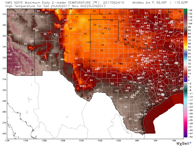
My Current Weather

Saturday, June 24, 2017

Warming Back Up By Monday & Who Has The Best Chance Of Getting Wet?


Today.


Sunday.


Monday.


Tuesday.


Wednesday.


Thursday.


Friday.


(Today Through Monday).


(Today Through Next Friday).


The Truth Is Stranger Than Fiction!

How Hot Has It Been & How Many Records Have Been Broken?


May 6, 2017.
Looking Northeast At The Capitan Mountain Range
 From Near The Monjeau Lookout Northwest Of Ruidoso, NM.

(June 1st - June 20th, 2017).


(June 2017).

Roswell Airport.


Artesia Airport.


Artesia Climate Co-Op Station.


Hope Climate Co-Op Station.


Brantley Lake Climate Co-Op Station.


Carlsbad Airport.


Carlsbad Climate Co-Op Station.


Hobbs, Airport.


Sierra Blanca Regional Airport.


Cloudcroft Climate Co-Op Station.


Note: The daily high temperature for the month is highlighted in red and the daily low temperature for the month is highlighted in blue on the tables above.

So far this month my highest temperature recorded here at our home in northwest Carlsbad on my Davis Vantage Pro2 Plus Weather Station has been the 108ºF reading on the 17th. Locally the 115ºF reading recorded at the 8-Mile Draw Raws located northeast of Roswell on the 17th of this month still stands as the highest official temperature recorded so far. 

The Cloudcroft Climate Co-Op Station recorded a high temperature of 87ºF on the 17th of this month. This falls short of their all-time highest temperature recorded of 89ºF which was set on June 26th, 1957 and again on July 4th, 1957. 

The Truth Is Stranger Than Fiction!

Thursday, June 22, 2017

One More Day Of Triple Digit Heat Then Relief.


(A Long Ways From The 111ºF That Was Forecast).

Cold Front Friday Spells Relief.


Roswell.


Carlsbad.


Ruidoso.


Cloudcroft.


NWS NDFD Forecast High Temps Friday.

Forecast Temps Valid At 6 PM MDT Friday.

GFS Forecast Temp Anomaly.
Valid At 6 PM MDT Friday.

GFS Forecast Temp Anomaly.
Valid At Noon MDT Saturday.

Thankfully our current heat wave is coming in with a little less bite than has been forecast. Not that I'm complaining either that's for sure. A rather strong unseasonably cold front is forecast to sweep south into the area tomorrow afternoon. Depending upon the timing of the arrival of the frontal passage our temps may or may not be as high as forecast. 

Anyway cooler temps are on the way this weekend with an increased likelihood of seeing scattered thunderstorms. Good because I'm way tired of this triple digit heat already. 

Last nights thunderstorms produced .12" here at our home in Carlsbad between 10 PM and 12:30 AM. Hopefully much more of this is on the way.

The Truth Is Stranger Than Fiction!

Sunday, June 18, 2017

How Hot Did It Get Saturday? Regional Temperature Lisitng.


Note: The high temperatures recorded yesterday are highlighted in the white boxes with red numbers. The black dots with the lines coming out of them represent the direction from which the wind is blowing this morning (8 AM MDT) and how fast in knots. This list includes a combination of official National Weather Service Airport Observations (ASOS & AWOS), CWOP Personal Weather Stations (PWS), APRS Weather Stations, and Union Pacific Railroad Stations (UPR), US Forest Service and BLM Stations (RAWS). Some of the PWS and UPR temperatures may not be reliable especially those readings listed of over 115ºF. 

(June 1st - June 17th, 2017).

Taos, NM.


Santa Fe, NM.


Albuquerque, NM. 


Tucumcari, NM.


Cannon AFB - Clovis, NM.


Sierra Blanca Regional Airport - Ruidoso, NM.


Roswell, NM.


Artesia, NM.


Carlsbad, NM.


Hobbs, NM.


Holloman AFB - Alamogordo, NM.


Las Cruces, NM.


Guadalupe Pass, Texas.


El Paso, Texas.


Midland, Texas.


Pecos, Texas.


Lubbock, Texas.


(Saturday, June 17, 2017.)


(6 AM MDT Sunday Morning).


( At 9 AM MDT Sunday Morning).


After yesterday's blistering heat which set many new daily record highs a cold front has managed to push southward into Southeastern New Mexico and parts of West Texas. Therefore a cooler air mass is forecast to overspread the area today producing afternoon highs only in the 80's and low 90's verses yesterdays readings of 100ºF to 115ºF. Unfortunately this isn't going to last as our upcoming week will see us go back into the furnace with forecast highs on Thursday and Friday locally flirting with the 110ºF mark.


The Carlsbad Airport recorded a high temp of 109ºF Saturday afternoon which was one degree shy of the record high temp for the date of 110ºF in 1977. I will post a complete listing of the local daily record high temperatures that have been established this month in a week or two when they become available.


(Saturday).


(This Upcoming Week).

Today.


Monday.


Tuesday.


Wednesday.


Thursday.


Friday.


The Truth Is Stranger Than Fiction!

NWS Albuquerque Burn Scar Matrix Forecast

Current NWS Watches/Warnings In Effect

New Mexico

Eddy County

Chaves County Plains & Mtn's

Culberson County

Lea County

Lincoln County

Otero County

Current US Temps

Current US Wind Chill/Heat Index Temperatures

NWS Midland Forecast

NWS Albuquerque Forecast

NWS Albuquerque Forecast

NWS El Paso Forecast

NWS Lubbock Forecast

NWS Lubbock Forecast

Average Daily High/Low Temperatures & Rainfall

Average Daily High/Low Temperatures & Rainfall