My Current Weather

Tuesday, October 31, 2017

Snow In The Guadalupe's & Sac's Overnight & Rain Upon The SE Plains.


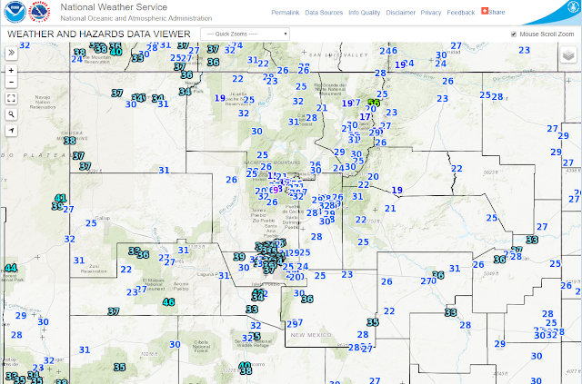
Blog Updated At 10:12 AM MDT.

Snow In The Sacramento Mtn's Overnight.

Russia Canyon South Of Cloudcroft.

Courtesy Of Sharon Smith 

Ski Apache Web Cam.

Captured At  7:13 AM MDT This Halloween Morning.


Captured At 8:04 AM MDT This Morning.


Captured At 7:36 AM MDT This Halloween Morning.


Captured At 7:30 AM MDT This Halloween Morning.

Local web cams from the Sacramento Mountains of South-Central New Mexico this morning were showing light snow falling. A dusting covered the grassy areas of Ski Apache, Cloudcroft, and Timberon as of 7-8 AM. Local New Mexico CoCoRaHS reports as of 8 AM indicated that 0.2" of snowfall fell 0.4 miles east-southeast of Cloudcroft and 0.1" 2.3 miles south of town.

Cannon AFB west of Clovis was reporting light sleet with a temp of 38ºF at 6 AM this morning. Between 2:32 AM and 2:51 AM MDT early this morning Guadalupe Pass was reporting a mix of light rain and snow. 

As of 6 AM this morning the public was reporting light snow in Portales south of Clovis in the Eastern Plains of the state while light rain was falling from the Pecos Valley eastward to the state line. I picked up .04" here at our home in northwest Carlsbad while the CoCoRaHS Station located 3.5 miles north-northeast of Artesia measured .11"

Local Radar Snapshots.

Santa Teresa Radar.

Captured At 4:58 MDT This Halloween Morning.

Captured At 7:36 MDT This Halloween Morning.

Radar showed a mix of light rain, sleet, and freezing rain over the Sacrament Mountains early this morning. 


Captured At 7 AM MDT This Halloween Morning.

Happy Halloween!


Local Halloween Climatology.


Climate Data Listed Above Is Courtesy Of:


---------------------------------------------------------------

(October 31st).


The Truth Is Stranger Than Fiction!

Monday, October 30, 2017

Colder Today & Halloween With A Few Lowland Showers & Mtn Snow Showers.


Valid At 3:42 AM MDT This Morning.


Valid At 3 AM MDT This Morning.


Valid At Midnight Last Night.


Valid At Midnight Last Night.

A small closed upper level low was located near San Diego, California early this morning and is forecast to move rapidly eastward across southern New Mexico today into Halloween as it opens up and weakens. 

A strong backdoor cold front was located between Roswell and Clovis as of 5 AM this morning and is moving rapidly southward and westward. After seeing high temperatures in the mid to upper 70's yesterday today's highs will be some 20 to 30 degrees colder behind the cold front. North to northeast winds are gusting in the 25 to 35 mph range behind the front. A High Wind Warning is in effect for Guadalupe Pass for this evening through Tuesday morning where northeast winds are forecast to gust up to 50 mph.


Today.


Halloween.


Wednesday.


Highs on Halloween will be in the 50's. Today's and Halloweens high temps will be some 15 to 20 degrees below normal for the date. Temperatures at sunset and afterwards will be in the mid 40's to near 50 with southeasterly winds around 10 mph so bundle the ghosts and goblins up. 

Right on cue as has been the case all month long the temperature roller coaster ride continues with highs on Wednesday bouncing right back up into the mid 70's to the low 80's which will be some 5 to 10 degrees above normal for the date. October is famous for these type of temperature extremes.

Rain Upon The Plains & Snow In The Mountains?


Valid Today Into 6 PM MDT Wednesday.

A few light rain showers may break out over the local area tonight into Halloween morning. A few light snow showers will also be possible across the higher elevations of the Guadalupe, Sacramento, and Capatin Mountains generally above 7,000'. Its possible that the Cloudcroft and Sunspot areas could see an inch or two of snow with the highest elevations such as Ski Apache west of Ruidoso possibly seeing more. 

(October 30th).


The Truth Is Stranger Than Fiction!

Saturday, October 28, 2017

First Freeze Of The Season Overnight.


Local Reported Low Temperatures This Morning.


Unofficially the coldest reading I could find locally is the 23ºF reported by the West Cox Canyon Personal Weather Station (PWS) south of Cloudcroft this morning. 


The Cottonwood Davis Personal Weather Station (PWS) recorded a low of 28ºF this morning for one of the coldest readings in the valley. 


Southeast of Roswell in the East Grand Plains area the Whitney Farms Davis Personal Weather Station (PWS) recorded a low of 29ºF. Officially (as of 6 AM) the Roswell Airport ASOS only dropped down to 33ºF. Its possible that when the new synoptic observation comes in at noon that a colder reading will be reported. Typically the coldest temperature occur around sunrise and often in the colder months the coldest reading will occur after 6 AM but will not be reported until the noon observation. Or with the time change coming up next Sunday the next 6 hourly high and low temperatures will be reported at 11 AM.

Both the Artesia Airport AWOS and the Carlsbad Airport ASOS observations reported a low of 32ºF this morning as of 6 AM MDT. As did the Hobbs AWOS


Here at our home in northwest Carlsbad my Davis Vantage Pro2 Plus PWS dropped down to 32.9ºF falling just short of the freezing mark. Thus the urban heat island effect on the thermometer in our backyard. For all intent and purposes it appears that a widespread light freeze did occur locally overnight. Now we await the killing freeze or hard freeze when the temperature drops down to below 28ºF.

(October 28th).


The Truth Is Stranger Than Fiction!

Thursday, October 26, 2017

Friday's Highs 30 To 35 Degrees Colder Than Today's Behind Tonight's Cold Front.


Temperature Anomalies At 3 PM MDT Today.


Temperatures have dropped down into the 20's and low 30's across much of Wyoming and the upper 30's to low 40's across northern and eastern Colorado as of 3 PM MDT this afternoon. These readings are ranging from 25ºF to 40ºF below normal behind a strong cold front that is moving southward. 


Meanwhile ahead of the southward advancing backdoor cold front our temperatures in Southeastern New Mexico have climbed up into the mid and upper 80's. So far we have manged to reach 88ºF here at our home in NW Carlsbad


Strong Backdoor Cold Front Comes Knocking Tonight.


Temperature Departures From Normal Friday.


After seeing our afternoon highs climb up into the mid to upper 80's today which is some 10ºF to 15ºF above normal for the date, our highs tomorrow will only be in the 50's here in Southeastern New Mexico. Clovis and Portales will only be in the 40's and perhaps even Roswell may not make it up to 50ºF. These readings will be some 20ºF to 25ºF below normal. Friday's highs will be some 30ºF to 40ºF lower than today's highs locally.

First Widespread Freeze Of The Season.


Current local National Weather Service forecasts call for most of Southeastern New Mexico to be at or below freezing by sunrise Saturday morning. Thus the areas first widespread freeze is expected to occur. Note that Roswell is forecast to get down as low as 25ºF and I expect to see similar readings in the rural areas along and near the Pecos River and on the Caprock Saturday morning. 


(Oct 26th).


The Truth Is Stranger Than Fiction!

NWS Albuquerque Burn Scar Matrix Forecast

Current NWS Watches/Warnings In Effect

New Mexico

Eddy County

Chaves County Plains & Mtn's

Culberson County

Lea County

Lincoln County

Otero County

Current US Temps

Current US Wind Chill/Heat Index Temperatures

NWS Midland Forecast

NWS Albuquerque Forecast

NWS Albuquerque Forecast

NWS El Paso Forecast

NWS Lubbock Forecast

NWS Lubbock Forecast

Average Daily High/Low Temperatures & Rainfall

Average Daily High/Low Temperatures & Rainfall