


New Mexico June 2022 Rainfall Totals.


Bernalillo County.
| G0586 GW0586 Albuquerque | APRSWXNET/CWOP 7011 ft | 0.00 | 1.21 | 1.80 | 2.69 | 4.32 |
Catron County.
| MGNN5 MOGOLLON | RAWS 7566 ft | 0.00 | 1.12 | 1.80 | 3.65 | 6.58 |
Cibola County.
| GMLN5 MALPAIS LAVA FLOW | RAWS 7514 ft | 0.00 | 0.18 | 0.58 | 3.18 | 4.14 |
Colfax County.
| TOLN5 TOLBY | SNOTEL 10180 ft | 0.00 | 2.00 | 2.80 | 3.30 | 3.50 |
Curry County.
| C3200 CW3200 Clovis | APRSWXNET/CWOP 4383 ft | 0.00 | 0.03 | 0.93 | 0.93 | 2.61 |
De Baca County.
| D3230 DW3230 Fort Sumner | APRSWXNET/CWOP 4360 ft | 0.00 | 0.01 | 0.78 | 1.22 | 1.65 |
Dona Ana County.
| WSM13 WSMR Museum | WSMR 4239 ft | 0.00 | 0.00 | 0.02 | 1.36 | 3.19 |
Grant County.
| TT013 IRAWS 16 (EMORY PASS | RAWS 8347 ft | 0.00 | 1.09 | 1.88 | 4.26 | 6.47 |
Guadalupe County.
| KSXU Santa Rosa Route 66 | NWS/FAA 4791 ft | 0.00 | 0.01 | 1.41 | 2.20 | 2.38 |
Los Alamos County.
| NFEN5 BANDELIER NATIONAL M | CRN 7255 ft | 0.13 | 1.85 | 3.07 | 3.74 | 4.57 |
Luna County.
| KDMN Deming Municipal Air | NWS/FAA 4301 ft | 0.00 | 0.00 | 0.23 | 1.08 | 1.38 |
McKinley County.
| TT491 RIO PUERCO QD #1 | RAWS 8105 ft | 0.00 | 0.00 | 0.00 | 1.16 | 3.59 |
Mora County.
| TT034 IRAWS 5 (HAMILTON ME | RAWS 10440 ft | 0.00 | 0.00 | 0.00 | 0.00 | 4.97 |
Rio Arriba County.
| VACN5 VACAS LOCAS | SNOTEL 9306 ft | 0.10 | 1.90 | 2.50 | 4.30 | 5.90 |
Roosevelt County.
| E3946 EW3946 Portales | APRSWXNET/CWOP 4010 ft | 0.00 | 0.00 | 0.00 | 0.00 | 0.80 |
San Juan County.
| CWRN5 ALBINO CANYON | RAWS 7173 ft | 0.00 | 1.19 | 1.19 | 1.32 | 2.30 |
San Miguel County.
| TT082 IRAWS 12 (DAVIS CREE | RAWS 8815 ft | 0.00 | 1.27 | 2.27 | 3.68 | 4.83 |
Sandoval County.
| VRDD Redondo (Valles Cald | DRI 10601 ft | 0.12 | 1.58 | 2.29 | 3.78 | 5.60 |
Santa Fe County.
| SFSN5 SANTA FE | SNOTEL 11445 ft | 0.00 | 2.30 | 3.30 | 5.40 | 6.80 |
Sierra County.
| LKTN5 LOOKOUT MOUNTAIN | SNOTEL 8500 ft | 0.00 | 0.20 | 1.60 | 3.30 | 5.70 |
Socorro County.
| MGLN5 MAGDALENA | RAWS 8500 ft | 0.00 | 0.10 | 1.15 | 1.64 | 4.00 |
Taos County.
| TABN5 TAOS POWDERHORN | SNOTEL 11057 ft | 0.20 | 2.60 | 3.30 | 4.30 | 5.80 |
Torrance County.
| KCQC Clines Corners | NWS/FAA 7087 ft | 0.00 | 0.53 | 0.86 | 1.82 | 3.35 |
Union County.
| E5463 EW5463 Sedan | APRSWXNET/CWOP 4665 ft | 0.02 | 0.54 | 0.54 | 0.54 | 1.66 |
Valencia County.
| SN001 LOS LUNAS PMC | SCAN 4846 ft | 0.00 | 0.53 | 0.90 | 2.03 | 3.24 |


Local National Weather Service Climate Co-Op Stations
(June 2022 Rainfall Totals).
Jal 4.74"
Ruidoso 4.61"
Elk 4.49"
Cloudcroft 4.31"
Artesia 3.98"
Mountain Park 3.24"
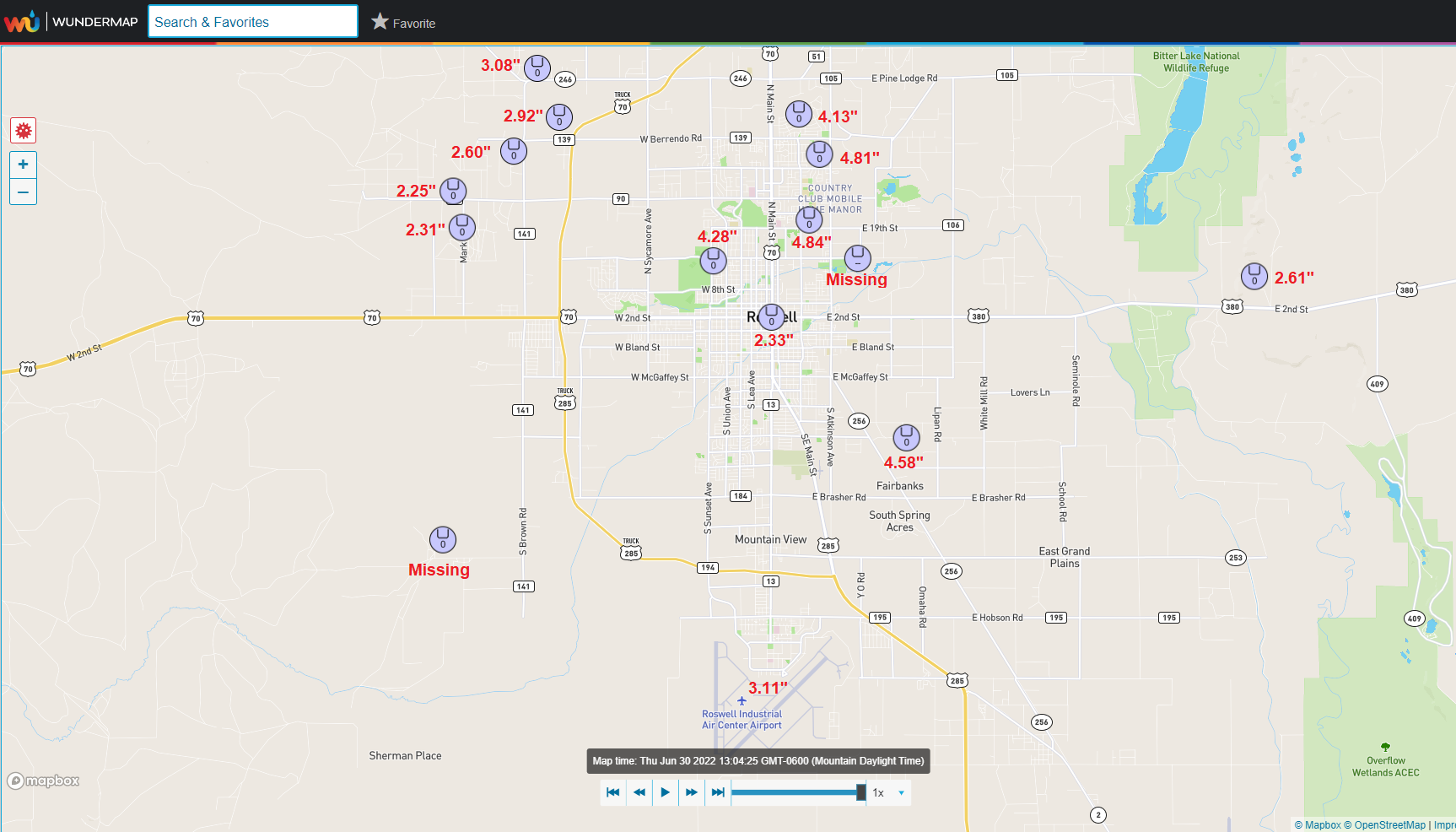
Roswell Industrial Airport 3.11"
Hope 2.71"
Albuquerque Intl Airport 2.38"
Hobbs Airport 1.65"
Caprock 1.64"
Brantley Dam 1.26"
El Paso Intl Airport 1.24"
Carlsbad Airport .88"
Portales .81"
All rainfall totals are preliminary and are subject to correction or change.
There Are None So Blind As Those Who "Will - Not" To See...107.


Comments
Post a Comment
Your comments, questions, and feedback on this post/web page are welcome.