

Next Storm Will Be A Wind Machine.

Carlsbad, New Mexico.
Our Next Winter Storm Will Be A Wind Machine.

At 5 AM MST Today, December 8, 2022.
ECMWF 500 MB (18,000') Forecast.

Valid At 5 PM MST Monday, December 12, 2022.
ECMWF 300 MB (30,000') Jet Stream Forecast.

Valid At 5 PM MST Monday, December 12, 2022.
Looking ahead to the first of next week our next inbound winter storm is taking shape over the Gulf of Alaska today. As this strong mid-upper level long wave trough of low pressure continues to dig southward today into Saturday it will strengthen. By Saturday evening it will have formed a deep closed low off of the Pacific Northwest coast. By Sunday morning around sunrise it is forecast to be located just west of Portland, Oregon.
As this potent storm continues its slow trek southward it is forecast to begin an eastward swing on Monday and by sunset should be centered over northern Utah. Monday night into Tuesday the center of the closed mid-upper level low will move eastward into northeastern Colorado.
Monday a strong jet stream wind speed max at the 30,000' level will slice across New Mexico from southwest to northeast. Forecast winds within this jet stream wind speed max at this level are expected to be in the 130-150 knot range or 150 to 175 mph.
Underneath the jet stream mid-level winds at the 10,000' level are forecast to be in the 50 to 70 knot range or 58 to 80 mph across the area. These strong winds aloft will mix down to the surface Monday into Tuesday resulting in a very windy period for us. It appears that a potentially significant high wind event may be in store for us.

Valid Monday, December 12, 2022.
A strong surface low will form over southeastern Colorado on Monday and deepen as it moves into northeastern Colorado Monday afternoon and evening. Thus the surface pressure gradient will strengthen and tighten over the eastern one half of New Mexico on Monday and Tuesday.
A strong Pacific cold front will move across the region Monday into Tuesday. The highest wind gusts will likely accompany this front along with areas of blowing dust and falling temperatures.
A potentially significant high wind event looks to be shaping up for New Mexico and nearby areas Monday into Tuesday. Current forecasts for the Sunspot and Cloudcroft areas already have southwesterly winds gusting up into the 65-75 mph range. This of course may change between now and Monday so keep up to date with the local forecasts.
Southwesterly winds will also rake the Southeastern Plains, southern Deserts, and West Texas during this time frame. The exact track of the mid-upper level closed low to our north will help determine the duration and maximum wind gusts of the event. For now it appears that we will be looking at southwesterly wind gusts in the 50-65 mph range. Localized areas of blowing dust are also a possibility.


Southwesterly winds will also rake the Southeastern Plains, southern Deserts, and West Texas during this time frame. The exact track of the mid-upper level closed low to our north will help determine the duration and maximum wind gusts of the event. For now it appears that we will be looking at southwesterly wind gusts in the 50-65 mph range. Localized areas of blowing dust are also a possibility.
Today.

Saturday.

Sunday.

Monday.

Tuesday.

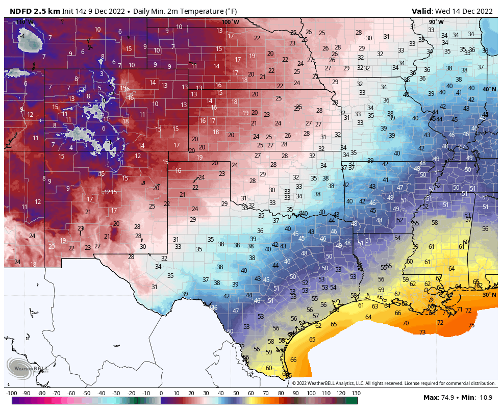
NWS NDFD Forecast Low Temperatures.
Wednesday Morning.

Valid At 5 PM MST Tuesday, December 13, 2022.
NWS NBM Total Snowfall Forecast.

Valid At 5 PM MST Tuesday, December 13, 2022.


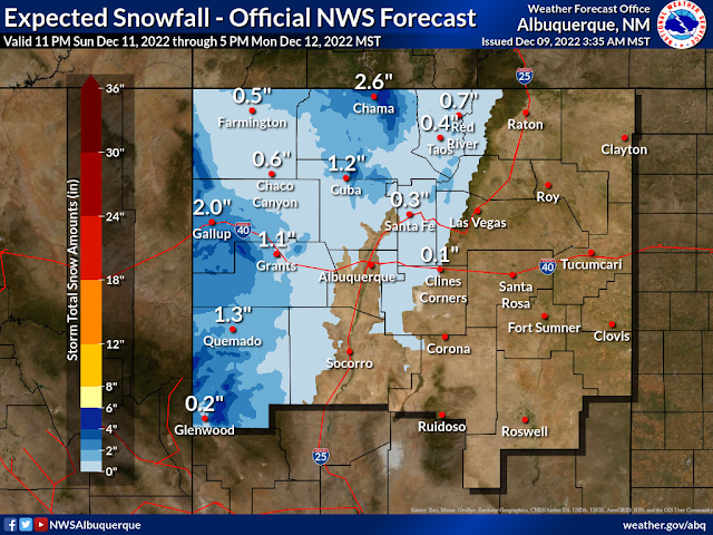
Unless this next storm digs further south it isn't going to be a big precipitation producer. However this mornings model runs are slowing the storms forward motion down so it is always possible for model forecast changes in the next several days.
Snow will fall over the western and northern mountains of the state with a chance for snow even across the valley floors but nothing significant. Current forecasts call for light snow maybe a couple of inches of the white stuff in the Sac's Monday night.
Long Range Pattern Change Towards Colder & Wetter.

WPC 8-14 Day Temperature Outlook.

WPC 6-10 Day Precipitation Outlook.

WPC 8-14 Day Precipitation Outlook.

Long range forecasts are calling for a pattern change meaning that the Polar Jet Stream will dig further south into the US while the Subtropical Jet Stream becomes more active. A trend towards colder than normal weather beginning later this week continuing through the Christmas Holidays looks to be on track. This will also be a wetter than normal period with an active Subtropical Jet Stream producing multiple winter storms that will affect our region of the country.
This will be good news for the Western and Southwestern US Ski Resorts and the snowpack across the Rockies. Does this mean we have a shot at a White Christmas this year in New Mexico? It's not possible to accurately predict this just yet but overall with the upcoming pattern change our chances should increase somewhat. More as we get closer to Christmas.
This will be good news for the Western and Southwestern US Ski Resorts and the snowpack across the Rockies. Does this mean we have a shot at a White Christmas this year in New Mexico? It's not possible to accurately predict this just yet but overall with the upcoming pattern change our chances should increase somewhat. More as we get closer to Christmas.
There Are None So Blind As Those Who "Will - Not" To See...107.


Comments
Post a Comment
Your comments, questions, and feedback on this post/web page are welcome.