Hot - Hotter With A Few T-Storms Over The Mountains.
A Developing T-Storm Over:
Sierra Blanca Peak - Ruidoso, New Mexico.
(As Of 8 AM MDT Wednesday, July 5, 2023).
(As Of 9 AM MDT Wednesday, July 5, 2023).
(As Of 9 AM MDT Wednesday, July 5, 2023).
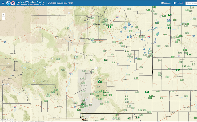
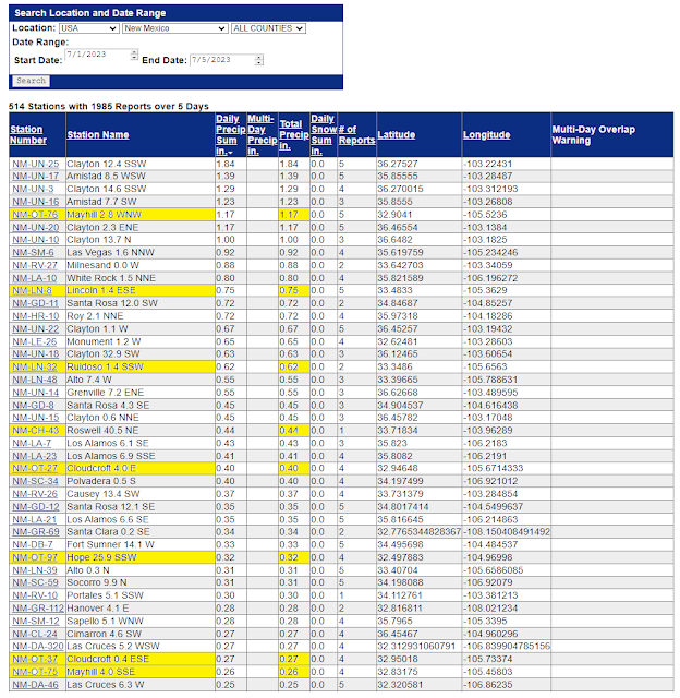
(July 1st - July th, 2023).
New Mexico CoCoRaHS Year-To-Date Rainfall Totals.
(January 1st - July th, 2023).
Do you keep track of your daily, monthly, or yearly rainfall totals at your home? If so consider joining the CoCoRaHS Volunteer Rainfall reporting network. It's free and fun and you will get on the map and spreadsheets like some many of the rest of us.
Hit and miss thunderstorms have dropped some decent rainfall totals across some areas over the past four days. Including a few spots in the Sacramento mountains. The Cloudcroft NWS Climate Co-Op Station has recorded .19" of rainfall so far this month. While a couple of Personal Weather Stations (PWS) in the Mayhill area have recorded rainfall totals so far of around 1.00" to 1.25". As well as a few stations in the Ruidoso area. Other mountain communities have received less than an inch for the most part so far. But hey at least you guys are getting wet.
Contrast this with our home here in Carlsbad where my year-to-date rainfall total (Jan 1st - July 4th) stands at a disappointing 1.89".
Daily rounds of hit and miss thunderstorms are in the forecast for the Sacramento, Capitan, and Guadalupe mountains for the rest of this week. The southeastern plains; nope, not, zip dada nada!
It is hard to break our local daily record high temperatures during the last couple of weeks in June. As hot as our 17-day stretch of high temps at or above 100º here in the southeastern plains was, it was not the hottest on record. Not when compared to other stretches like June of 1994. Roswell did establish their second highest officially recorded high temp of 112º on the 27th. But this did not break their record for the date, and their all-time record high temp of 114º set on June 27th, 1994.
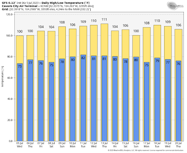
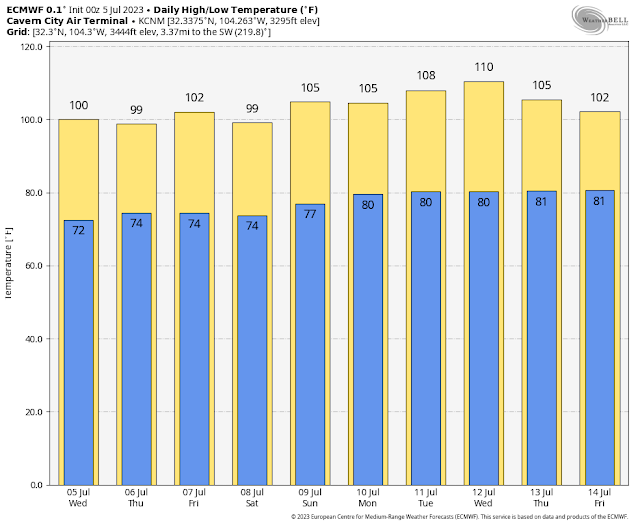
Carlsbad, New Mexico.
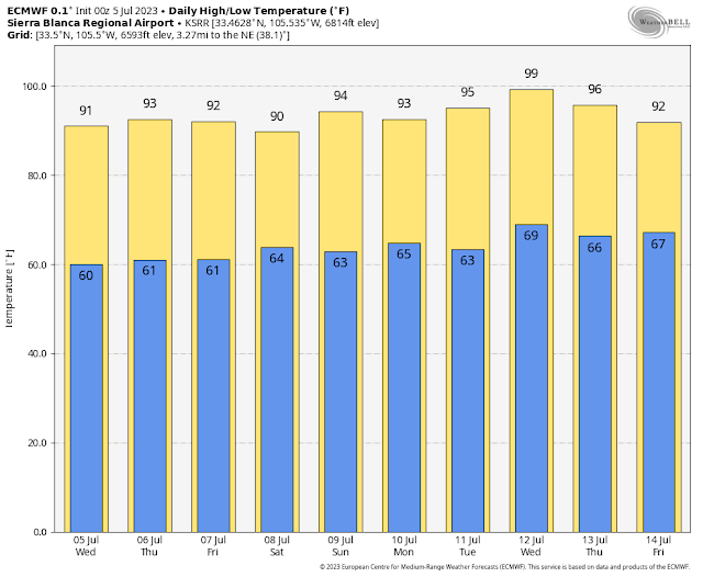
Sierra Blanca Regional Airport.
Use the forecast graphis above with a grain of salt. Daily forecast high temps will likely vary a little from this forecast over the upcoming sixteen days. But overall this looks to be the trend for the southeastern plains and the mountains. Note Cloudcroft does not have an airport so these graphics are not available there. Back to very hot and dry for the near future.
There Are None So Blind As Those Who "Will - Not" To See...107.









Comments
Post a Comment
Your comments, questions, and feedback on this post/web page are welcome.