Cooler Sunday & Monday With A Chance For Light Rain.
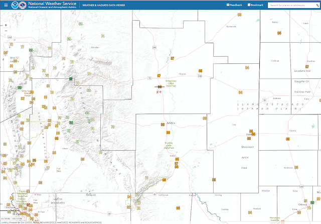
New Record Highs For November 19th.
733am Summary of record daily high temperatures from Thursday. #txwx #nmwx pic.twitter.com/tMge8cpUZU
— NWS El Paso (@NWSElPaso) November 20, 2020
#NMWx: #Albuquerque didn’t just break a 105 year old record temperature today, it smashed right though it! And, checks calendar, yes it is exactly a week before #Thanksgiving. And if you remember a year ago, #ABQ got a lot of snow the day before Turkey Day... #NewMexicoTrue pic.twitter.com/LMGcRbQMHi
— Kevin Murray (@claystorm) November 20, 2020
Today.
Valid At 8 AM MST This Friday Morning.
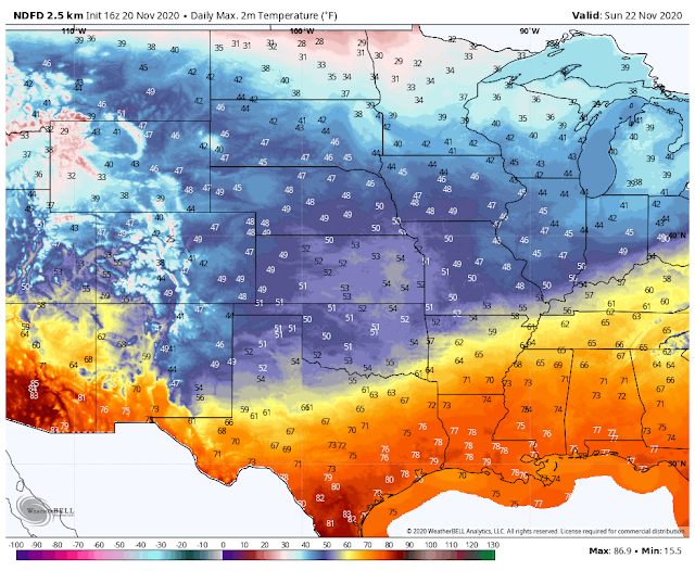
Forecast For Sunday.
Valid At 5 AM MST Sunday Morning.
Two Cold Fronts Affecting Our Weather This Weekend.
After Thursday afternoons unseasonably warm temperatures a slight cool down will occur today behind a weak cold front that moved in early this morning. Northerly winds behind the front have gusted up into the 25 to 35 mph range this morning but will die down this afternoon.
Highs today will be in the mid 70's. A second and stronger cold front will move southward into SE NM and W TX by around sunrise Sunday morning. Dropping our highs on Sunday down into the low to mid 50's to near 60.
Low clouds should develop Sunday night in the cooler upslope flow behind the front. Believe it or not but may even rain. Not much but areas of light drizzle and light rain are possible Sunday into Sunday night. Our chances of getting wet are only in the 20% to 40% range.
Valid Sunday Through Monday Morning.
NWS NDFD Snowfall Forecast.
Valid Sunday Through Monday Morning.
Any rain that does manage to fall will be light with most locations seeing a tenth of an inch or less. Snow levels will be high and generally between 9,000' and 10,000'.
Thanksgiving Week Uneventful Weather-Wise.
A quiet Thanksgiving week is anticipated for us this year. Another cold front is due by the end of the holiday week. Long-range model forecasts are hinting at a potential winter storm by the first week of December. But that's just too far out to get too excited about right now. We need the moisture desperately bad as our exceptional drought continues to expand in aerial coverage.
Nearly 50% of our area is now in exceptional drought. The greatest drought remains in SE New Mexico, the Western Permian Basin, and Presidio county. #txwx #nmwx pic.twitter.com/xcZkRHYhUa
— NWS Midland (@NWSMidland) November 19, 2020
The Truth Is Stranger Than Fiction!


Comments
Post a Comment
Your comments, questions, and feedback on this post/web page are welcome.