Why Are My Weather Posts Missing From Facebook.

Hello everyone. I just wanted to let you know that my Facebook page was shut down without any warning by Facebook this past Saturday, June 8th. All I was told was that I had violated their community standards. I don't know what triggered that; they didn't tell me. I was told this may be permanent or for six months.
My guess is that it may be because I posted several comments and articles from my Substack page about the riots in LA, and that must have triggered/angered someone, and they complained, thus Facebook shut me down. I don't know this as fact, though. I have appealed this decision, and I'm still waiting for their reply. I have read on X that this has happened to other Facebook users posting about the LA riots as well.
I always share my weather blog posts (that I post here) on my Facebook page and my X page. This included over twelve different New Mexico and West Texas Facebook Community sites. So there are thousands of you out there (based on my views and shares of those posts) who will no longer see those posts. My Facebook page may or may not be restored.
This is another good reason (as the National Weather Service often reminds us) to have multiple ways of receiving severe weather alerts when severe weather threatens your location. My weather web page is one of those ways, and I really appreciate all of you who have and still do use it. Thank you so much!!!
If my Facebook page is restored, I will continue to share my weather blog posts and some of the NWS Watches and Warnings...as I have been doing for years now.

From Exceptional Drought To Widespread Moderate To Heavy Rains In One Day!

Blog Updated 5-2-2021.

4-30-2021
Carlsbad, New Mexico

In one day's time, we went from exceptional drought conditions with days of blowing dust to widespread moderate to heavy rainfall areawide. It has been a long time since we have seen standing water like in the photo above from heavy rains.

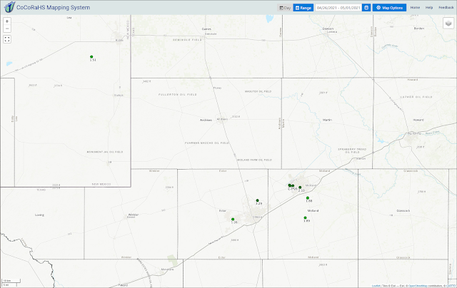
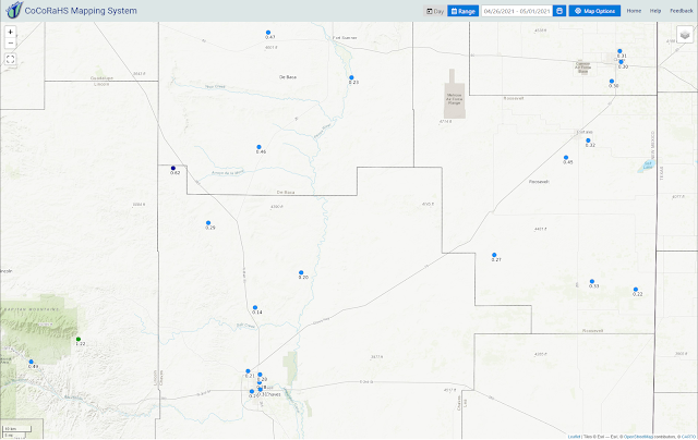
A wonderful slow-soaking rain occurred yesterday morning into early Friday morning. Although at times it was moderate to heavy no significant flooding or flash flooding was noted locally. My 72-hour storm total ended up at 2.11". This is my highest 24-hour total since I recorded 2.21" on 10-4-2015. This is also my greatest 24-hour total in the month of April since I first started keeping records at this sight in May of 2007. I have recorded my wettest April on record going back to 2007 with 2.24" for the month now. My year-to-date total now stands at 3.22". 


(As Of 5 PM MDT Friday, April 30th, 2021).

(As Of 5 PM MDT Friday, April 30th, 2021).

(As Of 5 PM MDT Friday, April 30th, 2021).


(As Of 5 PM MDT Friday, April 30th, 2021).

(As Of 5 PM MDT Friday, April 30th, 2021).


CoCoRaHS Volunteer Rainfall/Snowfall Observers Wanted.

Please consider joining the volunteer network of CoCoRaHS rainfall and snowfall observers nationwide. We have many gaps in Southeastern New Mexico and West Texas that need to be filled when rainfall reporting is considered. In fact areawide. This is a computer-based program that is free. For more info visit this link.

The Truth Is Stranger Than Fiction!

Comments

NWS Albuquerque Burn Scar Matrix

Current National Weather Service Watches/Warnings In Effect.

New Mexico

Chaves County Plains & Mtn's

Eddy County

Culberson County

Lea County

Lincoln County

Otero County

Current US Temps

Current US Wind Chill/Heat Index Temperatures

WPC 7-Day Precipitation Forecast

Roswell Live EarthCam

Ruidoso Live Webcam

Cloudcroft Live Webcam

NWS Midland 3-Day Precipitation Forecast

NWS Midland 3-Precipitation Chances

New Mexico 3-Day Precipitation Forecast

New Mexico Precipitation Chances

NWS El Paso 3-Day Precipitation Forecast

NWS El Paso Precipitation Chances

US 24-Hour Precipitation Forecast

US 3-Day Precipitation Forecast