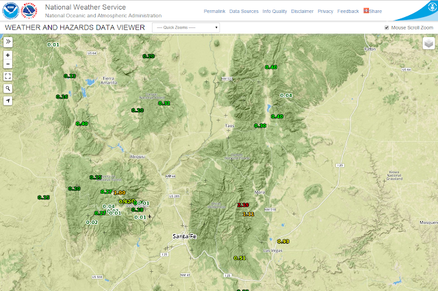
Decent Rainfall Over Parts Of NM - SE NM Left Out Again.


It appears that most of the lower elevations of Eddy and Lea Counties missed out on this latest precipitation go around. Some fairly decent rainfall amounts have fallen in the Sacramento mountains and this indicates an early and good start to our annual summer monsoon season. Additional rainfall totals can be viewed here

Time to dry back out and heat back up here in the plains. Our afternoon temps will climb back up in the 95-100 degree range this week...seasonally hot for the end of June. Our next best chance for t-storms will come late next week into the 4th of July weekend with another pattern change. 

The Truth Is Stranger Than Fiction!

NWS Midland Radar

Cannon AFB Radar

NWS Albuquerque Radar

NWS Lubbock Radar

Holloman AFB Radar

NWS El Paso Radar

Regional Radar

Current NWS National Watches/Warnings In Effect

Current NWS National Watches/Warnings In Effect
Click On The Map For The Latest Updates

New Mexico

Eddy County Plains & Guadalupe Mtn's

Chaves County Plains & Mtn's

Guadalupe Mtn's In Culberson County

Lea County

Lincoln County

Otero County

Current US Temps

Current US Wind Chill/Heat Index Temperatures

NWS Albuquerque Storm Total Rainfall Forecast

NWS Midland Storm Total Rainfall Forecast

NWS El Paso Storm Total Rainfall Forecast

NWS Albuquerque Storm Total Snowfall Forecast

NWS Midland Total Snowfall Forecast

NWS El Paso Total Snowfall Forecast

NWS Forecast High Temps Today

NWS Forecast Low Temps Tonight

Average Daily High/Low Temperatures

Average Daily High/Low Temperatures