

How Cold Will It Get With This Arctic Airmass?
Feb 18, 2022.
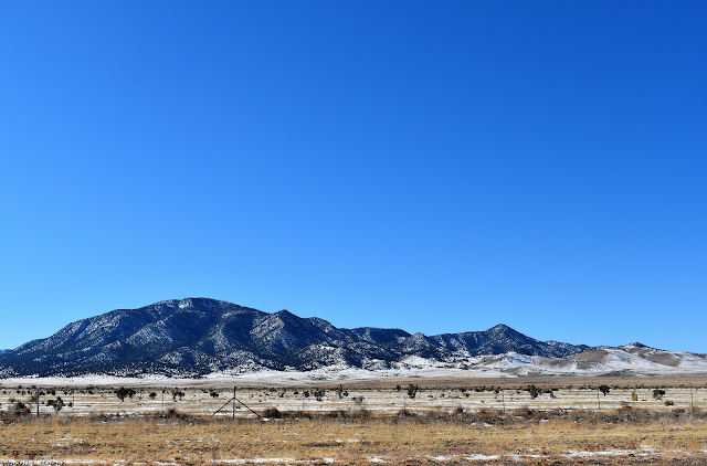
Church Mountain.
Southeast Of Carrizozo, NM.
(At 2:30 PM MST Tuesday).
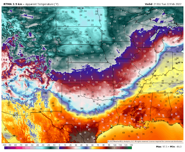
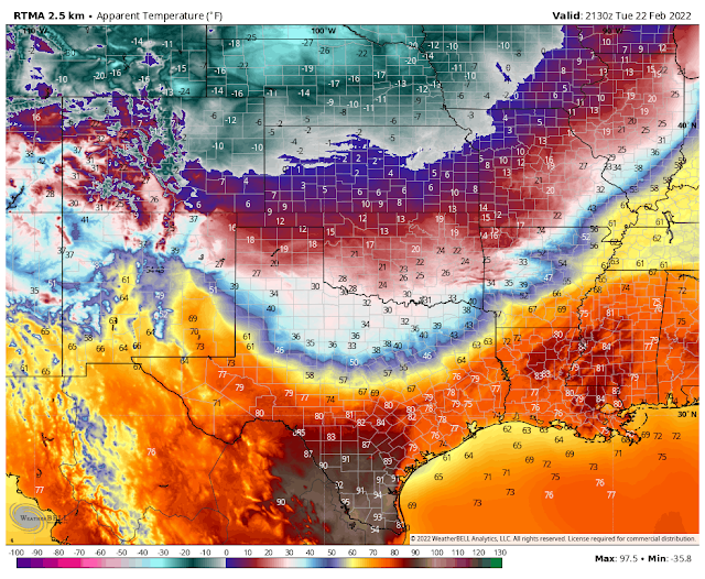
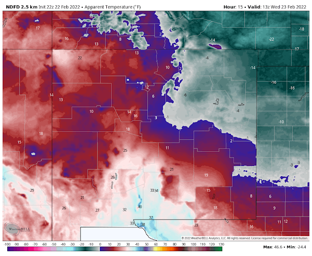
RTMA Apparent (Wind Chill) Temperatures.
(At 2:30 PM MST Tuesday).
(At 11 AM MST Tuesday).
Amazing Temperature Contrasts!
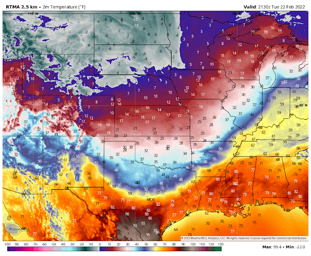
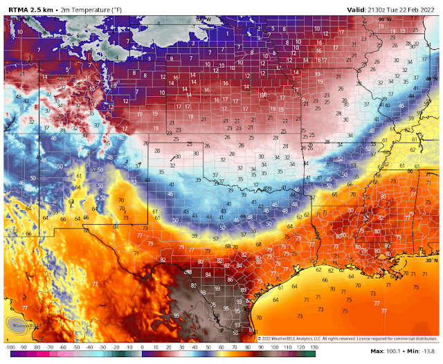
As of 2:30 PM MST this Tuesday afternoon an amazing temperature contrast existed across the arctic cold front draped across the region. Temperatures ranged from 100ºF at Zapata, Texas located in the upper Rio Grande Valley of far south Texas to -10ºF in northern North Dakota where wind chill values are down to -35ºF. That's a difference in actual temperatures of 110-degrees, factor in the wind chill and that's 135-degrees! Temperatures this afternoon in the heart of the coldest air are running some 30-degrees to 40-degrees below normal.

Turning Much Colder Tonight.
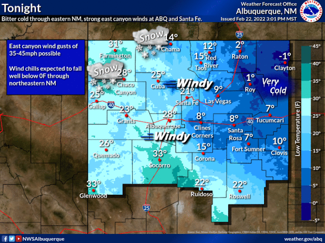
As of this writing (3:30 PM MST), my current temperature here at our home in Carlsbad has climbed up to 74ºF. Temperature behind the arctic frontal boundary draped across the eastern New Mexico and Texas border range from 25ºF in Clayton with a 10ºF wind chill, to 45ºF in Clovis, to 32ºF in Amarillo with a wind chill of 18ºF. Denver, Colorado is reporting 9ºF with a wind chill of -5ºF.
The back door arctic cold front will push south and west this evening into tonight moving through the southeastern plains before midnight. Much colder air will overspread the area tonight into Wednesday behind the front.
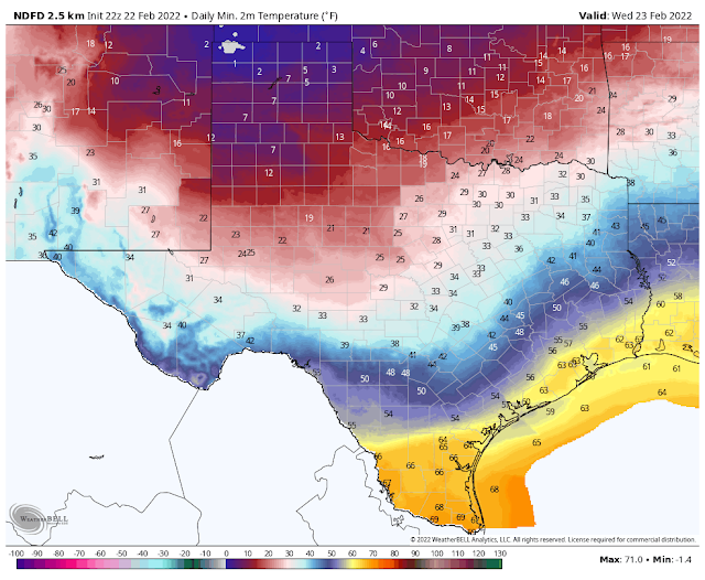
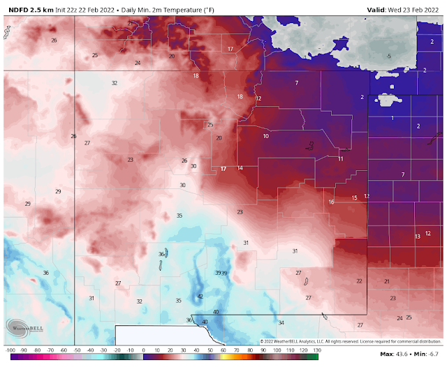
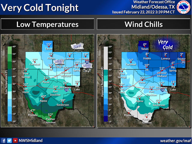
Current National Weather Service forecasts call for low temperatures tonight into Wednesday morning to drop down to near 10ºF in the Clovis area, near 12ºF in the Lubbock area, near 15ºF in Tatum, near 20ºF in Hobbs, and the low to mid 20's for the Pecos Valley. Forecast lows in the Sacramento Mountains should range from the upper 20's to the low 30's.
It will be colder to much colder across the eastern and southeastern plains and West Texas tonight than in the mountains. The arctic airmass associated with the front is very shallow (only about 1,500' in depth above the surface) so it will have a hard time pushing west across the mountains.
Wednesday Morning.
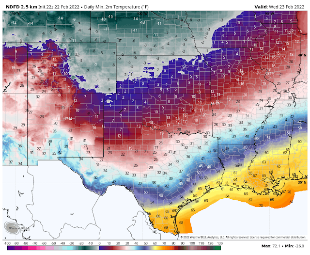
Forecast Apparent Temperatures/Wind Chill Temperatures.
(Late Tonight Into Wednesday Morning).
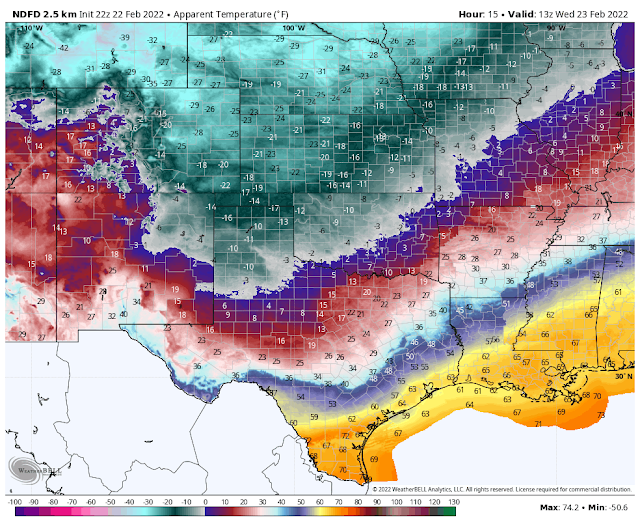
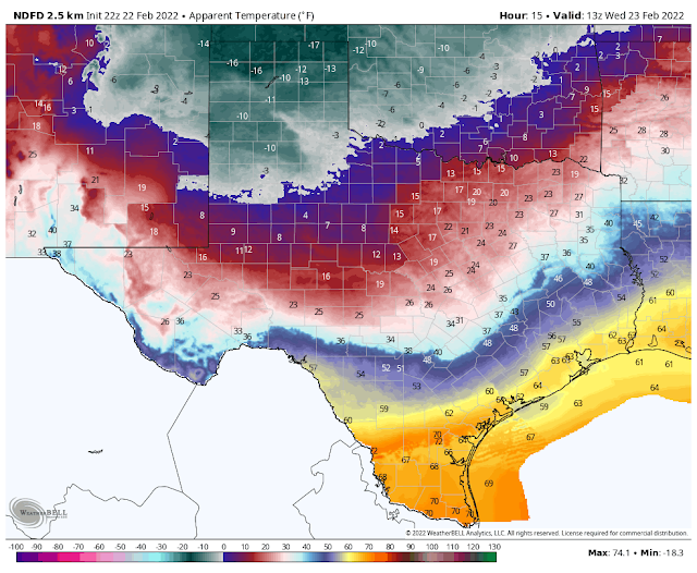
Surface winds will shift around from the southwest to the northeast this evening with the frontal passage, and to the east on Wednesday. These winds will be sustained at around 15-20 mph and gusty tonight into Wednesday morning. Very cold wind chill temperatures will occur with values dropping down to as low as 0ºF to -5ºF from Tatum north to the Clovis and Portales area. Down to -5ºF in the Lubbock area. Hobbs will see wind chill temps down in the single digits with the teens forecast for the Pecos Valley (Roswell, Artesia, and Carlsbad areas).
NWS NDFD Forecast High Temperatures.
Wednesday.
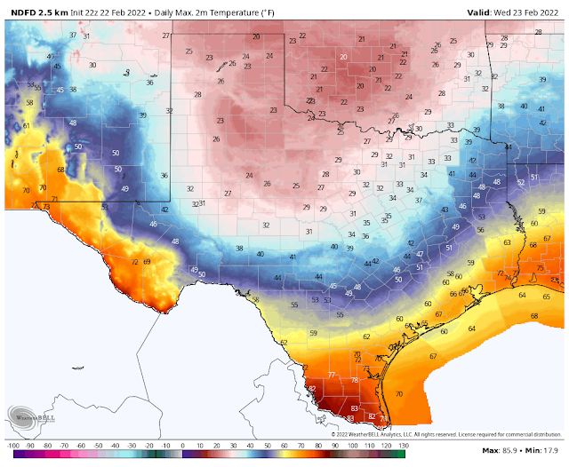
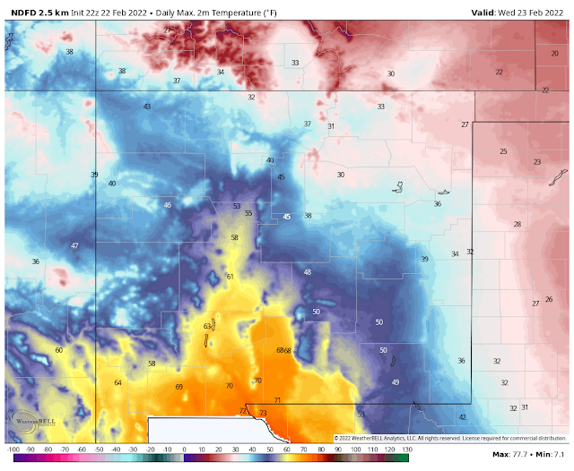
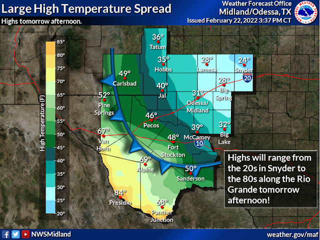
I'm not so sure that I buy the forecast high temperatures (locally) for Wednesday. Its very common for these arctic air masses to turn out to be colder than the model forecasts them to be, and to hang around longer when they are this cold. Current thinking is that the Pecos Valley will manage to climb up into the upper 40's to near 50ºF. Highs in the Sacramento Mountains should range from the low 40's in the Cloudcroft area to the low 50's for the Ruidoso area.
If the arctic airmass deepens more than is currently forecast and does not get dislodged by strong southwesterly winds at the surface and aloft, and low clouds manage to develop further westward into the Pecos Valley and not dissipate during the daytime, we won't get this warm. Hobbs is forecast to be in the mid 30's and that could be too warm also.
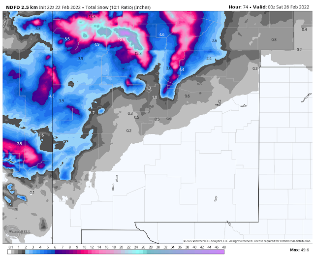
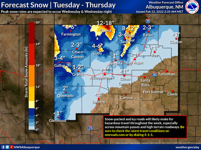
A strong and cold mid-upper low is forecast to drop southward tonight out of northwestern Nevada to western/northwestern Arizona by sunset Wednesday. Then swing eastward across Arizona and northern New Mexico Wednesday night into Thursday afternoon. With this northern forecast track, we don't stand much of a chance of seeing any snow from this storm. This includes the Sacramento mountains.
The Truth Is Stranger Than Fiction!


Comments
Post a Comment
Your comments, questions, and feedback on this post/web page are welcome.