

Colder In SE NM Than Parts Of The Sacramento Mtn's Wed & Thu.
Sierra Blanca Peak.
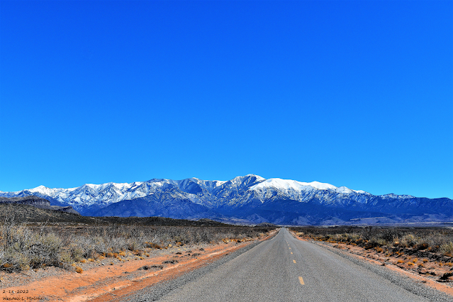
Looking East From Three Rivers, NM.
(Wednesday Morning Feb 23, 2022).


Wednesday Morning Low Temperatures.
(Official & Unofficial Lows).
Alto PWS 8
Gibson Land & Cattle Co - Near Tinnie 9
Tatum PWS 10
Smokey Bear Raws - Ruidoso 10
Caprock Raws 11
Mayhill Raws 12
Bell Canyon PWS 13
Dunken Raws 13
Queen Raws 13
Lubbock ASOS 14
Pinery Raws 15
SKP Ranch PWS - Lakewood 15
Hagerman PWS 16
Hobbs AWOS 16
Carlsbad ASOS 20
Mescalero Raws 44
Max/Min Temperature And Precipitation Table For
New Mexico
National Weather Service Albuquerque NM
646 PM MST Wed Feb 23 2022

Minimum and maximum temperatures for the last 18 to 24
hours.  Precipitation for the 24 hour period ending at 5PM MST
measured in inches and hundredths of an inch of rain and melted snow.

.BR ABQ 0223 M DH18/TAIRZS/TAIRZI/PPDRZZ/SFDRZZ/SDIRZZ
ABQ  : ABQ Sunport        5351:   44 /  18 /  0.00/   0.0/    0
BRG  : Belen Airport      5194:   63 /  21 /  0.00/      /
CVS  : Cannon AFB         4295:   27 /   6 /  0.00/      /
CAO  : Clayton            4964:   19 /  -5 /  0.00/   0.0/    0
CQC  : Clines Corners     7087:   24 /  -2 /  0.00/      /
CVN  : Clovis Airport     4216:   26 /   6 /  0.00/      /
AEG  : Double Eagle Arpt  5837:   45 /  12 /     M/      /
FMN  : Farmington         5502:   49 /  32 /  0.03/      /
GUP  : Gallup             6473:   48 /  28 /  0.04/      /
GNT  : Grants             6522:   50 /  23 /     M/      /
LVS  : Las Vegas Airport  6877:   23 /  -2 /  0.00/      /
RTN  : Raton Airport      6348:   25 /  -3 /  0.00/      /
ROW  : Roswell            3668:   37 /  17 /  0.00/   0.0/    0
SRR  : Ruidoso Airport    6811:   34 /   7 /  0.00/      /
SAF  : Santa Fe Airport   6348:   36 /   8 /  0.00/      /
SXU  : Santa Rosa         4790:   27 /   4 /  0.00/      /
ONM  : Socorro            4849:   64 /  35 /  0.00/      /
SKX  : Taos Airport       7090:   36 /  16 /  0.00/      /
TCC  : Tucumcari          4065:   27 /   6 /  0.00/      /
.END

.BR ABQ 0223 M DH18/TAIRZX/TAIRZN/PPDRZZ/SFDRZZ/SDIRZZ
EGNN5: Eagle Nest     8280: DH1600/  38 /   2 /  0.00/  0.0/   10
PORN5: Portales       4010: DH1700/  44 /   8 /  0.00/  0.0/    0
TORN5: Torreon Navajo 6700: DH1622/  51 /  16 /  0.00/  0.0/    0
.END

.BR EPZ 0223 MS DH17/TAIRZS/TAIRZI/PPDRZZ/SFDRZZ/SDIRZZ
DMN   :Deming              4314 :  70  /  26  /  0.00  /   M  /   M
ELP   :El Paso Intl Arpt   3917 :  61  /  39  /  0.00  /      /
EPZN5 :Santa Teresa NWS    4108 :  70  /  39  /  0.00  /      /
TCS   :T-or-C Airport      4859 :  66  /  36  /  0.00  /   M  /   M
ALM   :Alamogordo          4196 :  63  /  41  /  0.00
HMN   :Holloman AFB        4095 :  60  /  37  /  0.00
LCSN5 :Jornada Range CRN   4327 :  68  /  37  /  0.00
LRU   :Las Cruces Airport  4455 :  71  /  42  /  0.00
SVC   :Grant County Arpt   5443 :   M  /   M  /  0.00
0A0   :Spaceport America   4597 :  68  /  28  /  0.00
.END

.BR MAF 0223 C DH18/TAIPZS/TAIPZI/PPDPZZ
BATN5: Batdraw RAWS               :  44 /  18 /  0.00
CPPN5: Caprock RAWS               :  37 /  11 /  0.00
MPAN5: Paduca RAWS                :  37 /  19 /  0.00
QENN5: Queen RAWS                 :  45 /  13 /  0.00
HCYN5: Hobbs 5NW Mesonet          :  32 /  15 /  0.00
TTSN5: Tatum Mesonet              :  33 /   9 /  0.00
.END
(Thursday Morning Feb 24, 2022).


Thursday Morning Low Temperatures.
(Official & Unofficial Lows).
Carlsbad Airport ASOS 12
Elk Climate Co-Op Station 13
(Thursday Morning).
Max/Min Temperature And Precipitation Table For
New Mexico
National Weather Service Albuquerque NM
658 PM MST Thu Feb 24 2022

Minimum and maximum temperatures for the last 18 to 24
hours.  Precipitation for the 24 hour period ending at 5PM MST
measured in inches and hundredths of an inch of rain and melted snow.

.BR ABQ 0224 M DH18/TAIRZS/TAIRZI/PPDRZZ/SFDRZZ/SDIRZZ
ABQ  : ABQ Sunport        5351:   42 /  15 /  0.05/   1.5/    2
BRG  : Belen Airport      5194:   44 /  15 /  0.00/      /
CVS  : Cannon AFB         4295:   46 /   6 /    T /      /
CAO  : Clayton            4964:   42 /   1 /  0.00/   0.0/    0
CQC  : Clines Corners     7087:   32 /   6 /  0.05/      /
CVN  : Clovis Airport     4216:   47 /   5 /  0.00/      /
AEG  : Double Eagle Arpt  5837:   39 /   4 /     M/      /
FMN  : Farmington         5502:   36 /  23 /  0.05/      /
GUP  : Gallup             6473:   31 /  18 /  0.04/      /
GNT  : Grants             6522:   36 /  19 /     M/      /
LVS  : Las Vegas Airport  6877:   36 /   7 /  0.00/      /
RTN  : Raton Airport      6348:   40 /   1 /  0.00/      /
ROW  : Roswell            3668:   50 /  15 /  0.00/   0.0/    0
SRR  : Ruidoso Airport    6811:   43 /  25 /  0.00/      /
SAF  : Santa Fe Airport   6348:   36 /   5 /  0.01/      /
SXU  : Santa Rosa         4790:   43 /  10 /  0.00/      /
ONM  : Socorro            4849:   51 /  31 /  0.00/      /
SKX  : Taos Airport       7090:   29 /   9 /  0.03/      /
TCC  : Tucumcari          4065:   50 /   9 /  0.00/      /
.END

.BR ABQ 0224 M DH18/TAIRZX/TAIRZN/PPDRZZ/SFDRZZ/SDIRZZ
EGNN5: Eagle Nest     8280: DH1600/  28 /   8 /  0.18/   3.6/   13
TORN5: Torreon Navajo 6700: DH1630/  39 /   8 /  0.00/      /
.END

.BR EPZ 0224 MS DH17/TAIRZS/TAIRZI/PPDRZZ/SFDRZZ/SDIRZZ
DMN   :Deming              4314 :  52  /  35  /  0.00  /   M  /   M
ELP   :El Paso Intl Arpt   3917 :  58  /  39  /  0.00  /      /
EPZN5 :Santa Teresa NWS    4108 :  55  /  32  /  0.00  /      /
TCS   :T-or-C Airport      4859 :  52  /  32  /  0.00  /   M  /   M
ALM   :Alamogordo          4196 :  52  /  36  /  0.00
HMN   :Holloman AFB        4095 :  51  /  41  /  0.00
LCSN5 :Jornada Range CRN   4327 :  51  /  33  /  0.00
LRU   :Las Cruces Airport  4455 :  54  /  33  /  0.00
SVC   :Grant County Arpt   5443 :   M  /   M  /     M
0A0   :Spaceport America   4597 :  52  /  36  /  0.00
.END

.BR MAF 0224 C DH18/TAIPZS/TAIPZI/PPDPZZ
BATN5: Batdraw RAWS               :  42 /  13 /  0.00
CPPN5: Caprock RAWS               :  48 /  14 /  0.00
MPAN5: Paduca RAWS                :  50 /  16 /  0.00
QENN5: Queen RAWS                 :  54 /  11 /  0.00
HCYN5: Hobbs 5NW Mesonet          :  52 /  15 /  0.00
TTSN5: Tatum Mesonet              :  50 /  14 /  0.00
.END


These data are preliminary and have not undergone final quality
control by the National Climatic Data Center /NCDC/. Therefore...
these data are subject to revision. Final and certified climate data
can be accessed at www.ncdc.noaa.gov.

$$
With an arctic airmass entrenched across eastern and southeastern New Mexico Wednesday and Thursday morning, low temperatures were warmer in parts of the Sacramento Mountains than they were in the Pecos Valley and the rest of southeastern New Mexico. This is not at all an uncommon occurrence with these cold but shallow arctic air masses during the winter.
Windy Day Across Southern New Mexico Wednesday.
(Wednesday, Feb 23, 2022).
Public Information Statement
National Weather Service El Paso TX/Santa Teresa NM
710 PM MST Wed Feb 23 2022

...HIGHEST WIND GUST REPORTS FOR FEB 23 AS OF 7PM...

Location                     Speed     Time/Date       Lat/Lon
San Agustin Pass 1.6 E Organ 77 MPH    0650 PM 02/23   32.43N/106.57W
Chihuahuan Desert Rangeland  71 MPH    0420 PM 02/23   32.53N/106.81W
WSMR EMRE                    69 MPH    0550 PM 02/23   32.47N/106.50W
Condron Field (WSMR)         66 MPH    0600 PM 02/23   32.34N/106.41W
Hachita Valley               64 MPH    0440 PM 02/23   31.70N/108.34W
Lordsburg Playa I10 MP11 (NM 63 MPH    0335 PM 02/23   32.28N/108.88W
Deming ASOS                  62 MPH    0215 PM 02/23   32.27N/107.72W
T-or-C ASOS                  61 MPH    0224 PM 02/23   33.23N/107.27W
WSMR Rad                     61 MPH    0645 PM 02/23   32.80N/106.50W
Burro Mountain RAWS          60 MPH    0559 PM 02/23   32.67N/108.54W
Spaceport America Awos       60 MPH    0315 PM 02/23   32.99N/106.97W
Dripping Springs RAWS        59 MPH    0526 PM 02/23   32.32N/106.59W
Winston (EPZWxNet)           57 MPH    0228 PM 02/23   33.35N/107.65W
WSMR LC-32                   57 MPH    0635 PM 02/23   32.41N/106.40W
Lordsburg Playa I10 MP7 (NMD 55 MPH    0450 PM 02/23   32.25N/108.93W
North Lordsburg Playa        55 MPH    0225 PM 02/23   32.25N/108.95W
Lordsburg Playa I10 MP9 (NMD 54 MPH    0455 PM 02/23   32.27N/108.90W
Las Cruces AWOS              53 MPH    0335 PM 02/23   32.27N/106.92W
Lordsburg Playa I10 MP12 (NM 53 MPH    0425 PM 02/23   32.29N/108.87W
Chiricahua Desert Museum     52 MPH    0520 PM 02/23   31.87N/109.02W
High Rolls                   52 MPH    0659 PM 02/23   32.94N/105.84W
Lordsburg Playa I10 MP13 (NM 52 MPH    0435 PM 02/23   32.32N/108.81W
Silver City - Mountain View  51 MPH    0300 PM 02/23   32.77N/108.26W
Arrey 2N                     50 MPH    0601 PM 02/23   32.88N/107.31W
Organ (DACFC)                50 MPH    0458 PM 02/23   32.42N/106.60W
San Andres RAWS              48 MPH    0501 PM 02/23   32.58N/106.53W
Hanover 5ENE                 47 MPH    0400 PM 02/23   32.82N/108.00W
WSMR C-Station               47 MPH    0630 PM 02/23   32.36N/106.38W
WSMR Salt Creek              47 MPH    0300 PM 02/23   33.12N/106.36W
Mescalero RAWS               46 MPH    0541 PM 02/23   33.16N/105.77W
Santa Teresa NWS RSOIS       46 MPH    0429 PM 02/23   31.87N/106.70W
WSMR Apache                  46 MPH    0235 PM 02/22   32.63N/106.39W
Las Cruces                   45 MPH    0415 PM 02/23   32.36N/106.72W
El Paso International Airpor 45 MPH    0609 PM 02/23   31.82N/106.38W
WSMR Pony                    45 MPH    0355 AM 02/23   32.87N/106.49W
Delta Clipper                45 MPH    0535 PM 02/23   32.90N/106.41W

Observations are collected from a variety of sources with varying
equipment and exposures. We thank all volunteer weather observers
for their dedication. Not all data listed are considered official.

$$
The Truth Is Stranger Than Fiction!


Comments
Post a Comment
Your comments, questions, and feedback on this post/web page are welcome.