

Quick Hitting Storm With A Chance For Light Snow.
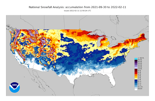
(Sept 30th, 2021 - Feb 10th, 2022).


A clipper-type trough of low pressure will side-swipe eastern New Mexico today into Saturday morning as it swings east across the region. This will push a cold front southward through the eastern half of New Mexico today into tonight.
Strong northerly winds with gusts near 40 mph will occur with and behind the frontal passage. Localized areas of blowing dust will also be possible.
Strong northerly winds with gusts near 40 mph will occur with and behind the frontal passage. Localized areas of blowing dust will also be possible.
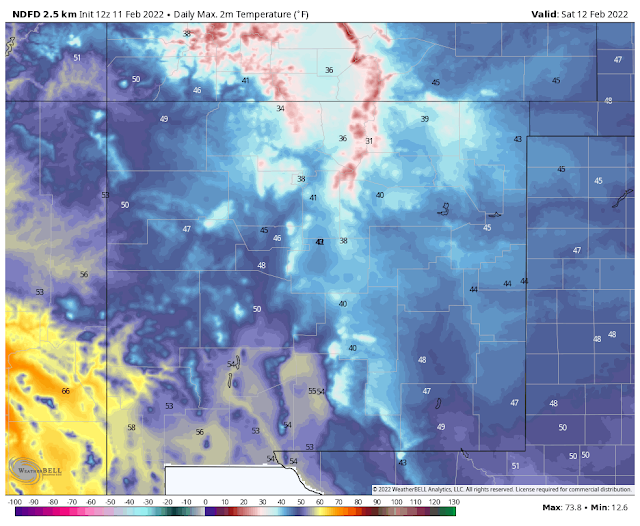
Today.

Saturday.
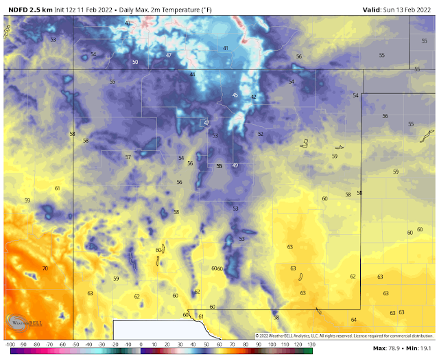
Super Bowl Sunday.
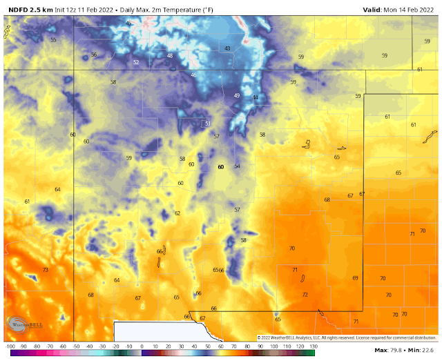
Monday.
Another beautiful late winter day is on tap locally today with high temperatures across the southeastern plains of New Mexico climbing up to near 70ºF, to the low 70's. Highs in the Sacramento mountains will range from 58ºF in Ruidoso to 46ºF in Cloudcroft today.
A fast-moving cold front will move southward and westward through the local area tonight. Cooler temps will overspread the area behind the front on Saturday. Highs across the southeastern plains are forecast to be in the mid-40's to near 50ºF. Highs in Ruidoso are forecast to be around 40ºF, and the low-mid 30's for the Cloudcroft area.
A quick warm-up will occur on Super Bowl Sunday into the first of next week ahead of a stronger and colder storm arriving mid-week into late week. Temperatures at the lower elevations will climb back up into the low to mid 60's on Sunday and the low-mid 70's on Monday.
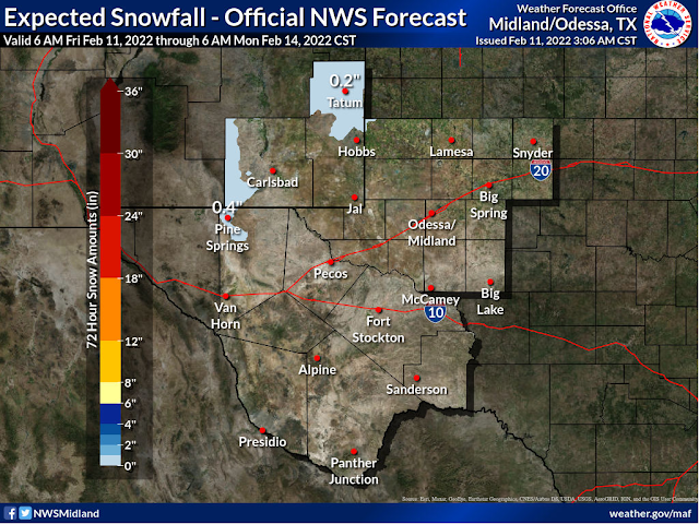
NWS NDFD Forecast Snowfall Totals.


NWS El Paso Forecast Snowfall Totals.
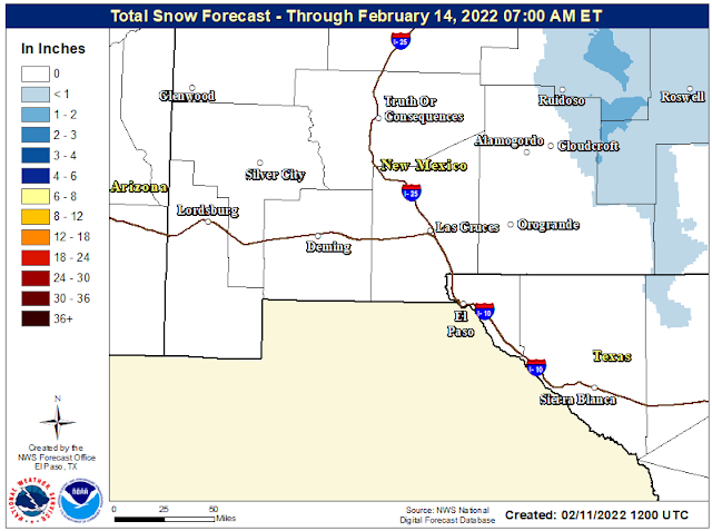
Light snow will be possible late tonight into Saturday morning for the southeastern plains and Sacramento and Capitan mountains. Current forecasts (as of 7 AM MST Friday) don't indicate much accumulation if any for most of us. Generally a half of an inch or less for the northern areas of the southeastern plains with less than that across the rest of the local area.
The northern Sacramento mountains will have the best chance of accumulating snowfall, especially in the Ruidoso area. Again a half of an inch or less is currently being forecast by the models, maybe a little more at Ski Apache.
Watching Next Weeks Storms.

Another closed mid-upper level low is forecast by the models to dive southward out of the Gulf of Alaska along the Pacific Northwest Coast on Monday. Then dig southeastward into Arizona by Wednesday. Once again the models are struggling with this next winter storm...a theme we've seen all winter long. There are indications that the closed low may impact our local weather in two phases...Tuesday into Wednesday, and then a second round late in the week.
Tuesday into Thursday looks to be windy with strong southwesterly and westerly winds raking the area. How much rain and snow from this next storm? Not sure yet. More on this later.
Tuesday into Thursday looks to be windy with strong southwesterly and westerly winds raking the area. How much rain and snow from this next storm? Not sure yet. More on this later.
The Truth Is Stranger Than Fiction!


Comments
Post a Comment
Your comments, questions, and feedback on this post/web page are welcome.