Increasing Chances For Scattered To Numerous T-Storms - Some Severe Today!
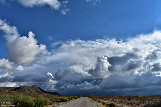
Looking West Towards Queen.
On The Queen Hwy (Hwy 137).
Scattered To Numerous T-Storms -
Some Severe This Afternoon & Evening!
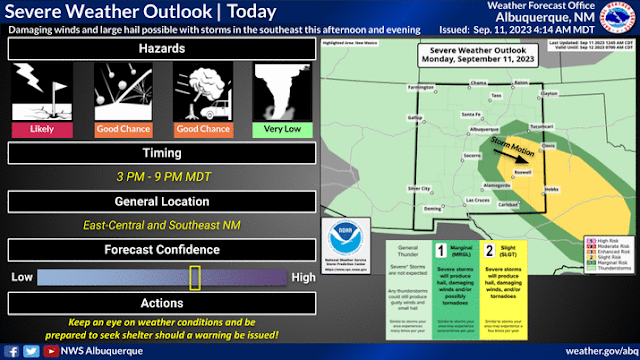
Severe Weather Outlook Today.
Today.
National Blend Of Models (NBM) Total Rainfall Forecast.
Weather Prediction Center 7-Day Rainfall Forecast.
A Much Anticipated Change In Our Weather Begins Today.
Hot Today But a Big Cooldown Starting Tuesday.
A much anticipated change in our weather will occur today and continue through the rest of this week. A strong cold front is forecast to move south into southeastern New Mexico and West Texas this afternoon, and will continue to push southward and westward tonight into Tuesday. This front will bring a much cooler air mass into the area. Some of the coolest daytime temps that we've seen since May will occur on Tuesday. HIghs on Tuesday may not get out of the 70's across parts of the local area, and the 60's in the mountains.
High temps today will flirt with the 90-degree mark. Depending upon how far south and how fast the front moves this afternoon. Gusty northerly to northeasterly winds will accompany the frontal passage. Given that thunderstorm outflow boundaries will be developing this afternoon I wouldn't be surprised to see another Haboob develop.
Across the Sacramento, Capitan, and Guadalupe mountains highs today will range from the low to mid 80's below 7,000' to the mid 70's above 9,000'. These readings will cool by some ten to fifteen degrees on Tuesday.
Increasing Chances For Showers & Thunderstorms Starting Today.
Remnant moisture from former Hurricane Jova caught up in the westerly flow aloft will add additional mid-level moisture to the atmosphere and aide in the development of showers and thunderstorms today into the middle of the week. Low-level easterly and southeasterly upslope flow will develop along and behind the approaching cold front and this will provide additional moisture to fuel shower and thunderstorm development.
Severe T-Storms This Afternoon & Evening.
Parts of eastern and southeastern New Mexico and West Texas have been placed in the Slight Risk Category for severe thunderstorms by the Storm Prediction Center (SPC) this afternoon and evening.
Scattered to numerous showers and thunderstorms are forecast to break out over the area this afternoon continuing well into the night. In fact I think that rain may still be falling in some areas early Tuesday morning. Areas of low clouds, fog, scattered rain showers and embedded thunderstorms may also develop later tonight and persist into Tuesday morning.
Severe thunderstorms appear likely today into this evening. Large hail, damaging thunderstorm wind gusts in excess of 58 mph, locally heavy rainfall that may produce localized flash flooding are all possible. Of particular concern will be the burn scar areas in the mountains. Rainfall totals may exceed two inches with the stronger thunderstorms. By the end of the week some locations may see storm total rainfall amounts anywhere from one inch to four inches.
Supercell thunderstorms are possible this afternoon and evening. Any supercell thunderstorm that manages to anchor itself to the cold front will also have a better chance of producing a few tornadoes. A cluster of thunderstorms known as a mesoscale convective system (MCS) may also develop and move southeastward through the area as thunderstorms conquel later today.
There Are None So Blind As Those Who "Will - Not" To See...107.


Comments
Post a Comment
Your comments, questions, and feedback on this post/web page are welcome.