Thunderstorms May Produce Locally Heavy Rain!
A Flash Flood Watch will be in effect as of noon today into this evening for the areas above that are shaded in green. This includes the Lincoln County burn scars. Scattered thunderstorms today and tonight will be capable of dumping locally heavy amounts of rain in a short period of time, which will very quickly lead to flash flooding over and below the burn scars. Never attempt to drive across a flooded arroyo, creek, stream, or low lying area. Most flash flood deaths in New Mexico occur at night and in vehicles. Please remember "Turn Around - Don't Drown."
24-Hour Rainfall Totals.
SE NM Weather Today.
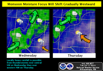
At the mid-levels of the atmosphere an easterly wave is forecast to continue moving westward into the Big Bend areas of west Texas, northern Mexico, and southern New Mexico into Friday. This feature will combine with a modest southerly monsoonal flow working its way northward into the state from Mexico.
Scattered afternoon and nighttime thunderstorms are expected across the area today into Friday. Some of these storms will be capable of producing locally heavy rainfall. The stronger storms will be capable of producing rainfall rates of an inch an hour or greater. Localized flash flooding may occur underneath these heavier storms and this will be especially true over and below the burn scar areas.
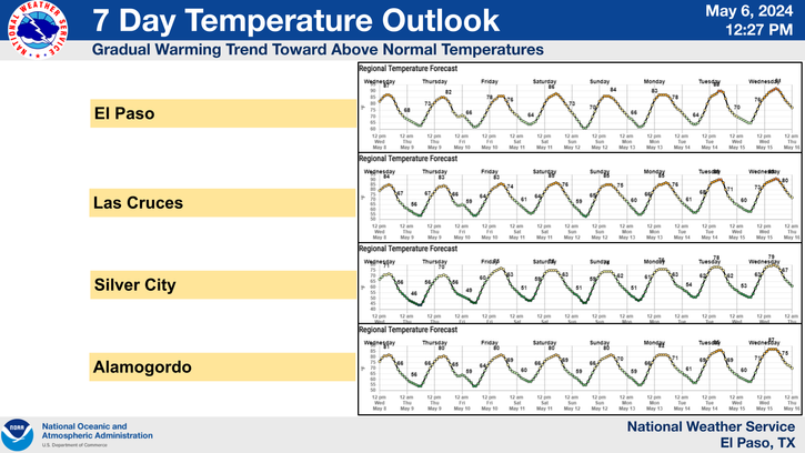
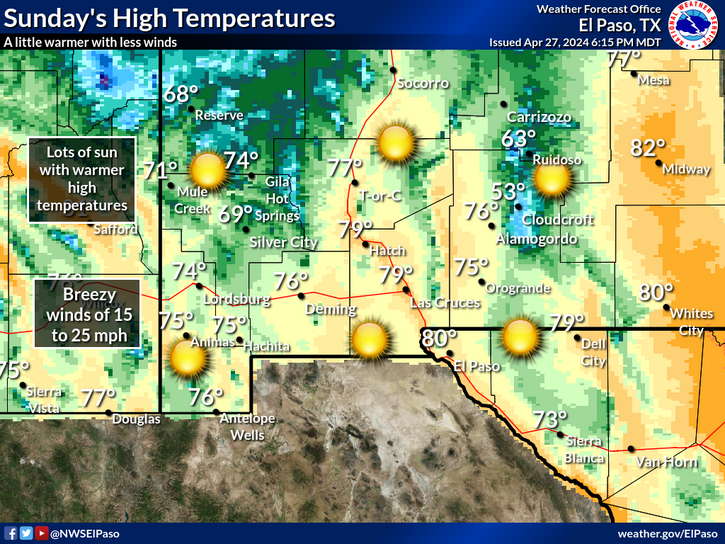
Our afternoon high temperatures will be near seasonal normal's today into the weekend with readings ranging from the mid-upper 90's forecast. Naturally it will be cooler in the mountains with the Ruidoso area looking at highs near 80, and the Cloudcroft area looking at highs from the upper 60's to the low 70's.
A Look Back Into Weather History-
"On this day in 1987, slow moving thunderstorms caused flooding on the Guadalupe River in Texas resulting in tragic loss of life. A bus and van leaving a summer youth camp stalled near the rapidly rising river, just west of the town of Comfort, and a powerful surge of water swept away 43 persons, mostly teenagers. Ten drowned in the floodwaters. Most of the others were rescued from tree tops by helicopter."
The Truth Is Stranger Than Fiction!
My Web Page Is Best Viewed With Google Chrome.


Comments
Post a Comment
Your comments, questions, and feedback on this post/web page are welcome.