Current Date & Time

My Current Weather Conditions

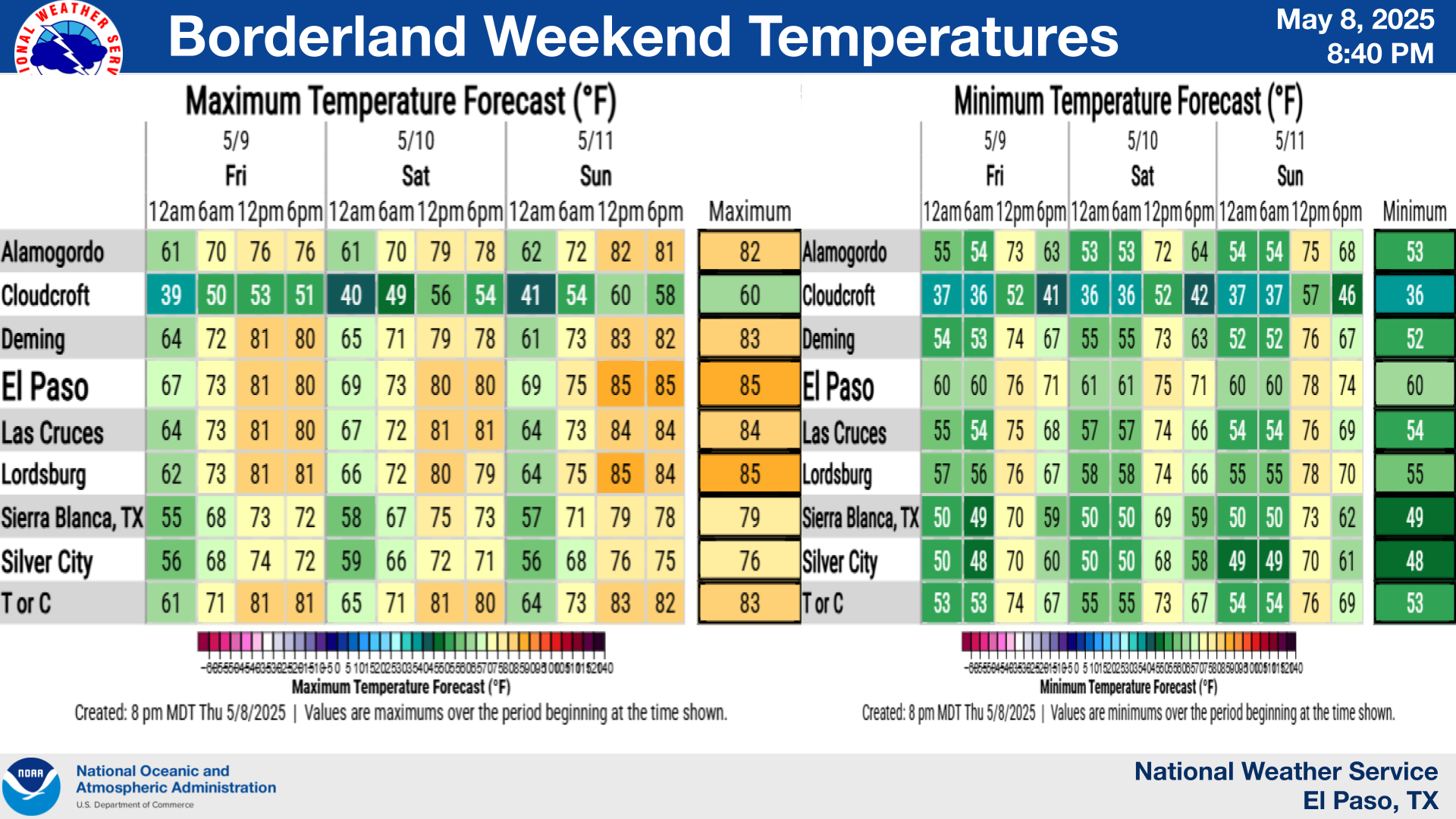
NWS Temperature Forecasts

NWS Albuquerque High/Low/& Preicp Chances Forecasts

NWS Albuquerque 2026 Monsoon Outlook.

Horse Canyon Fire Update - 7-5-2012.


HORSE CANYON FIRE UPDATE Thursday, July 5, 7:00 am

Summary: The rains arrived to the fire today; a couple different times and 2 inches was recorded at a nearby weather station. All resources on the fire were requested to return back to the Incident Command Post (ICP) to avoid any accidents or injuries, and all resources safely returned to ICP.   Due to the wetting rain, a majority of the resources will be demobilized today and made available for other incidents. The Temporary Flight Restriction (TFR) will be deactivated this afternoon.
 This fire is not impacting the public visiting Carlsbad Caverns National Park and we encourage the public to come enjoy the Cave tours and park ranger programs, such as the bat flight program. The tours are on their normal schedule and a list is available at;www.nps.gov/cave.
 Fire Prevention Message: Know Before You Go! Many areas are in fire restrictions so please check the following website: www.publiclands.org
 Detected:  Friday, June 29, 2012                                  Containment: 75% percent   
 Location:  Guadalupe Ranger District, Lincoln NF         Cause: Lightning
 Fuel Type: Pinon, Juniper, Grass, and Brush                Injuries:  0                                         
Today’s weather:      Temp: 79-81, RH: 35% – 41% Winds: South 11-13 mph
Current Size:             7,287 acres; fire mapped today which provided a more accurate acreage
 Resources Committed:
  
Crews
6
Engines
7
Dozers
0
Helicopters
1
Watertenders
0
Campcrew
1
Overhead
66
Total Personnel
226


The Truth Is Stranger Than Fiction!

 My Web Page Is Best Viewed With Google Chrome.

Comments

New Mexico

Texas

Arizona

Colorado

Eddy County

Guadalupe Mtns Eddy & Culberson County

Chaves County Plains & Mtn's

Lea County

Lincoln County

Otero County

Regional Radar

Texas Panhandle Radar

West Texas Radar

Far West Texas Radar

NWS Regional Radar

NWS Regional Radar

NWS Midland Radar

NWS Albuquerque Radar

NWS El Paso Radar

NWS Lubbock Radar

My Blog Posts Archive List (2010 - 2026)

Show more

My Top 10 Most Popular Posts

Artesia, NM Mothership Supercell Thunderstorm. 9-17-2016.

Monster Of A Snowstorm Coming This Christmas Weekend?

Powerful Winter Storm Is Hammering New Mexico! Worst Is Yet To Come.

25th Anniversary Of The Carlsbad, NM (May 31, 1991) Tornado Coming Up.

Major Winter Storm May Paralyze/Bury Parts Of NM & Nearby Areas Tonight Into Wednesday!

2011 Skywarn Spotter Training Classes & My Thoughts.

Tonight's GFS Is As Drunk As This Mornings ECMWF. Historic Snowstorm Next Weekend?

Major Winter Storm To Hammer New Mexico & West Texas Thanksgiving Week!

Cloudcroft & Ruidoso, NM Seasonal Snowfall Totals.

Are We Fixing To Go From Drought To Flood In SE NM?

My Favorite Blog List.

🔴 Live 24/7 National Weather Radar & Alerts, Weather Intensity Score & YallBot!

Ryan Hall, Y'all

NWS El Paso - 2026 Monsoon Outlook

Weather With Travis:

Average Daily High/Low Temps & Precipitation

Average Daily High/Low Temps & Precipitation

My Precipitation Totals - 2.1 NNW Downtown Carlsbad

My Precipitation Totals - 2.1 NNW Downtown Carlsbad

My Snowfall Totals - 2.1 NNW Downtown Carlsbad, NM

My Snowfall Totals - 2.1 NNW Downtown Carlsbad, NM

Substack

Disclaimer

This blog and its contents are for informational purposes only! Always have multiple sources of information available to rely upon during severe weather. Do not rely solely on the Internet. Be weather-aware, plan ahead, have a backup plan, and be ready to act before severe weather strikes your location.