Winter Returns To Desert Southwest.
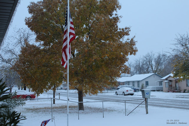
Carlsbad, New Mexico - November 24, 2013.
I recorded 3.3" of snowfall on the 23rd and 24th and a total of .91" of precipitation from that storm here at our home in Carlsbad. On the morning of the 24th snow had accumulated to a depth of 3". My high temp that day way 33ºF after a low of 27ºF. Artesia had 2" of snow out of the storm and Roswell recorded .3" with 3" on the ground on the morning of the 24th.
This Mornings GFS 500 MB Analysis.
Valid At 5 AM MST.
Off we go with a slow but steady progression into more winter-like conditions across not only New Mexico but over most of the western one third of the nation. A series of winter storms will dive out of the Gulf of Alaska and into the Western US today into the next couple of weeks. Our next winter storm that will impact the state is currently located northwest of the Pacific Northwest and will drop southward and will be located just off shore of northern California by late Saturday night. by Each additional one of these storms will contribute to the growing snowpack across the country.
Snow Cover As Of 11 PM MST Wednesday, Nov 23, 2016.
GFS 500 MB Forecast.
Valid At 5 AM MST Monday, Nov 28, 2016.
By sunrise Monday morning the GFS computer forecast model has a developing closed low centered near Flagstaff, Arizona. This is a radical change in forecast location of the storm versus last night's European (ECMWF) model forecast which placed the center of the closed low (500 MB) over eastern South Dakota, with a secondary lobe near Las Cruces, New Mexico.
GFS 500 MB Forecast.
Valid At 5 PM MST Monday, Nov 28, 2016.
This mornings 12Z/5 AM MST run of the GFS model picks up on this "splitting" of the storm by sunset Monday. I suspect that both models are struggling with the eventual location and track of the storm which will have potential huge impacts upon New Mexico's weather late this weekend into early next week.
GFS Temperature Anomaly Forecast.
Valid At 11 AM MST Monday, Nov 28, 2016.
GFS Surface Precipitation Type Forecast.
Valid At 11 AM MST Monday, Nov 28, 2016.
GFS Storm Total Snowfall Forecast.
Valid At 5 AM MST Tuesday, Nov 29, 2016.
Canadian (GEM) Storm Total Snowfall Forecast.
Valid At 5 AM MST Tuesday, Nov 29, 2016.
GFS Forecast High Temps.
Valid At 5 PM MST Monday, Nov 28, 2016.
GFS Forecast High Temps.
Valid At 5 PM MST Tuesday, Nov 29, 2016.
A lot of uncertainty concerning our next winter storm to affect the state beginning late this weekend and continuing into early next week. As is always the case just how far south the upper level storm will drop will be a big factor in how much falls over the area and when and where. For now the general idea is for colder and stormier weather with the potential for pars of the state especially the mountains to see some decent snowfall early next week.
The Truth Is Stranger Than Fiction!


Comments
Post a Comment
Your comments, questions, and feedback on this post/web page are welcome.