First Week Of February Record Warmth Comes To An End As Winter Returns!
January 31, 2025.
New Mexico Weather Synopsis Monday, Feb 100, 2025.
Area Forecast Discussion...UPDATED National Weather Service Albuquerque NM 1101 AM MST Mon Feb 10 2025.SYNOPSIS... Issued at 314 AM MST Mon Feb 10 2025 Breezy conditions will develop this afternoon with temperatures warming a few degrees in northeastern New Mexico while remaining areas of the state remain near or slightly below yesterdays readings. A few stray flurries are forecast over the northern mountains today, and then another cold front will enter eastern New Mexico tonight into Tuesday. Light showers will develop over central and north central New Mexico Tuesday with activity favoring the northern mountains where a couple inches of fresh snow will accumulate. Showers will occasionally redevelop over northern New Mexico Tuesday night, and then a pair of upper level disturbances will arrive, ushering in cooler air and more batches of light to moderate rain and snow into the state on Wednesday. Temperatures across all of northern and central New Mexico will drop below normal on Wednesday, but especially in the northeastern plains. Shower activity will reduce on Thursday, but a stronger and more substantial storm system will then bring more widespread rain and mountain snow to western and north central areas of the Land of Enchantment Thursday night and Friday before slowly decreasing on Saturday.Area Forecast Discussion National Weather Service Midland/Odessa TX 1103 AM CST Mon Feb 10 2025 .KEY MESSAGES... Updated at 1101 AM CST Mon Feb 10 2025 - there are medium to high rain chances (40-70%) for the eastern Permian Basin and Lower Trans-Pecos through Tuesday night. Total rainfall will be negligible (near 0.1 inches for most of this area). - A High Wind Watch is in effect from Tuesday evening through Thursday afternoon for the Guadalupe and Delaware Mountains, as well as eastern Culberson County. Stronger winds are possible from Friday evening through Saturday evening. - Elevated to critical fire weather is possible this week, mainly Wednesday and Saturday along and west of the Pecos.Area Forecast Discussion National Weather Service El Paso TX/Santa Teresa NM 1022 AM MST Mon Feb 10 2025 .KEY MESSAGES... Updated at 907 AM MST Mon Feb 10 2025 - A more progressive pattern will steer several troughs across the Southwestern U.S. this week. Although primarily dry conditions expected to continue, there are opportunities for rain and snow, Wednesday and Friday mainly over our northern areas, including the Gila, Sierra County, and the Sacs. - Still warm through Tuesday, then cooling to near normal. - Near breezy today, then breezy to windy and gusty Tuesday and Wednesday with near critical fire weather concerns.
Back To Winter With Yo-Yo Weather.
(Valid At 5 PM MST Wednesday, Feb 12, 2025).
Today.
Valid Today Through 5 AM MST Thursday.
National Blend Of Models Storm Total Snwofall Forecast.
NWS Albuquerque Storm Total Snowfall Forecast.
Yo-Yo Weather This Week.
January ended up being below normal temperature-wise not only for New Mexico but most of the nation. February started off by saying here hold my beer, and went gang busters with well above normal temperatures for the first nine days of the month. An interesting correction to say the least.
Numerous daily record high temperatures were set across New Mexico during this periord. It felt more like spring in southeastern New Mexico than winter that's for sure. The Roswell Airport ASOS recorded a high of 89 on Thursday the 7th for the warmest reading locally. See my temperature spreadsheet table for additional daily high temps and records.
February can be one wild and crazy month weather-wise in New Mexico. It is often marked by extremes in themperatures, wind, and snowfall. For expample on February 8th, 1933 the Artesia Climate Co-Op Staiton officially started the day off with a bone numbing -35F for a low temperature. Only to climb up to 7F later in the day for a high. Nothing this drastic is coming our way thankfully.
New Daily Record High Temps Tied/Broken.
(1st Week Of February, 2025).
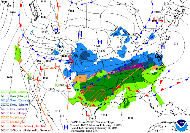
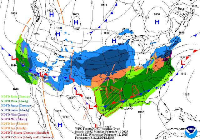
Two upper-level troughs of low pressure will swing eastward across the region this week. With a third forecast to impact the region in the middle of next week. So we are back to a more active pattern which is to be expected this time of the year. In fact, as we get closer to the end of the month I expect to see these series of upper-level storms sweeping across the region to continue and even intensify as we get closer to the beginning of the meteorological spring (March 1st). The question that begs to be answered is whether or not these winter storms can drop far enough south to bring beneficial rain and snow to the state?
Given that we are firmly stuck in a La Nina pattern a windy, dusty, and dry late winter or early spring still looks on tap for much of the area. Some areas of the northern New Mexico mountains have faired a little better than other ranges in the state this winter as far as snowfall is concerned. Overall the state is hurting as far as our normal winter snowpack is concerned. Unfortunately, this pattern we are stuck with favors an increasing risk for high fire danger as the snowpack melts in the spring and the winds continue to crank up. Not good at all and I'm hoping for a pattern change even though I don't see anything significant coming up.
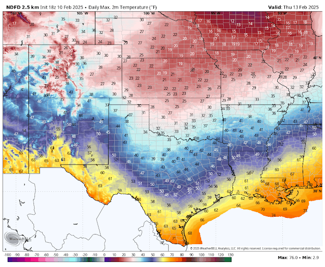
Our thermometers will take a roller-coaster ride this week as several cold fronts sweep into the state this week and the upcoming weekend. Nothing drastic is forecast as far as temps are concerned but at least it will feel more like February rather than April.
The western, northern, and central mountains stand the best chances for seeing measurable snowfall from the two upcoming winter storms this week. The lower elevations in these areas will see a mix of rain and snow.
The Sacramento and Capitan mountains will see light snow this week with the Ruidoso and Cloudcroft areas having a 10% to 40% chance of snow showers tonight into Wednesday night and again Friday and Saturday.
Southeastern New Mexico will see areas of low clouds and fog develop tonight into Tuesday with pockets of light rain and or drizzle possible. Overall rainfall totals should stay below a tenth of an inch so nothing to get excited about. Portions of northern Lea County could see some snow flurries mix in with the light rain or drizzle Tuesday night.
Strong southwest to westerly winds will rake the Guadalupe mountains Tuesday evening through Thursday with sustained speeds of 30 to 40 mph with gusts to near 70 mph. A high Wind Watch is in effect. Westerly winds will gust up to around 35 to 50 mph in the Sacramento mountains Tuesday into Wednesday.
Southwesterly to westerly winds will crank up across the southeastern plains Tuesday and Wednesday as well with gusts in the 35-50 mph range. Localized areas of blowing dust will occur especially in and near our more dust-prone locations.
There Are None So Blind As Those Who "Will - Not" To See...107.


The nightmare continues
ReplyDelete