Turning Colder - Hard Freeze Saturday Morning.
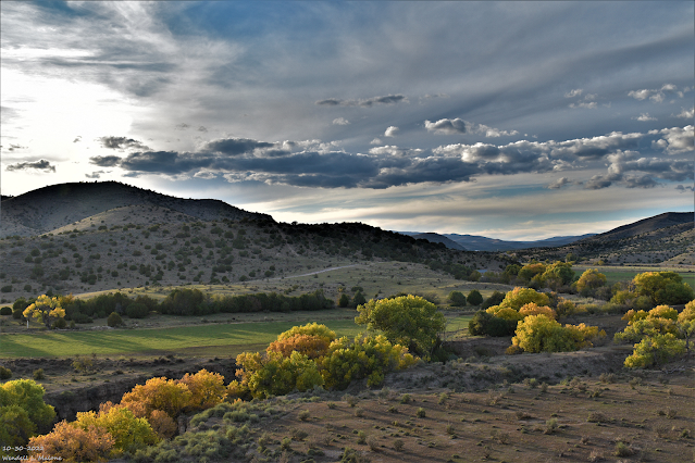
Penasco River Valley
Looking West From Near Elk, NM.
Turning Colder - Hard Freeze Saturday Morning.
Today.
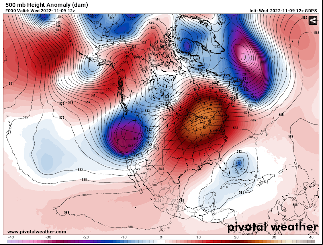
(At 5 AM MST Wednesday Morning).
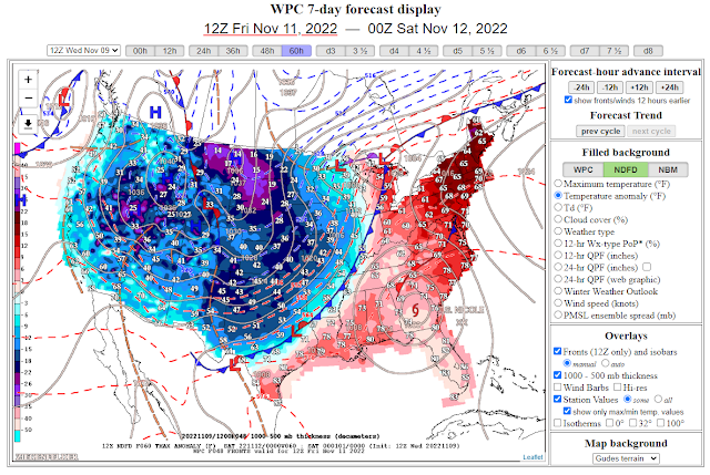
A strong storm centered over northern Nevada early this Wednesday morning will swing east across the Great Basin today through Friday. A strong Pacific cold front will sweep eastward across the region today into tonight. By sunrise Thursday morning it will have moved of the local area and into West Texas. A secondary cold front will drop south out of Colorado and down the Eastern Plains Thursday night and Friday morning.
Today.
Thursday.
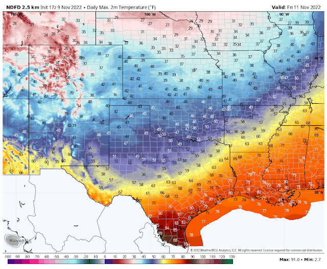
Friday.
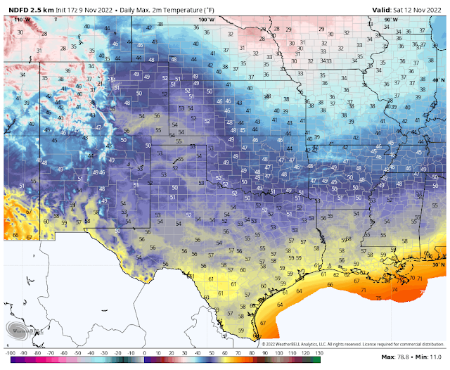
Saturday.
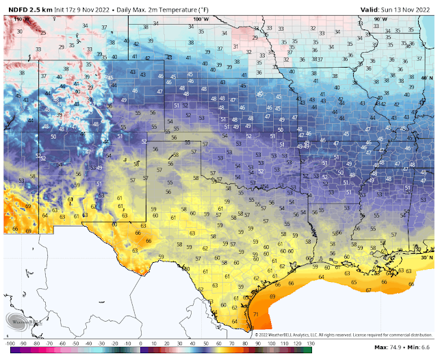
Sunday.
Above Seasonal High Temps Today.
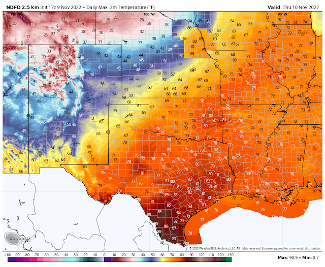
Ahead of the Pacific cold front high temperatures will climb up into near 80ºF to the low 80's over the Southeastern Plains today. Southwesterly winds will gust up to around 25 mph this afternoon.
On Thursday we will see our highs in the mid 60's to near 70ºF. With the frontal passages Thursday night and Friday morning, our highs on Friday and Saturday will only be in the low to mid 50's.
The Ruidoso area will see high temps today in the low 60's, the low 50's on Thursday, and Friday the mid 40's. Southwest winds this afternoon into tonight will gust up to around 35 mph.
The Cloudcroft area will see highs today in the low 50's, the low 40's on Thursday, and the mid to upper 30's on Friday and Saturday. Southwest winds will gust up to around 40 mph this afternoon and near 50 mph tonight. West winds will gust up to around 30 mph on Thursday.
This approaching cold front will be dry so no snow is in the local forecasts for the mountains.
NWS NDFD Low Temperature Forecasts.
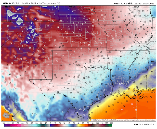
Saturday Morning.
Saturday Morning.
Often times the Canadian (GEM) model has a better handle on our local forecast low temperatures when associated with cold fronts moving south out of Canada. This may be the case locally Saturday morning with it forecasting our low temps in the Pecos Valley and the rest of Southeastern New Mexico in the teens to low-mid 20's. I expect our first hard freeze Saturday morning.
There Are None So Blind As Those Who "Will - Not" To See...107.







Comments
Post a Comment
Your comments, questions, and feedback on this post/web page are welcome.