


Near 80 Today - Windy Thursday - A Freeze Saturday Morning For SE NM?

Looking SW At Sierra Blanca Peak From Nogal, NM.
(At 7 AM MDT Wed, Nov 2, 2022).


Cold air has progressively been getting colder with time across northern and central Alaska and the northwestern half of Canada. Time to start watching these areas for arctic cold fronts moving south into the US. Many locations this morning are in the single digits with some negative temps noted.

Once again low clouds and pockets of fog developed overnight in Southeastern New Mexico and West Texas. Yesterday morning the visibility dropped below 1/4 of a mile in the Carlsbad and Hobbs areas. This morning (as of 8:45 AM MDT) the visibility in the fog has dropped down to 1/2 of a mile at the Roswell Airport, and less than 1/4 of a mile at the Artesia and Carlsbad Airports. The Hobbs Airport was reporting 3 miles in fog.
Breezy Today - Windy Thursday & Friday.

Valid At Noon MDT Thursday.
ECMWF 500 MB (18,000') Analysis.

ECMWF 500 MB (18,000') Forecast.

ECMWF 500 MB (18,000') Forecast.

Our next storm in line was located near Seattle, Washington at midnight last night. This mid-level storm will drop south into southern Nevada by sunrise Thursday morning. Then the storm swings northeast into northern New Mexico by sunrise Friday morning.

A Pacific cold front will sweep eastward across New Mexico on Thursday. Moving through Southeastern New Mexico and West Texas Thursday night and Friday morning.


Highs today in the Ruidoso area will be near 60 and highs on Thursday will be in the mid 50's. Highs on Friday will be near 40 to the low 40's. Lows Saturday morning will be in the mid 20's.
The Cloudcroft area will see highs today in the upper 40's to near 50 and highs on Thursday will be in the mid 40's. Highs on Friday will be near 30 in the Cloudcroft area. Lows Saturday morning will be in the upper teens to near 20.
The Cloudcroft area will see highs today in the upper 40's to near 50 and highs on Thursday will be in the mid 40's. Highs on Friday will be near 30 in the Cloudcroft area. Lows Saturday morning will be in the upper teens to near 20.

As the storm crosses New Mexico on Thursday strong jet stream winds at the 30,000' level (140 knots/161 mph) will aide in strengthening the low-mid level winds across New Mexico.
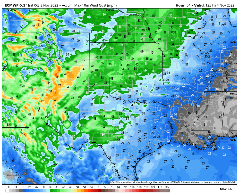
Southwest winds will increase across the lowlands of southern New Mexico, the Southeastern Plains, and parts of West Texas on Thursday to sustained speeds of 2-25 mph with gusts to 30-40 mph. These winds will shift around to the west on Friday and gust up into the 30-40 mph range.
Across the Sacramento mountains southwest winds will increase to sustained speeds on Thursday and Thursday night to 25-35 mph with gusts to 45-55 mph. Westerly winds on Friday will gust up to around 30-40 mph.
Localized areas of blowing dust will be possible Thursday afternoon and evening.
Localized areas of blowing dust will be possible Thursday afternoon and evening.
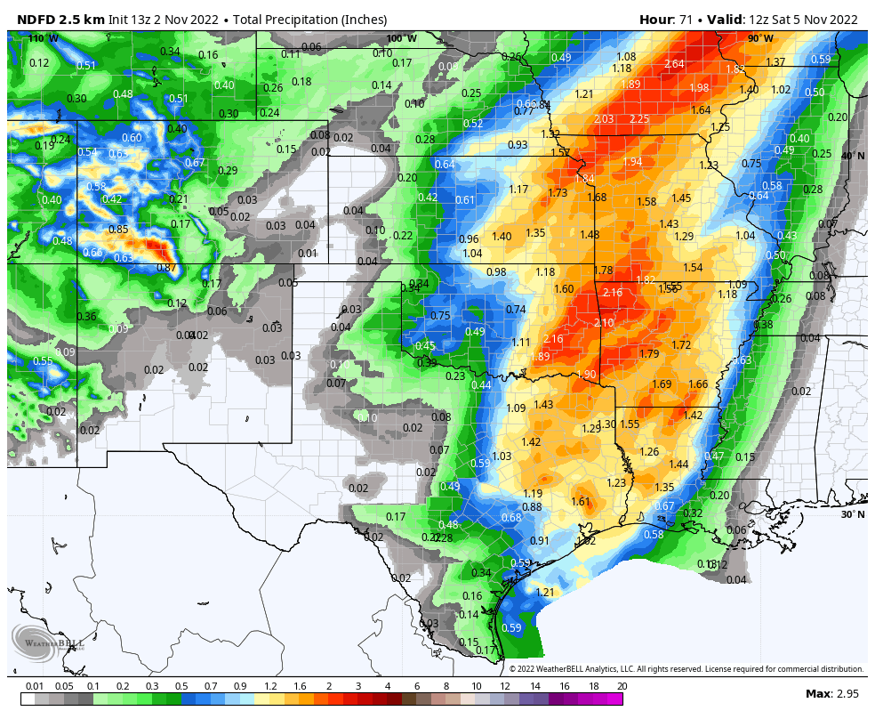
NWS NDFD Storm Total Snowfall Forecast.


Snowfall with this storm will be limited to the western and northern mountains for the most part. At least the heaviest accumulating totals. Winter Weather Advisories are in effect for parts of the northern mountains from midnight tonight through noon on Friday.
There is a slight chance for light snow showers across the higher elevations of the Sac's on Friday. Since the center of this storm will be north of us and given that it is a dry storm this should be a non snow producer.
There is a slight chance for light snow showers across the higher elevations of the Sac's on Friday. Since the center of this storm will be north of us and given that it is a dry storm this should be a non snow producer.
There Are None So Blind As Those Who "Will - Not" To See...107.


Comments
Post a Comment
Your comments, questions, and feedback on this post/web page are welcome.