Current Date & Time

Fall Freeze Data For New Mexico

First Half Of July 2016 Has Been Hot In Southeastern New Mexico.


(Departure From Normal In Degrees-C).


The Highest Was 112ºF On June 26, 2011.

My High Temp On The 14th Was 111ºF. Making This The Highest Temp Of The Year So Far.

Daily Temps Recorded At Our Home In Carlsbad, NM.

I have recorded a total of 23 days so far this summer with daily high temperatures at or above 100ºF. As of yesterday (Friday) I had recorded 13 days in a row with highs at or above 100ºF. The average daily high temp for the first 15 days of the month was 105ºF.

My low temperature here at our home on the 8th was only 79ºF. This is the warmest low temperature that I have recorded here at our home in the past 10 years.

First 15-Days Of July 2016 Were Hot In SE NM.

(KROW).


Roswell has recorded a total of 23 days so far this summer with daily high temperatures at or above 100ºF. As of yesterday (Friday) the Roswell Airport had recorded 15 days in a row with highs at or above 100ºF. The average daily high temp for the first 15 days of the month was 105ºF. Their highest temp was recorded on the 11th with 110ºF.


(KATS).


The Artesia Climate Co-Op Climate Station located 6 miles south of town at the New Mexico State AG Research Station recorded a high temp of 109ºF on the 11th. They have recorded a high temp of 100ºF on 23 days so for this summer. The average daily high temp for the first 15 days of the month was 104ºF.

(1905-2016).


(KCNM).


The Carlsbad Airport has recorded 23 days so far this summer with a high temp of 100ºF or higher. The Airport recorded a high of 110ºF on the 11th and 14th. The average daily high temp for the first 15 days of the month was 105ºF.

Comparing this summer so far with the brutal summer of 2011 we find that the Carlsbad Airport recorded 76 days that year that the temperature reached or exceeded 100ºF. May had 4 days, June 26 days, July 20 days, August 25 days, and September 1 day. The highest temp that year recorded at the Carlsbad Airport was 112ºF on June 26th. 

(1930-2016).


(1900-2016).

(Near Ruidoso, NM KSRR).


The Sierra Blanca Regional Airport (Elevation 6,851' MSL) has recorded a high temp of 90ºF 10-days this month so far. The highest was 93ºF on the 14th. 

The Truth Is Stranger Than Fiction!

Comments

My Blog Archive List (July 2010 - August 2025).

Show more

My Current Weather Conditions

NWS Albuquerque 2026 Winter Outlook

Eddy County

Guadalupe Mtns Eddy & Culberson County

Lea County

NWS Midland Web Page

NWS Midland Web Page
Click On The Map To Open It Up

SE New Mexico & West Texas Precipitation Forecasts

NWS Midland Hazardous Weather Outlook

NWS Midland Hazardous Weather Outlook
Click On The Image To See The Rest Of The Outlooks

NWS Midland Hazardous Weather Outlook

NWS Midland Hazardous Weather Outlook
Click On The Image To See The Rest Of The Outlooks

NWS Midland Hazardous Weather Outlook

NWS Midland Hazardous Weather Outlook

NWS Midland Forecast Graphic

NWS Midland Graphic Forecast

NWS Midland Forecast Graphic

NWS Midland Forecast High Temperatures Today

NWS Midland Forecast Low Temperatures Tonight

New Mexico

Chaves County Plains & Mtn's

Lincoln County

NWS Albuquerque Web Page

NWS Albuquerque Web Page
Click On The Map To Open It Up

NWS Albuquerque New Mexico Precipitation Forecasts

NWS Albuquerque Hazardous Weather Outlook

NWS Albuquerque Hazardous Weather Outlook

NWS Albuquerque Forecast Grpahics

NWS Albuquerque Forecast Graphics

NWS Albuquerque Forecast Graphic

NWS Albuquerque Graphic Forecast

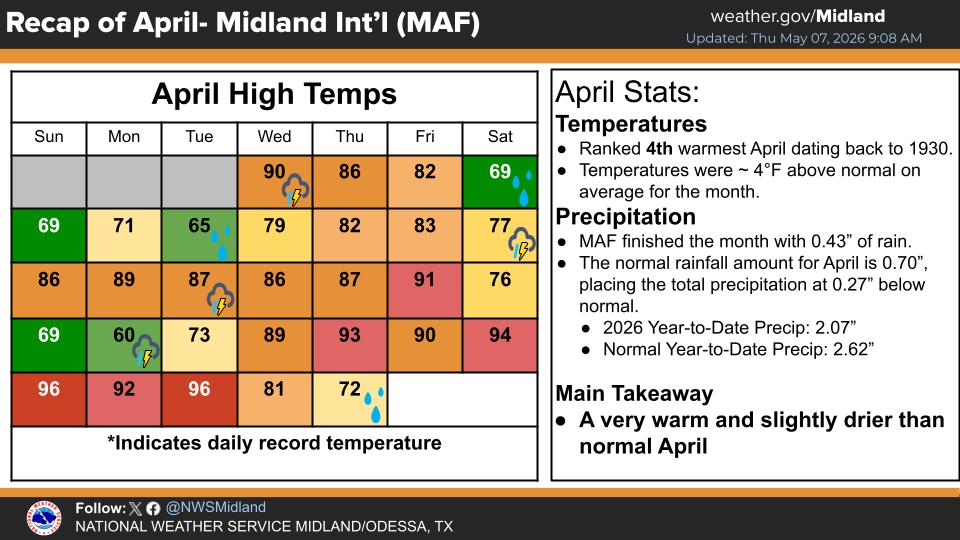
NWS Albuquerque Forecast High Temperatures Today

NWS Albuquerque Forecast Low Temperatures Tonight

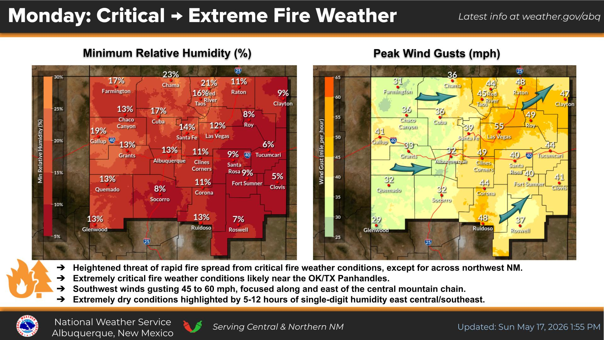
NWS Albuquerque Peak Wind Gust Forecast

Texas

Otero County

NWS El Paso Web Page

Southern New Mexico & Far West Texas Precipitation Forecasts

NWS El Paso Hazardous Weather Outlook

NWS El Paso Hazardous Weather Outlook
Click On The Image To See The Rest Of The Outlooks

NWS El Paso Hazardous Weather Outlook

NWS El Paso Hazardous Weather Outlook
Click On The Image To See The Rest Of The Outlooks

NWS El Paso Hazardous Weather Outlook

NWS El Paso Hazardous Weather Outlook

NWS El Paso Hazardous Weather Outlook

NWS El Paso Graphic Forecast

NWS El Paso Graphic Forecast

NWS El Paso Graphic Forecast

NWS El Paso Graphic Forecast

NWS El Paso Forecast High Temperatures Today

NWS El Paso Forecast Low Temperatures Tonight

NWS Lubbock Web Page

NWS Lubbock Web Page
Click On The Map To Open It Up

NWS Lubbock South Plains Precipitation Forecasts

NWS Lubbock Hazardous Weather Outlook

NWS Lubbock Hazardous Weather Outlook
Click On The Image To See The Rest Of The Outlooks

NWS Lubbock Hazardous Weather Outlook

NWS Lubbock Hazardous Weather Outlook
Click On The Image To See The Rest Of The Outlooks

NWS Lubbock Hazardous Weather Outlook

NWS Lubbock Hazardous Weather Outlook

NWS Lubbock Graphic Forecast

NWS Lubbock Graphic Forecast

NWS Lubbock Graphic Forecast

NWS Lubbock Hi Temperature Forecast Today

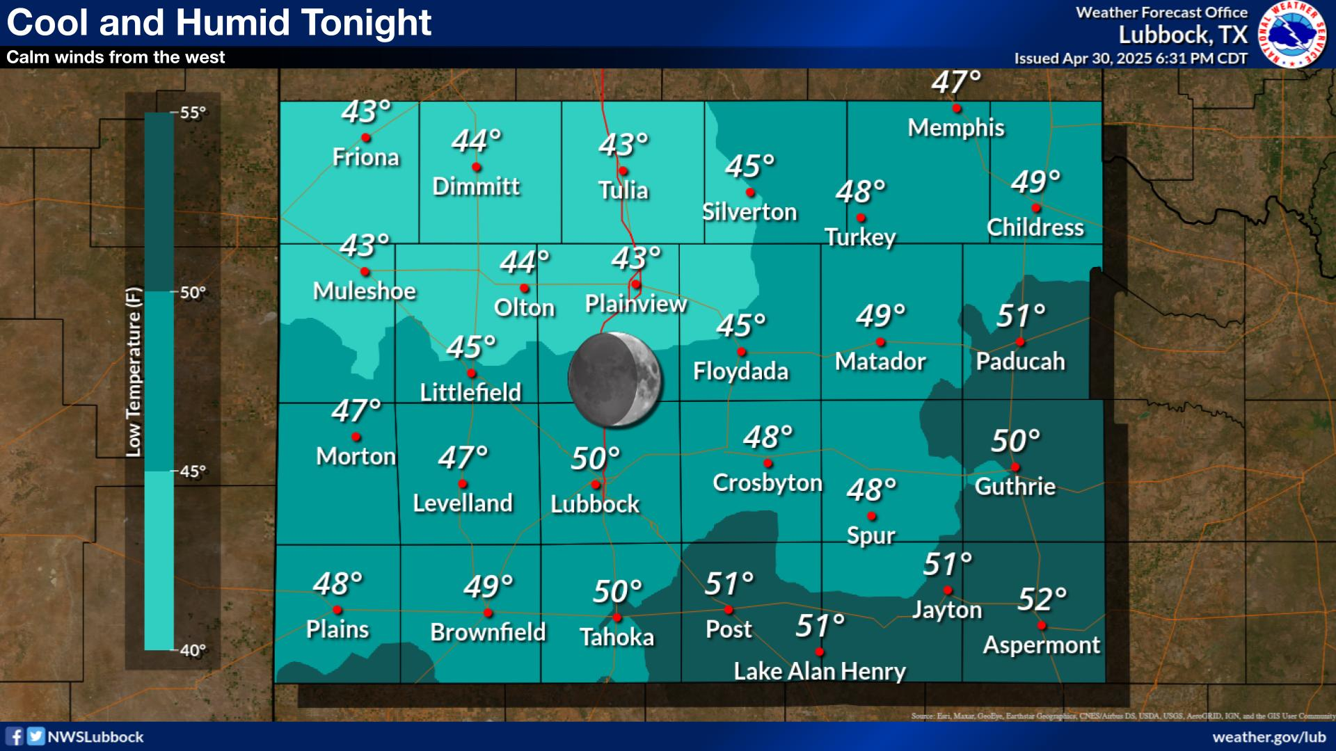
NWS Lubbock Low Temperature Forecast Tomight

My Rainfall Totals - 2.1 NNW Downtown Carlsbad

My Rainfall Totals - 2.1 NNW Downtown Carlsbad

My Seasonal Snowfall Totals - 2.1 NNW Downtown Carlsbad

My Seasonal Snowfall Totals - 2.1 NNW Downtown Carlsbad

Disclaimer

This blog and its contents are for informational purposes only! Always have multiple sources of information available to rely upon during severe weather. Do not rely solely on the Internet. Be weather-aware, plan ahead, have a backup plan, and be ready to act before severe weather strikes your location.