Current Date & Time

New Daily NM Record High Temperatures April 25 - May 12, 2020.


(April 25 - May 12, 2020).


An impressive total of 159 new daily record high temperatures was either tied or broken between April 25th and May 12th. Roswell and Jal top the list with both stations reaching 102ºF. 

There were 7 new all-time monthly high temperatures either tied or broken from April 25th through May 12th.

On May 3rd the Carlsbad Climate Co-Op Station recorded an overnight low temperature of only 73ºF. This beats the previous record warm minimum temperature for the date of 70ºF last set in 1930. All total there were 85 total new daily record daily high minimum temperatures that were either tied or broken from April 25 through May 12 in New Mexico.

Nine new monthly all-time new high minimum temperatures were established April 25th  through May 12th.

The Truth Is Stranger Than Fiction!

Comments

My Blog Archive List (July 2010 - August 2025).

Show more

My Current Weather Conditions

MY CoCoRaHS Precipitation Data

NWS Albuquerque 2026 Winter Outlook (Updated Nov 3rd).

NWS Midland Web Page

NWS Midland Web Page
Click On The Map To Open It Up

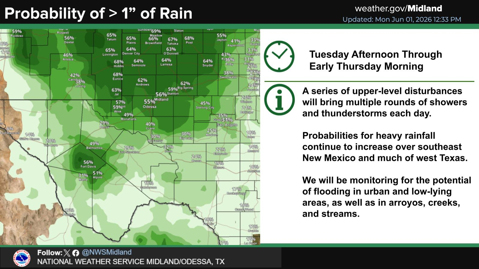
SE New Mexico & West Texas Precipitation Forecasts

Eddy County

Guadalupe Mtns Eddy & Culberson County

Lea County

NWS Midland Hazardous Weather Outlook

NWS Midland Hazardous Weather Outlook
Click On The Image To See The Rest Of The Outlooks

NWS Midland Hazardous Weather Outlook

NWS Midland Forecast High Temperatures Today

NWS Midland Forecast Low Temperatures Tonight

NWS Midland Peak Wind Gust Forecast

NWS Midland Graphic Forecast

NWS Midland Graphic Forecast
A scheduled, nationwide test of the Emergency Alert System is planned for November 17, 2026 at 2:20 pm ET. The test message will be distributed to the public via television and radio broadcasts - NOAA Weather Radios will not receive the test. If for any reason the test cannot proceed on the assigned date, December 3 will serve as the back-up. For more information please see this Press Release (https://www.fema.gov/press-release/20261116/fema-and-fcc-conduct-nationwide-test-emergency-alert-system-november-17-2026).

NWS Midland Forecast Graphic

NWS Midland Forecast Graphic
Another cool day expected with patchy morning fog and drizzle. Clouds may try to break over some places late, but may hold over southeast New Mexico. Another chilly night tonight with patchy fog developing again in places.

NWS Albuquerque Web Page

NWS Albuquerque Web Page
Click On The Map To Open It Up

NWS Albuquerque New Mexico Precipitation Forecasts

New Mexico

Chaves County Plains & Mtn's

Lincoln County

NWS Albuquerque Hazardous Weather Outlook

NWS Albuquerque Hazardous Weather Outlook

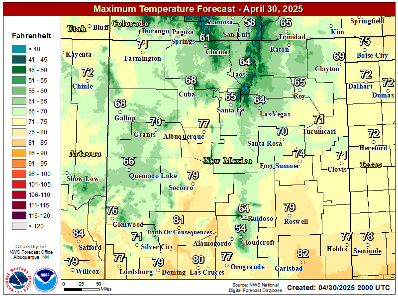
NWS Albuquerque Forecast High Temperatures Today

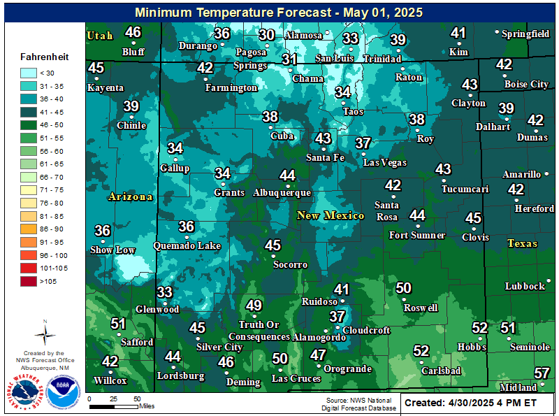
NWS Albuquerque Forecast Low Temperatures Tonight

NWS Albuquerque Wind Chill Forecast

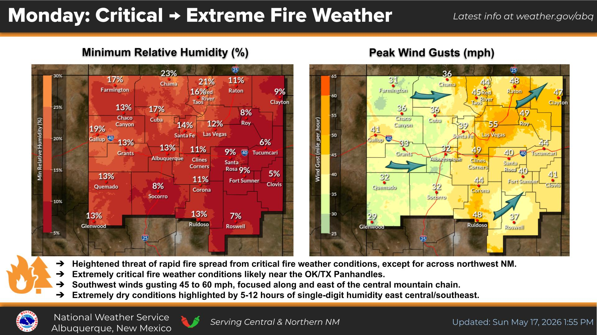
NWS Albuquerque Peak Wind Gust Forecast

NWS Albuquerque Graphic Forecast

NWS Albuquerque Graphic Forecast
A Dense Fog Advisory is in effect through 11AM MST for much of central NM, including the Santa Fe Metro.

NWS Albuquerque Graphic Forecast

NWS Albuquerque Graphic Forecast
Another round of high mountain snow accumulations are expected Tuesday night across northern NM. Between 1 and 4 inches of snow is likely. Around 6" would be a reasonable high-end snow fall amounts. Snow will taper off by noon Wednesday.

NWS Albuquerque Graphic Forecast

NWS Albuquerque Graphic Forecast
Increasing south to southwest winds are expected across parts of northern and central NM today ahead of an approaching storm system. Expect difficult crosswinds on east to west oriented roadways. Unsecured objects may blow around.

NWS Albuquerque Forecast Grpahics

NWS Albuquerque Forecast Grpahics
A storm system will bring rain and mountain snow to the area today. Chances are trending up for early next week. Temperatures will remain near to below normal this week.

NWS El Paso Web Page

Southern New Mexico & Far West Texas Precipitation Forecasts

Texas

Otero County

NWS El Paso Hazardous Weather Outlook

NWS El Paso Hazardous Weather Outlook
Click On The Image To See The Rest Of The Outlooks

NWS El Paso Hazardous Weather Outlook

NWS El Paso Hazardous Weather Outlook
Click On The Image To See The Rest Of The Outlooks

NWS El Paso Forecast High Temperatures Today

NWS El Paso Forecast Low Temperatures Tonight

NWS El Paso Wind Chill Forecast

NWS El Paso Peak Wind Gust Forecast

NWS Lubbock Web Page

NWS Lubbock Web Page
Click On The Map To Open It Up

NWS Lubbock South Plains Precipitation Forecasts

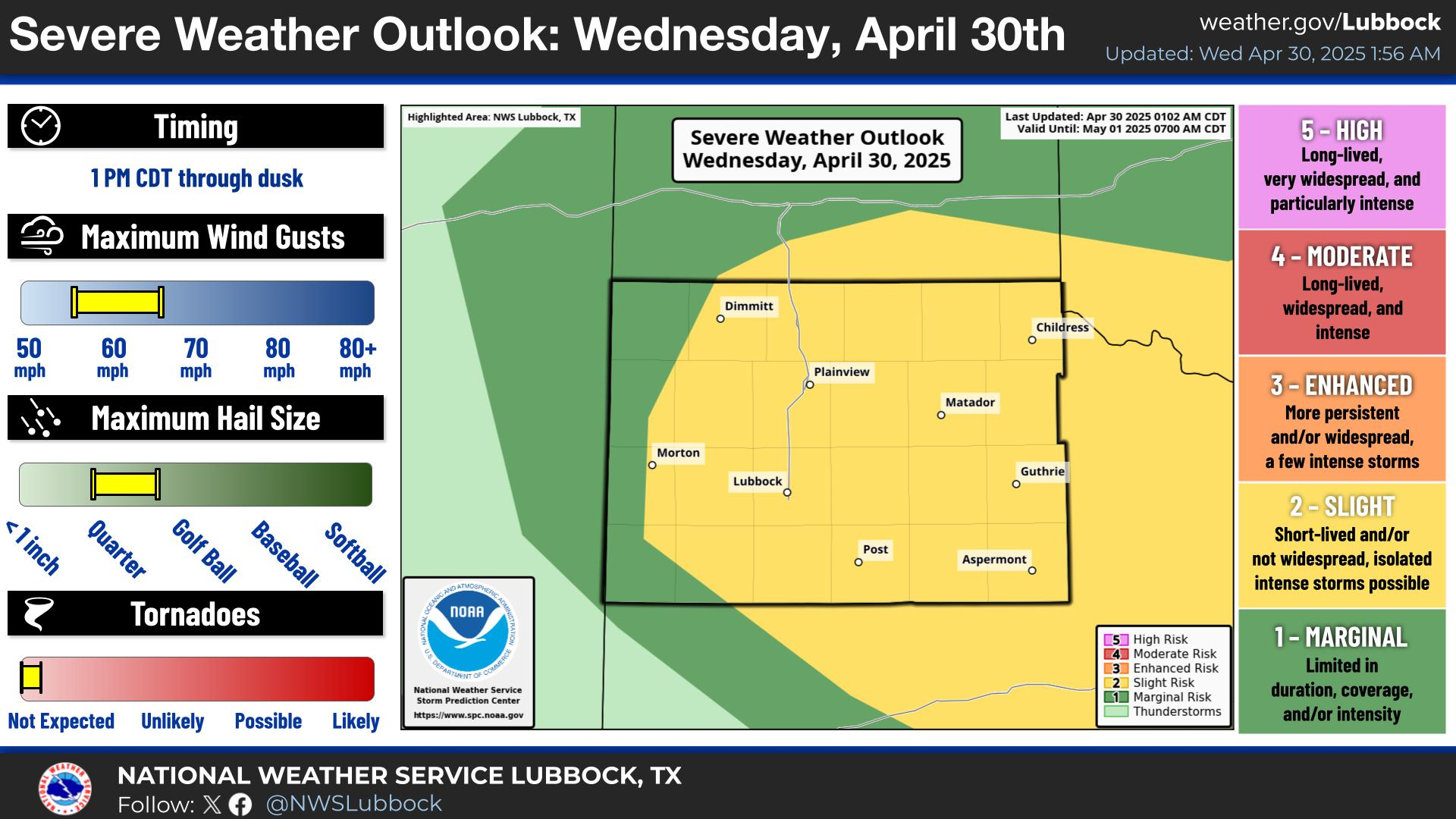
NWS Lubbock Hazardous Weather Outlook

NWS Lubbock Hazardous Weather Outlook
Click On The Image To See The Rest Of The Outlooks

NWS Lubbock Hazardous Weather Outlook

NWS Lubbock Hazardous Weather Outlook
Click On The Image To See The Rest Of The Outlooks

NWS Lubbock Hi Temperature Forecast Today

NWS Lubbock Low Temperature Forecast Tomight

NWS Lubbock Graphic Forecast

NWS Lubbock Graphic Forecast
Clouds and fog will continue across most of the region today and tonight, though it will be slightly warmer with highs in the mid 50s/60. Overnight lows will still be in the low 40s.

NWS Lubbock Graphic Forecast

NWS Lubbock Graphic Forecast
Cool and cloudy conditions will stick around through mid-week before a brief warmup late this week.

My Rainfall Totals - 2.1 NNW Downtown Carlsbad

My Rainfall Totals - 2.1 NNW Downtown Carlsbad

My Seasonal Snowfall Totals - 2.1 NNW Downtown Carlsbad

My Seasonal Snowfall Totals - 2.1 NNW Downtown Carlsbad

Disclaimer

This blog and its contents are for informational purposes only! Always have multiple sources of information available to rely upon during severe weather. Do not rely solely on the Internet. Be weather-aware, plan ahead, have a backup plan, and be ready to act before severe weather strikes your location.