

Cooler Today Into The Weekend As Summer Loses It's Grip.
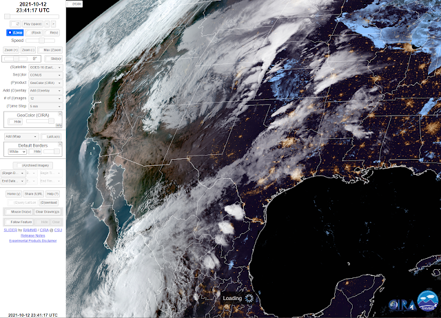
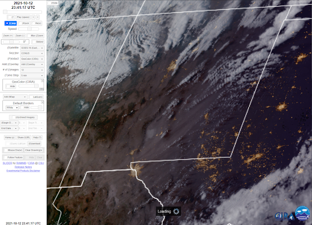
Late Tuesday afternoon I captured these two screenshots of the GeoColor satellite images. They show a couple of interesting items. First in the top shot is Hurricane Pamela as she moves towards the northeast south of the Baja Penisula. The second is a zoomed-in image in the bottom photo of the blowing dust occurring across northern Mexico, southern New Mexico, and northeastward into Southeastern and eastern New Mexico.
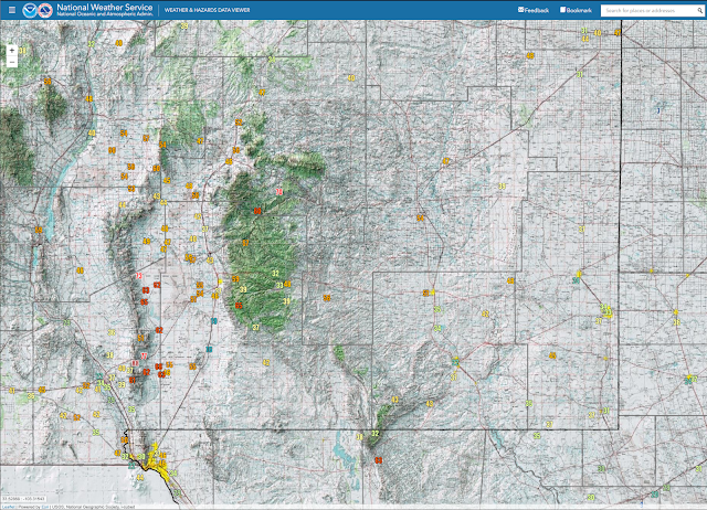
San Augustin Pass located east of Las Cruces on US Hwy 70 clocked a peak wind gust of 88 mph Tuesday afternoon. The Sierra Blanca Regional Airport northeast of Ruidoso clocked a peak wind gust of 70 mph. The Cosmic Raws located at Sunspot south of Cloudcroft 65 mph.The Smokey Bear Raws in Ruidoso 60 mph.

At 8 AM MDT Wednesday, October 13, 2021.


GFS 500 Millibar (18,000') Forecast.

As our windbag of a storm departs this morning our next weather maker is forecast to arrive on Thursday. A short wave trough of low pressure is forecast to swing across the northern Rockies and northern New Mexico Thursday. This will tighten up the pressure gradient both aloft and at the surface. So another breezy day is on tap.
(Thursday).
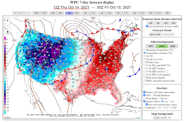
As this mid-upper level storm departs the area Thursday afternoon it will "kick" a cold front south through the state. Cooler air will overspread the area behind the front Thursday night into Saturday. We will see our coldest temps of the season in the valley and mountains locations of southern and Southeastern New Mexico. No precipitation is forecast locally.


NWS NDFD Forecast Low Temperatures Thursday.


NWS NDFD Forecast High Temperatures Thursday.


NWS NDFD Forecast Low Temperatures Friday.


NWS NDFD Forecast High Temperatures Friday.


What a difference a couple of days can make. The first picture is from Sunday and I took the second one this morning north of Chama. It went from autumn to winter in just two days. #NMwx pic.twitter.com/uZwISlCevB
— Hannah Grover (@hmgrover) October 12, 2021
The Truth Is Stranger Than Fiction!


Comments
Post a Comment
Your comments, questions, and feedback on this post/web page are welcome.