


Next Potential Storm To Impact The Region Next Week.
First Look At Next Weeks Storm.
Valid At Noon MDT Wednesday, Oct 27, 2021.
ECMWF 500 Millibar (18,000') Forecast.
Valid At Noon MDT Wednesday, Oct 27, 2021.
GEM 500 Millibar (18,000') Forecast.

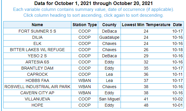
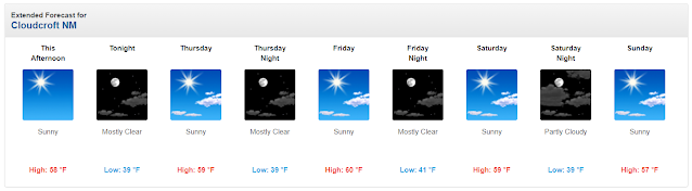
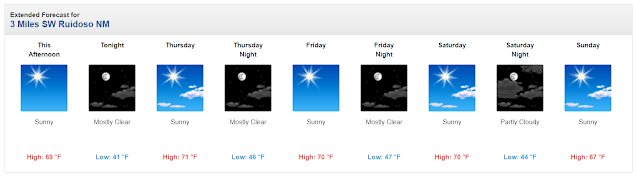
Our local weather of late has been rather tranquil of late. Our temperatures have been running a little above average to date but other than that nothing significant has occurred recently. Parts of the local area did receive their first freeze of the season. Freezing temperatures have occurred across the Capitan and Sacramento mountains generally above 6,000'. The area has yet to experience its first widespread killing freeze at the lower elevations of the Southeastern Plains
Listed below are the locations and their reported freezing temperatures and dates of occurrence.
A very active jet stream will continue to send very strong mid-upper level storms into the Gulf of Alaska today into the first of next week and beyond. This morning's run of the computer forecast models hints that our next storm to affect the region may occur the first and middle of next week.
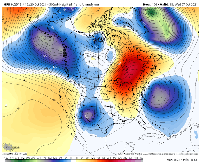
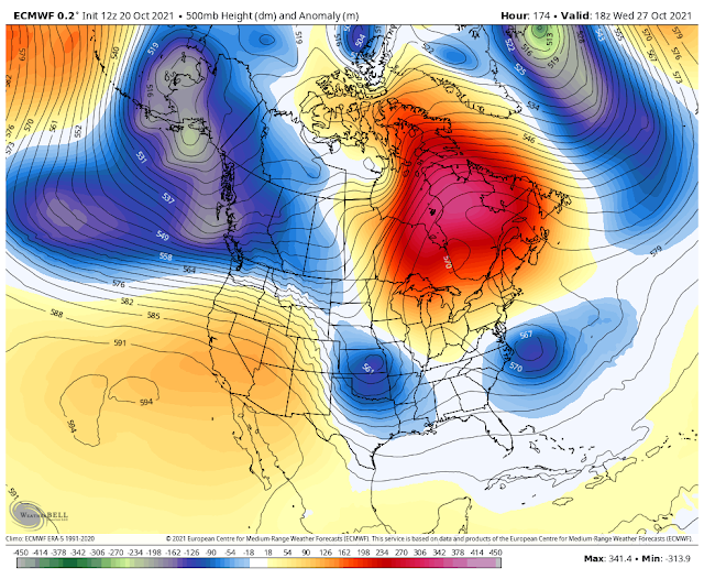
The GFS model is the strongest with its forecasts and drops a closed low into southern New Mexico by next Wednesday (the 27th). The European and Canadian models don't agree with this and have a much weaker storm swinging by the state and exiting much faster. We are a week out from any such impacts so it's difficult to pin anything down this far out. But at least there is a chance of a storm in the cards and hoping it brings some much-needed rain and snow to the state.
(Some 5º-15º Above Normal For The Date).


The Truth Is Stranger Than Fiction!


Always good info
ReplyDelete