

Two Storms Knock Our Temps Back Down To Near Normal.


September 9, 2021.
Artesia, New Mexico.
Pecan Orchard On South 13th St.
This will undoubtedly be the theme today and again on Tuesday as two strong fall storms sweep the area and produce strong southwesterly wind gusts. We had a wet summer this year and our local crop of needle grass will accumulate up against everything every time the wind blows this fall, winter, and spring.
Blog Update At 11:00 AM MDT Sunday.
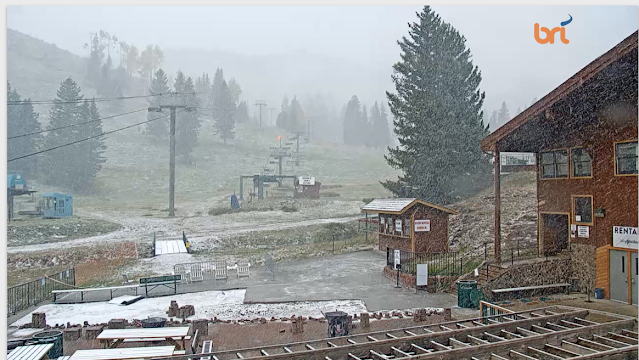
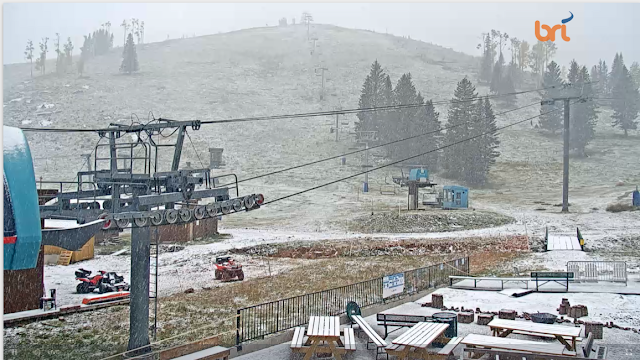
A light to moderate shower is ongoing at Ski Apace west of Ruidoso, NM as of 11:00 AM MDT this Sunday morning. The nearby Sierra Blanca Snotel is reporting 1 inch of snow and a temp of 40ºF. Meanwhile, Guadalupe Pass is reporting a peak wind gust so far of 68 mph.
Roswell topped out at 99ºF Saturday afternoon. Wink, Texas reported 100ºF, the Artesia Airport 95ºF, the Carlsbad Airport 97ºF, and here at our home in Carlsbad I also recorded 97ºF. These readings were around 12º to 15º above normal for the date. Summer just refuses to give up.
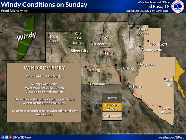
First Fall High Wind Event Today.

GFS 500 Millibar (18,000') Wind Forecast.
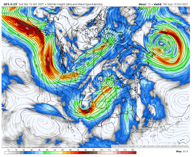
Valid At Noon MDT Today.
Our first fall high wind event will sweep the area today. A strong short wave trough of low pressure is forecast to swing eastward across eastern New Mexico today. An associated Pacific cold front will move southeastward across the state today. Strong winds aloft will combine with a tight surface pressure gradient and atmospheric mixing to produce high winds locally today into early this evening.
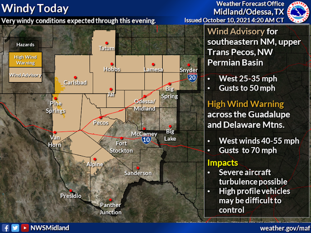
A High Wind Warning is in effect today for Guadalupe Pass and nearby locations for west winds sustained at around 40-55 mph with gusts near 70 mph.
Wind Advisories are in effect today for Chaves, Eddy, Lea, Lincoln, and Otero Counties for west winds sustained at around 25-35 mph with gusts near 45-50 mph.
Patchy areas of blowing dust will also occur in a few areas this afternoon during the strongest winds and associated with the frontal passage. Visibilities may suddenly drop below 3 miles in these areas with the strongest wind gusts.
Turning Cooler Today Into Next Week.
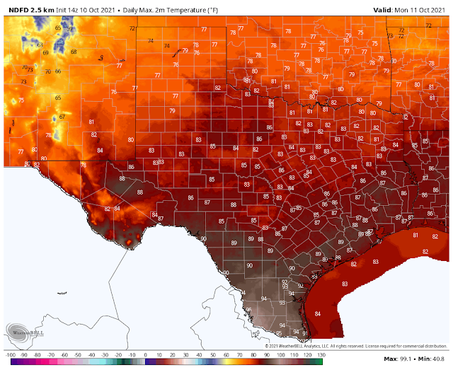
Highs Today.


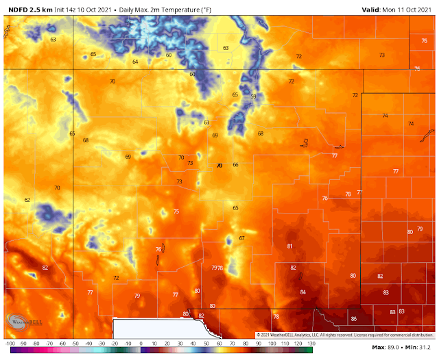
NWS NDFD Forecast Low Temperatures.
Monday Morning.


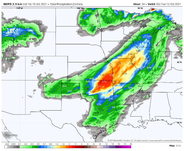
NWS NDFD Rainfall Forecast.
NWS NDFD Snowfall Forecast.
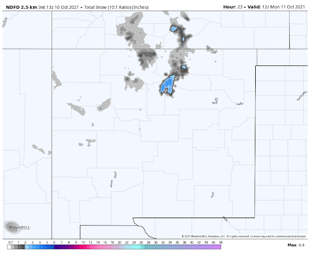
Valid Today Through 6 PM MDT Monday.
Light snow will occur today over parts of the higher mountains of northern New Mexico will light rain showers will dot the northeastern and eastern plains. Snow levels today across northern New Mexico are forecast to around 8,000' to 9,000' dropping down to around 5,000' to 6,000' tonight.
Our next storm arrives Tuesday with another high wind event locally and cooler temps for the rest of the week.
Second Storm Arrives Tuesday.
...TWO STORMS WILL BRING PROGRESSIVELY COLDER WEATHER TODAY
THROUGH WEDNESDAY MORNING, ACCOMPANIED BY BOUTS OF STRONG WINDS...

Two potent storm systems are forecast to bring the coldest
temperatures of the season so far to northern and central NM, with
the first storm crossing today and the second Tuesday through
Tuesday night. This first storm system will bring windy weather
through western, central, and southern NM with gusts of 35 to 45
mph possible. A wind advisory has been issued for the southeast
zones. Light to moderate showers of rain and high mountain snow
will skirt across northern NM this morning, then consolidate
across the east this afternoon. and the northeastern plains
Sunday morning. A sharp drop in temperatures will follow for
Monday morning with overnight lows dipping to freezing across
western and northern NM, ending the growing season in the upper
Rio Grande Valley. A hard freeze warning has been issued.

The second system will bring a likely end to the growing season
for many more in the Rio Grande Valley and highlands east of the
central mountain chain with widespread freezing temperatures
forecast Tuesday night into Wednesday morning. This storm system
will also be defined by strong southwest winds ahead of it Tuesday
afternoon reaching gusts of 45 to 50 mph and up to 60 to 65 mph
over the south-central mountains. The potential for snow reaching
valley floors will also exist across northern New Mexico Tuesday
night with light accumulations.

$$

40
The Truth Is Stranger Than Fiction!


Comments
Post a Comment
Your comments, questions, and feedback on this post/web page are welcome.