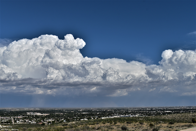
Looking SE From C-Hill In Carlsbad.
(As Of 9 AM MDT Tuesday Morning).
(As Of 9 AM MDT Tuesday Morning).
(As Of 9 AM MDT Tuesday).
Local 24-Hour Rainfall Totals.
Yesterday afternoon thunderstorms produced localized heavy rainfall. The heaviest rainfall fell just north of Red Bluff Reservoir on the New Mexico/Texas State Line southeast of Carlsbad. Estimates as high as 5" may have fallen.
Another pocket of heavy rainfall fell 20 miles east of Carlsbad just northwest of the WIPP Site. Both of these totals noted above may be a little high since radar indicated that the thunderstorms that produced this heavy rainfall also were producing hail. Hail tends to exaggerate the estimated rainfall totals in a storm.
A second complex/line of thunderstorms developed north of Roswell after sunset and moved south and southwest into the Pecos Valley before midnight. The heaviest estimated rainfall was noted just north of Dexter and southwest of Bottomless Lakes State Park where 2.50" may have fallen. A public report of 1.60" was posted on Facebook from Dexter. A Personal Weather Station (PWS - Grimmie) just north of Dexter measured 1.53".
A Roswell CoCoRaHS Station located 0.3 miles south-southwest recorded .99". An Artesia CoCoRaHS Station located 3.5 miles north-northeast recorded .92". The Roswell Airport ASOS measured .87".
Monday afternoon a strong thunderstorm dumped 1.47" of rain at the Weed Personal Weather Station (PWS - Dark Ridge Observatory).
Public Information Statement
National Weather Service Albuquerque NM
921 AM MDT Tue Aug 30 2022

...PRECIPITATION REPORTS...

Location                     Amount    Time/Date       Lat/Lon

...New Mexico...

...Chaves County...
Roswell 40.5 NE              1.29 in   0800 AM 08/30   33.72N/103.96W
Roswell No. 1 Portable       1.00 in   0840 AM 08/30   33.50N/103.92W
Roswell 0.3 SSW              0.99 in   0700 AM 08/30   33.37N/104.53W
Roswell Air Center           0.87 in   0851 AM 08/30   33.30N/104.50W
Roswell 28.5 NNE             0.76 in   0700 AM 08/30   33.76N/104.36W
Roswell 5.5 E                0.70 in   0700 AM 08/30   33.38N/104.43W
Bitter Lake WL Refuge 14 NNE 0.42 in   0837 AM 08/30   33.65N/104.32W
Bitter Lake WL Refuge 14 NNE 0.40 in   0837 AM 08/30   33.65N/104.32W
Bitter Lakes WL Refuge       0.35 in   0602 AM 08/30   33.48N/104.40W
Roswell 5.1 N                0.30 in   0800 AM 08/30   33.44N/104.52W
Roswell 1.7 NW               0.23 in   0529 AM 08/30   33.39N/104.55W

...Lincoln County...
Arabela 2.5 SSW              0.21 in   0700 AM 08/30   33.55N/105.19W
Ruidoso 2 SSW                0.16 in   0700 AM 08/30   33.36N/105.67W

...Mora County...
IRAWS 5                      0.19 in   0900 AM 08/30   35.89N/105.59W
Chacon 2.1 ENE               0.16 in   0700 AM 08/30   36.16N/105.34W

...Quay County...
San Jon                      0.36 in   0700 AM 08/30   35.11N/103.33W

...Rio Arriba County...
Alcalde 5.9 NE               0.21 in   0700 AM 08/30   36.15N/105.99W
Alcalde                      0.11 in   0630 AM 08/30   36.09N/106.06W

...Roosevelt County...
Elida 9.1 S                  1.04 in   0700 AM 08/30   33.81N/103.65W
Causey 11.0 S                0.59 in   0830 AM 08/30   33.71N/103.12W
Milnesand                    0.30 in   0700 AM 08/30   33.64N/103.34W

...San Miguel County...
Villanueva 0.5 SW            0.37 in   0800 AM 08/30   35.26N/105.37W
Apache Springs 1 NE          0.30 in   0909 AM 08/30   35.39N/105.18W
Rowe 2.7 NNW                 0.27 in   0700 AM 08/30   35.53N/105.70W
Mineral Hill 1 WNW           0.10 in   0700 AM 08/30   35.62N/105.43W

...Taos County...
Iraws 20                     0.29 in   0901 AM 08/30   36.06N/105.50W
Valdez 1 NNW                 0.22 in   0909 AM 08/30   36.56N/105.59W
Questa 1.1 NE                0.12 in   0700 AM 08/30   36.71N/105.58W

...Torrance County...
Encino 6 W                   0.64 in   0700 AM 08/30   34.63N/105.57W

...Union County...
Amistad 7.7 SW               0.44 in   0700 AM 08/30   35.86N/103.27W

Observations are collected from a variety of sources with varying
equipment and exposures. We thank all volunteer weather observers
for their dedication. Not all data listed are considered official.

$$
There Are None So Blind As Those Who "Will - Not" To See...107.


Comments
Post a Comment
Your comments, questions, and feedback on this post/web page are welcome.