


Staying Safe During Severe Weather.
Funnel Cloud Over Atoka, NM. June 13, 1984.

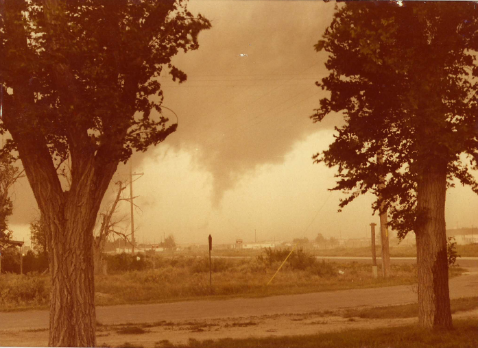
Roswell, NM Tornado April 8, 2004.

Rotating Wall Cloud 3 Miles North Of Lakewood, NM.
October 11, 1997.
.jpg)
Our home in Carlsbad, New Mexico. My wife holding a bucket of hail.
March 7, 2010.

Whites City, NM Supercell Thunderstorm April 29, 2009.
Good morning all. We are still on track for some important changes in our local weather here in southeastern New Mexico and west Texas this week. The good news is that we still have a decent chance of seeing some wetting rains starting Wednesday and continuing into the weekend.
However its May and this is usually our most likely time of the year to experience severe thunderstorms. Mid May through Mid June is typically the heart of our severe weather season here in southeastern New Mexico.
With this thought in mind here are a couple of links to help keep you and your family safe in the event severe weather threatens your area.
1. This link is courtesy of the National Weather Service and is free. You should be able to use this on your phones as long as you have internet service. Simply type in your location of interest for all of the very latest up to date National Weather Service forecasts, Watches, Warnings, Special Weather Statements, Radar data, and other pertinent local weather data.
Example:
Roswell, NM or Roswell, New Mexico
Artesia, NM or Artesia, New Mexico
Carlsbad, NM or Carlsbad, New Mexico
http://mobile.weather.gov/#typeLocation
2. I also use Radar Scope on my Android phone for my radar updates. This service is not free and requires a small one time fee (at least on my Verizon Android). Local National Weather Service Watches, Warnings, and Storm Reports are available via this service too.
http://radarscope.tv/products/
The Truth Is Stranger Than Fiction!
My Web Page Is Best Viewed With Google Chrome.


Comments
Post a Comment
Your comments, questions, and feedback on this post/web page are welcome.