Brutal Arctic Cold Coming Next Week!
Looking south from Carlsbad at Altocumulus Standing Lenticular Clouds.
Brutal Arctic Cold Set To Invade Next Week.
North America Temperatures.
At 7 AM MST Saturday, February 6,2021.
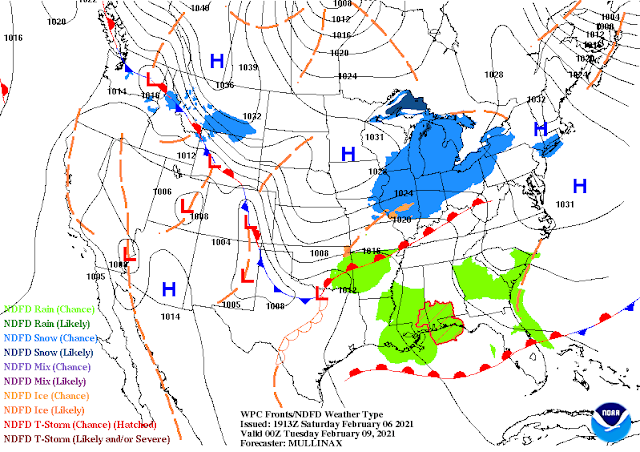
Saturday Morning February 6, 2021.
A brutally cold arctic air mass has been building across most of interior Alaska and northern Canada over the past week. This morning's reported low temperatures were widespread in the -30F to -40F range, with pockets of -50F and approaching -60F.
How Cold Is Cold & How Soon?
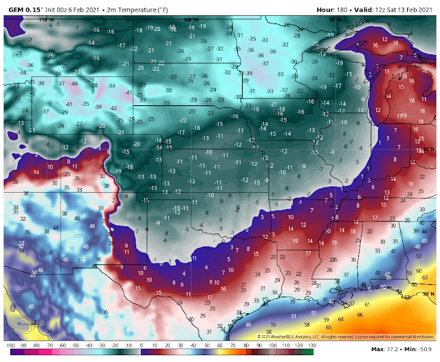
Canadian (GEM) Apparent Temperature Forecast.
Valid At 5 AM MST Saturday, February 13, 2021.
Canadian (GEM) Temperature Anomaly Forecast.
Valid At 5 AM MST Saturday, February 13, 2021.
- Just how cold this impending brutal arctic air mass will end up getting in our local next of the woods next week is unknown for now. As one can guess the forecast models are all over the place with this outbreak temperature-wise and snowfall-wise. Hopefully, they start settling down and come into better agreement next week. This is a first look at the potential impacts of this arctic air mass. These forecasts will change next week. Possibly for the better or the worse. Many times when dealing with air masses this cold the computer forecast models have a bias of being too warm and too slow on the timing of the arctic frontal boundary passages.
- I used last night's (Friday nights) run of the Canadian (GEM) forecast model above as the worst-case scenario. This potentially record-breaking brutally cold arctic air mass has the potential to be the coldest that has affected the local area since the Arctic Outbreak of January 31st - February 4th, 2011. We may or may not see temperatures this cold locally so take this with a huge grain of salt.
- When does the arctic cold front arrive in SE NM and nearby West TX? As early as Tuesday with a reinforcing stronger shot Thursday or Friday? This is highly unknown right now (as of Saturday afternoon). The frontal boundary has the potential to wobble back and forth across the area. From east to west and north to south.
- During my lifetime growing up in Eddy County, New Mexico I've watched these arctic fronts oscillate back and forth at many times. I've seen temperatures on the west and south side of these fronts climb up in the 70's and 80's in the warm downsloping southwesterly and westerly winds. While immediately to the north and east of these fronts the temperatures were in the single digits and teens. We've been in the single digits in Artesia while Cloudcroft 90 miles to the west, at an elevation of 8,750' in the southern Sacramento Mountains was in the 50's. Roswell, Artesia, and Carlsbad in the 70's with Tatum and Hobbs in the single digits and teens.
- Will it get down to 0F or colder here in Southeastern New Mexico and parts of West Texas? Yes, that is very possible. It's also possible we could see wind chill values in the -10F to -20F range late next week into the weekend. But it's also possible that we may not get that cold.
- What I do know is that our "warm winter trend" of late is coming to a dramatic end next week. We potentially could see below-normal temperatures for up to a week. Some of us may also drop below freezing and stay there for multiple days in a row.
- I'll keep everyone up to date as new info becomes available. This is one of those local weather events that has the potential to be historic with widespread record-setting cold temperatures. Should the models be right and we do get down into the single digits or colder (below zero) then we would see significant impacts upon our local Oil Field and Agriculture Industries.
The Truth Is Stranger Than Fiction!


Comments
Post a Comment
Your comments, questions, and feedback on this post/web page are welcome.