


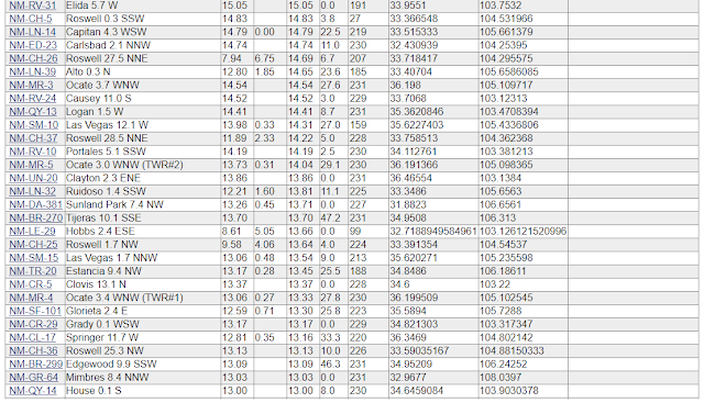
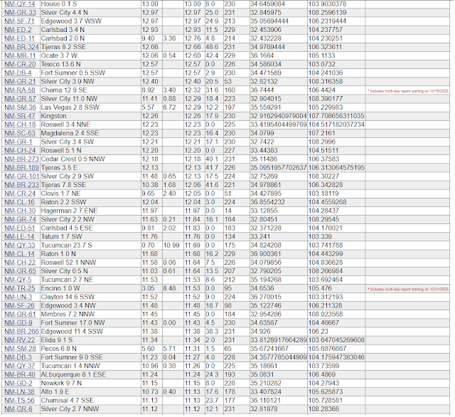
Regional Year-To-Date Rainfall Totals.
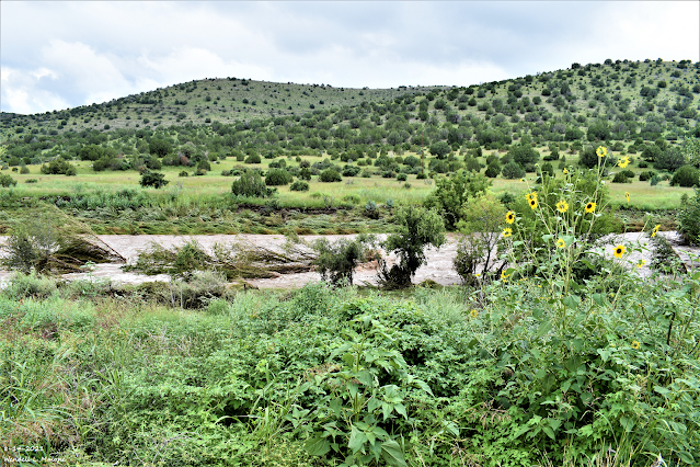
Runyan Ranches Mile Marker #56.
Flash Flooding On The Rio Penasco.
Reported Year-To-Date Rainfall Totals.


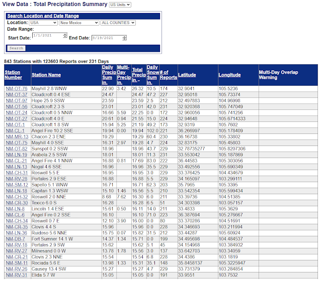

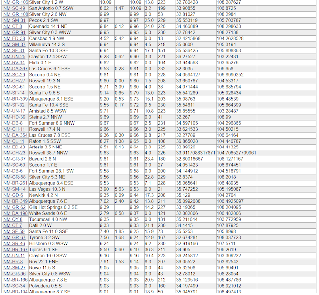
This is a limited summary of the region's yearly rainfall totals (January 1st - August 18, 2021). Some of these totals may not represent the latest up-to-date data available. A CoCoRaHS volunteer rainfall observer located 2.8 miles west-northwest of Mayhill (Otero County) leads the state with a rainfall total so far of 26.32".
Here on the Southeastern plains, the Hope NWS Climate Co-Op Station is the wettest so far this year with 23.59".
The Truth Is Stranger Than Fiction!


Comments
Post a Comment
Your comments, questions, and feedback on this post/web page are welcome.