

Next Fall Storm Inbound With Cooler & Wetter Conditions Thursday Into Saturday.
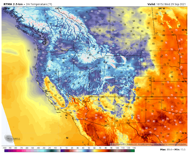
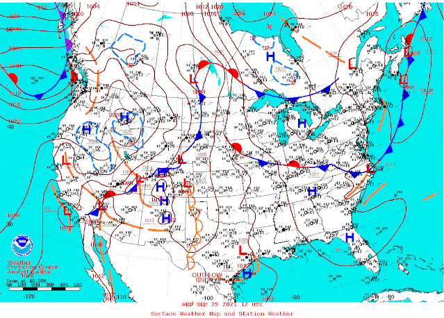
At 6 AM MDT Wednesday, Sept 29, 2021.

Looking at the surface maps a cold front stretched from near San Diego northeast to near Las Vegas to Cheyanne to southern Canada at 6 AM MDT this Wednesday morning. This front is forecast to move southward and eastward today into the weekend. Thursday will see the front work very slowly southward and westward into Southeastern New Mexico and the south-central mountains and southern New Mexico. It is forecast to stall out and or slow down by Friday night just south of the New Mexico border.

At sunrise, this morning a mid-level long-wave trough of low pressure stretched southeastward from the Gulf of Alaska into the Desert Southwest and the Baja Region.
GFS 500 MB (18,000') Forecast.

Forecast models indicate that a closed mid-upper level low will form over Arizona tonight. Then drift slowly southeastward into southern New Mexico on Friday. It then is forecast to open up, weaken, and swing northeastward into the Texas Panhandle Saturday afternoon.
Southeasterly low-level upslope flow behind the approaching cold front will increase the surface moisture over the area Thursday into Friday. Mid-level moisture will surge northward and into New Mexico from the south Thursday into Saturday.
Wednesday.
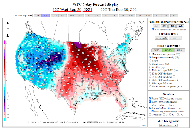
Thursday.
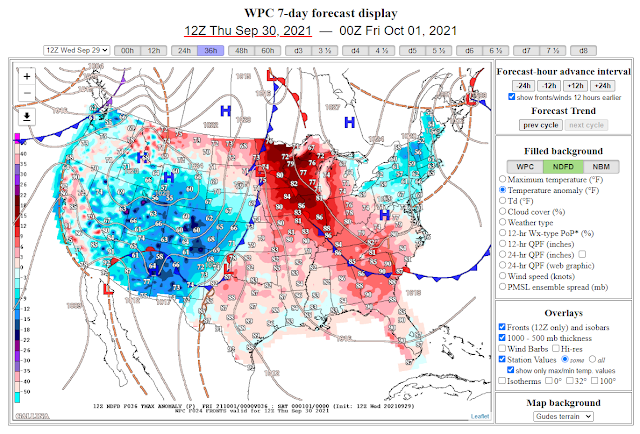
Friday.
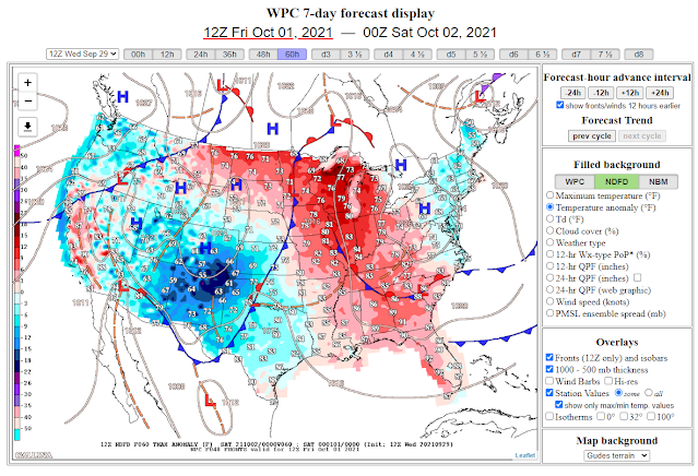
A cooler and much wetter airmass will overspread the state and area Thursday into Friday behind the backdoor cold front. Chances for heavy rain and localized flash flooding will also increase over portions of the state. A turn to more fall-like conditions will overspread the area into the weekend with overcast skies and widespread rainfall. Snow will even be possible across the highest mountain peaks across the state mainly above 11,000'.
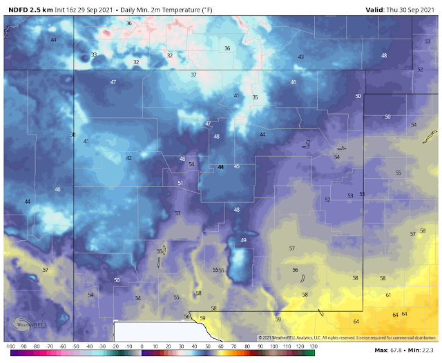
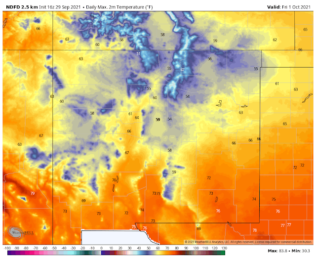
High Temperatures Today.


High Temperatures Thursday.


Low Temperatures Friday.


High Temperatures Friday.

Low Temperatures Saturday.


(Valid Today Through 6 AM Saturday).


(Valid Thursday Into Saturday Morning).
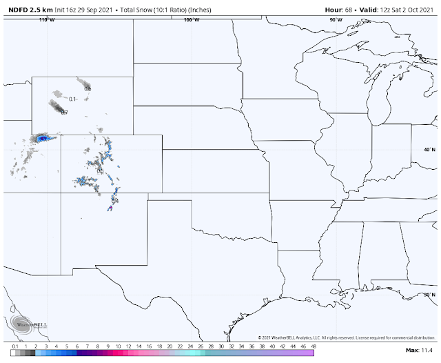
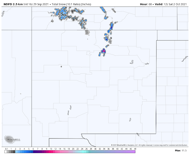
Snow is forecast over the highest elevations of the northern mountains of New Mexico associated with this next inbound storm. Generally speaking, the snow line will run around 11,000' with up to a foot possible Thursday into Saturday morning.
(Past 3-Days).


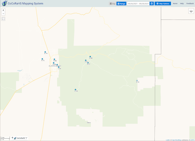
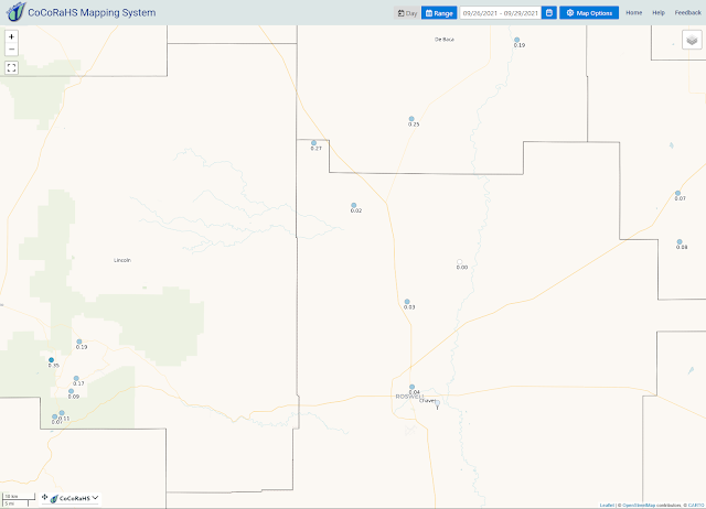
Over the past three days, our first mid-upper level storm produced light to moderate rainfall totals across the Southeastern Plains, the Sacramento mountains, and southern New Mexico.
RAIN 
• 2 NE SAN ANTONITO - 0.78 in.
• 12 SSW EL VADO - 0.72 in.
• 7 SSW COYOTE - 0.62 in.
• OJO ENCINO - 0.47 in.
• 6 SSE QUEMADO LAKE - 0.47 in.
• 2 SE MADRID - 0.46 in.
• FENCE LAKE - 0.36 in.
• 1 ESE CEDAR HILL - 0.33 in.
• 1 SSE LUIS LOPEZ - 0.32 in.
• 1 WNW SANTA CRUZ - 0.30 in.
• 13 ENE BURNHAM - 0.30 in.
• DULCE - 0.27 in.
• 12 N NAVAJO DAM - 0.26 in.
• 2 N CHAMA - 0.25 in.
• 8 NNE OMEGA - 0.25 in.
• 1 S CEDAR HILL - 0.25 in.
• 5 ENE ENSENADA - 0.23 in.
• 3 NE AZTEC - 0.22 in.
• 1 WSW FARMINGTON - 0.21 in.
• 1 SSE ESCONDIDA - 0.17 in.
• 2 WSW AZTEC - 0.17 in.
• 2 NE SOCORRO - 0.16 in.
• 1 ESE AZTEC - 0.15 in.
• 1 E AZTEC - 0.15 in.
• 1 N CANONES - 0.14 in.
• 5 E AZTEC - 0.14 in.
• 2 SW FARMINGTON - 0.13 in.
• 8 SW ALBUQUERQUE - 0.13 in.
• 1 ESE TRUCHAS - 0.12 in.
• 2 NNE FARMINGTON - 0.12 in.
• 3 NE FARMINGTON - 0.10 in.
• 3 WSW FARMINGTON - 0.10 in.
• 2 W DATIL - 0.10 in.
• 3 ENE FARMINGTON - 0.10 in.
• 3 SSW FARMINGTON - 0.10 in.
• 3 S FARMINGTON - 0.10 in.
Last updated:
0919 AM 09/28/20
0919 AM 09/28/20
The Truth Is Stranger Than Fiction!


Comments
Post a Comment
Your comments, questions, and feedback on this post/web page are welcome.