Summer Won't Give It Up - But The Beginning Of The End Is In Sight.
Southeast Of Cloudcroft, New Mexico.
Near The James Ridge Lookout Tower.
Fall Comes Knocking Next Week.
Valid At 6 AM MDT.
Tuesday, Sept 14, 2021.
GFS 500 MB/18,000' Forecast.
Valid At 6 PM MDT.
Monday, Sept 20, 2021.
GFS 300 MB/30,000' Forecast.
Valid At 6 PM MDT.
Monday, Sept 20, 2021.
High pressure at the mid-upper levels of the atmosphere continues to control our local weather and will do so for the rest of this week and into this weekend. Come the first of next week (starting next Monday) changes are on the way.
Our first fall-like storm will dive southeastward out of the Pacific Northwest and into the central Rockies by the first of next week. The jet stream will crave out a mid-upper level closed low that will swing across southern Colorado and northern New Mexico next Monday and Tuesday. This based on this morning's GFS model forecasts. Details concerning the timing and location of this storm will likely change as we get closer to the first of next week and new data is fed into the forecast models.
But overall we should see a trend next week towards cooling temps with a continued shutdown of our annual monsoon.
Snow is in the forecast for parts of the Rockies according to this morning's GFS model forecasts. Last night's European (ECMWF) model picks up on this as well.
Today.
Wednesday.
Thursday.
Friday.
Saturday.
Sunday.
Monday.
Valid At 6 PM MDT.
Monday, Sept 20, 2021.
GFS Forecast Temperature Anomalies.
Valid At 6 PM MDT.
Monday, Sept 20, 2021.
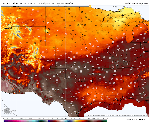
Summer rules our daily weather today into next Monday. Highs at the lower valley locations will continue in the 90's. Across the Sacramento mountains, Cloudcroft will see their high temps in the low-mid 70's today into next Monday. Ruidoso will see highs today in the mid 80's and near 80 the rest of this week into next Monday.
By mid-week, next week, we should experience a cool-down state and areawide.
GFS Snowfall Forecast.
Valid At 6 PM MDT.
Monday, Sept 20, 2021.
ECMWF Snowfall Forecast.
A strong cold front will sweep eastward and southward across the central Rockies late this weekend into the first of next week.
Bitter Lakes Wildlife Refuge - 88/58
Roswell - 88/62
Hope - 85/58
Artesia - 87/57
Carlsbad - 87/63
Carlsbad Airport - 87/62
Carlsbad Caverns - 83/61
Pine Springs - 78/59
Jal - 89/61
Tatum - 85/55
Hobbs - 87/59
Picacho - 82/53
Ruidoso - 74/43
Cloudcroft - 68/43
Mountain Park - 75/51
Alamogordo - 87/59
The Truth Is Stranger Than Fiction!


Comments
Post a Comment
Your comments, questions, and feedback on this post/web page are welcome.