


Widespread Rain Showers & Thunderstorms (Some Severe) Today Into Friday.

Lakewood, NM.
Another Smoky Sunset.
Next Storm Already Impacting The Area.

Valid At 6 PM MDT Today.

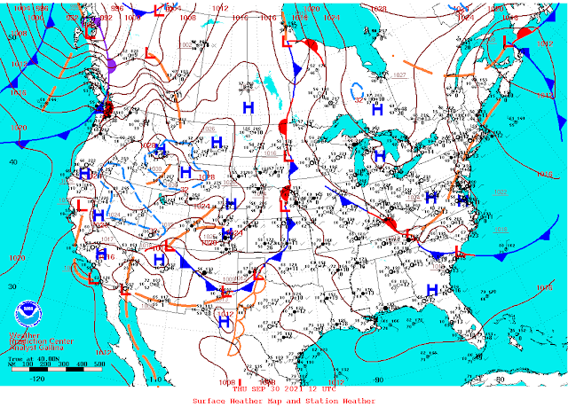
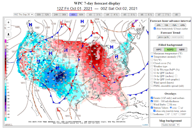
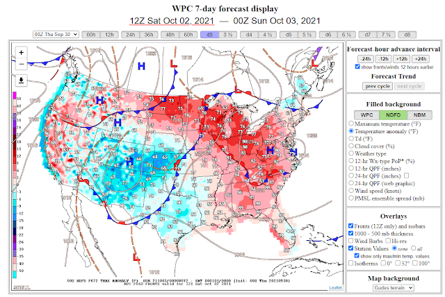
At sunrise this morning a backdoor cold front was easing into Southeastern New Mexico. As of 8:30 AM it had made it as far south as Artesia. The cold front is forecast to continue its slow progression southward and westward today into tonight. A cooler and much wetter airmass will overspread the state and local area today into Sunday with temperatures below seasonal averages to start October off.
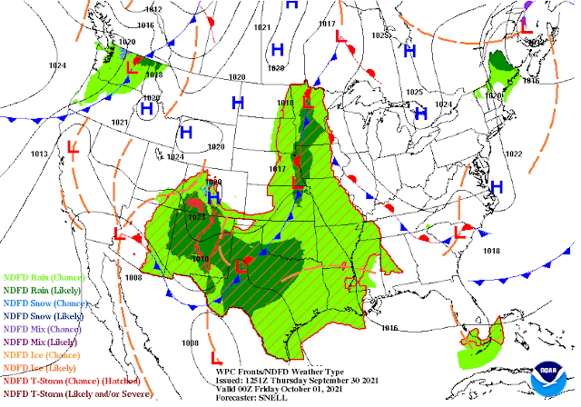
Radar shows scattered to numerous rain showers and a few thunderstorms dotting the landscape this morning. This activity will increase in aerial coverage and intensity today and become more widespread this afternoon into Friday. Localized heavy rainfall and isolated localized flash flooding will also be possible in Southeastern New Mexico. Current model forecasts call for the heaviest rains to remain north of us, however.
Radar shows scattered to numerous rain showers and a few thunderstorms dotting the landscape this morning. This activity will increase in aerial coverage and intensity today and become more widespread this afternoon into Friday. Localized heavy rainfall and isolated localized flash flooding will also be possible in Southeastern New Mexico. Current model forecasts call for the heaviest rains to remain north of us, however.
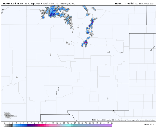
Snow still remains possible across the highest mountain peaks of northern New Mexico generally above 11,000'. It's possible that Sierra Blanca Peak and the upper reaches of Ski Apache could see some snow tonight into Friday. Snow levels are still forecast to run around 11,000' into the weekend.
Severe Weather Outlook Today.
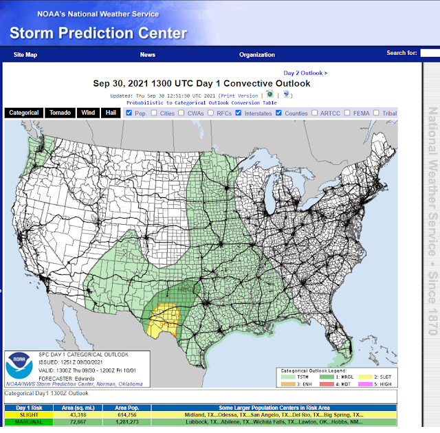
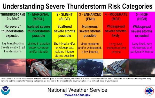
Scattered thunderstorms this morning will become more widespread and stronger this afternoon and early evening across parts of Southeastern New Mexico and nearby West Texas. Some of these will become severe and produce damaging wind gusts in excess of 60, mph, large hail, and frequent deadly cloud to ground lightning. Localized heavy rainfall and flash flooding will also accompany the stronger of these thunderstorms. The tornado threat appears to be low but you can never completely rule this threat out with severe thunderstorms so don't be surprised if a couple do develop this afternoon and early evening.
Today.

Saturday.
Sunday.
Today.


Low Temperatures Friday Morning.


Low Temperatures Saturday Morning.


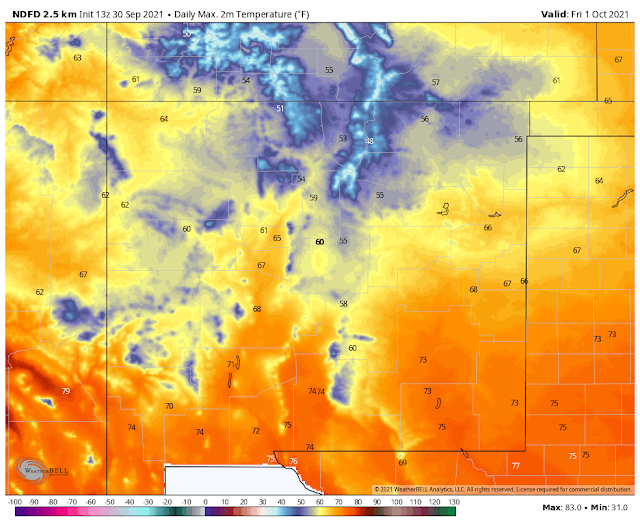
Forecast high temperatures across the lower elevations of Southeastern and parts of West Texas will generally run in the 70's today through Saturday. Sunday will see the thermometer rise back into the 80's. High temperatures across the Sacramento, Capitan, and Guadalupe mountains will range from the 50's to 60's today into the weekend. Lows in the mountains will drop down into the 40's in the Ruidoso area and the 30's in the Cloudcroft area.
The Truth Is Stranger Than Fiction!


Comments
Post a Comment
Your comments, questions, and feedback on this post/web page are welcome.