Current Date & Time

Fall Freeze Data For New Mexico

Storm Surprises Some With Snow.

October 26, 2023.
South Of Cloudcroft, NM.

Storm Surprises Some With Snow.

Friday, Nov 10, 2023.

Storm Total Rainfall & Snowfall Amounts.
(Thursday - Saturday).

Sacramento Camp & Conference Center southwest of Weed 4".
Public reports via Facebook in the Sacramento/Weed/Mayhill area 3" - 4".
Public reports via Facebook in the 16-Springs Canyon area 1" - 2".
James Canyon area 11 miles east of Cloudcroft 21/4". 
Rain briefly mixed with and changed over to light snow in Roswell and Lovington.

Our latest storm was a little stronger than forecast and dropped more snow than was anticipated in a few places. Interestingly enough Cloudcroft officially only managed to pick up a trace of snow from this storm. While the CoCoRaHS Station in town (0.4 ESE) measured 0.3". No reports from Ski Apache were received since they aren't open yet but their webcam showed what looked like to be a at least a couple of inches of fresh snow. 

Here in the Pecos Valley moderate rainfall totals were noted and included .40" from a public report in Atoka, 4 miles south of Artesia. 

Very dense fog enveloped the Sacramento mountains Friday afternoon into early Saturday morning with visibilities reported to be measured less than 100 feet in some areas. Dense fog covered southeastern New Mexico and parts of West Texas this Sunday morning with visibilities less than 1/4 of a mile in places.

Our next storm to impact the state and area will occur late this upcoming week into next weekend with the possibility of lowland rain and mountains snows.

(As Of 8 AM MST Saturday, Nov 11, 2023).

(As Of 8 AM MST Saturday, Nov 11, 2023).


(As Of 8 AM MST Saturday, Nov 11, 2023).


There Are None So Blind As Those Who "Will - Not" To See...107.

Comments

My Blog Archive List (July 2010 - August 2025).

Show more

My Current Weather Conditions

NWS Albuquerque 2026 Winter Outlook

Eddy County

Guadalupe Mtns Eddy & Culberson County

Lea County

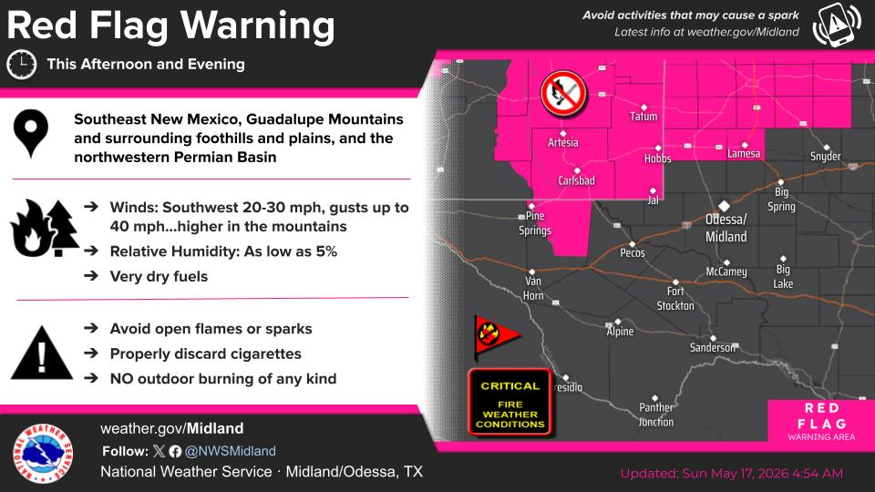
NWS Midland Web Page

NWS Midland Web Page
Click On The Map To Open It Up

SE New Mexico & West Texas Precipitation Forecasts

NWS Midland Hazardous Weather Outlook

NWS Midland Hazardous Weather Outlook
Click On The Image To See The Rest Of The Outlooks

NWS Midland Hazardous Weather Outlook

NWS Midland Hazardous Weather Outlook
Click On The Image To See The Rest Of The Outlooks

NWS Midland Hazardous Weather Outlook

NWS Midland Hazardous Weather Outlook

NWS Midland Forecast Graphic

NWS Midland Graphic Forecast

NWS Midland Forecast Graphic

NWS Midland Graphic Forecast

NWS Midland Forecast High Temperatures Today

NWS Midland Forecast Low Temperatures Tonight

New Mexico

Chaves County Plains & Mtn's

Lincoln County

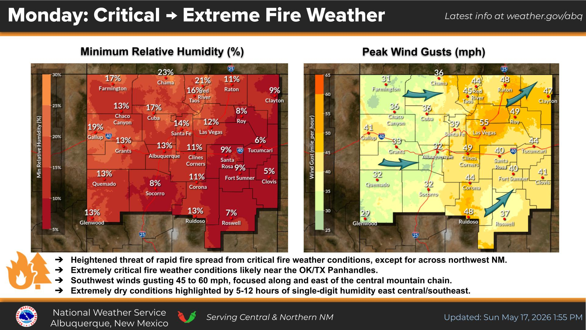
NWS Albuquerque Web Page

NWS Albuquerque Web Page
Click On The Map To Open It Up

NWS Albuquerque New Mexico Precipitation Forecasts

NWS Albuquerque Hazardous Weather Outlook

NWS Albuquerque Hazardous Weather Outlook

NWS Albuquerque Forecast Grpahics

NWS Albuquerque Forecast Graphics

NWS Albuquerque Forecast Graphic

NWS Albuquerque Graphic Forecast

NWS Albuquerque Forecast High Temperatures Today

NWS Albuquerque Forecast Low Temperatures Tonight

NWS Albuquerque Peak Wind Gust Forecast

Texas

Otero County

NWS El Paso Web Page

Southern New Mexico & Far West Texas Precipitation Forecasts

NWS El Paso Hazardous Weather Outlook

NWS El Paso Hazardous Weather Outlook
Click On The Image To See The Rest Of The Outlooks

NWS El Paso Hazardous Weather Outlook

NWS El Paso Hazardous Weather Outlook
Click On The Image To See The Rest Of The Outlooks

NWS El Paso Hazardous Weather Outlook

NWS El Paso Hazardous Weather Outlook

NWS El Paso Hazardous Weather Outlook

NWS El Paso Graphic Forecast

NWS El Paso Graphic Forecast

NWS El Paso Graphic Forecast

NWS El Paso Graphic Forecast

NWS El Paso Graphic Forecast

NWS El Paso Forecast High Temperatures Today

NWS El Paso Forecast Low Temperatures Tonight

NWS Lubbock Web Page

NWS Lubbock Web Page
Click On The Map To Open It Up

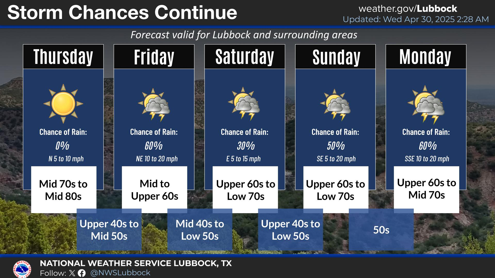
NWS Lubbock South Plains Precipitation Forecasts

NWS Lubbock Hazardous Weather Outlook

NWS Lubbock Hazardous Weather Outlook
Click On The Image To See The Rest Of The Outlooks

NWS Lubbock Hazardous Weather Outlook

NWS Lubbock Hazardous Weather Outlook
Click On The Image To See The Rest Of The Outlooks

NWS Lubbock Hazardous Weather Outlook

NWS Lubbock Hazardous Weather Outlook

NWS Lubbock Graphic Forecast

NWS Lubbock Graphic Forecast

NWS Lubbock Graphic Forecast

NWS Lubbock Graphic Forecast

NWS Lubbock Hi Temperature Forecast Today

NWS Lubbock Low Temperature Forecast Tomight

My Rainfall Totals - 2.1 NNW Downtown Carlsbad

My Rainfall Totals - 2.1 NNW Downtown Carlsbad

My Seasonal Snowfall Totals - 2.1 NNW Downtown Carlsbad

My Seasonal Snowfall Totals - 2.1 NNW Downtown Carlsbad

Disclaimer

This blog and its contents are for informational purposes only! Always have multiple sources of information available to rely upon during severe weather. Do not rely solely on the Internet. Be weather-aware, plan ahead, have a backup plan, and be ready to act before severe weather strikes your location.