Posts

Showing posts from February, 2019

Reported Peak Wind Gusts Friday Night & Saturday.

Image
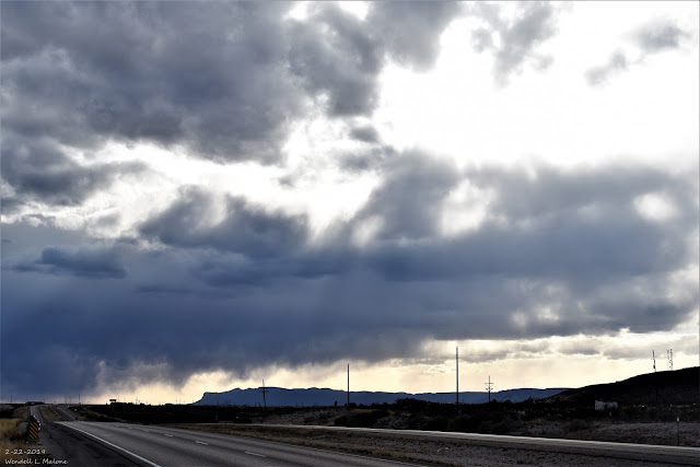
Blog Updated At 3:24 PM MST Saturday. Friday, February 22, 2019. Looking Southwest From North Of Whites City, New Mexico. Virga is a common site this time of the year in New Mexico. The Carlsbad Airport ASOS (Automated Surface Weather Observing System) was reporting that these cumulus cloud bases were 11,000' above the ground Friday afternoon when I shot this photo. Notice the ragged appearance at their bases. These are virga trails or precipitation that is falling from the cloud bases but due to the very dry air at and above the surface is evaporating before it reaches the ground. The temperature at the airport at the time was 70ĀŗF with a dew point temperature of 23ĀŗF producing a relative humidity value of just 17%. Very gusty winds are often associated with virga and when strong enough virga bombs form producing blinding localized areas of blowing dust. Reported Peak Winds Last Night And Today. Peak Wind Gusts Reported Saturday Since Midnight. KOA Cam...

Heavy Snow For The Mountains - High Winds/Blowing Dust For SE NM.

Image
Powerful Winter Storm Moves Across NM Today Into Saturday. Click On This Link For The Latest NWS Watches/Warnings In Effect. Winter Storm Warnings are in effect for western and northern New Mexico. High Wind Watches and Wind Advisories cover Southeastern New Mexico and parts of West Texas. U.S. GFS 500 Millibar/18,000' Analysis. Valid At 11 PM MST Thursday Night. A powerful winter storm that has buried Arizona in heavy snow is forecast to move slowly eastward into New Mexico today into Saturday. Heavy snows are forecast across parts of the state today into tonight. High winds and blowing dust will rake the plains east of the central mountain chain late tonight into Saturday.  Surface Map Forecast. Valid At 11 PM MST Friday Night. HRRR Simulated Radar Forecast. Valid At 8 PM MST Friday Evening. High Wind Watches & Advisories Are In Effect. A Pacific cold front will race across the state tonight as the upper level storm to ou...

Local Snowfall Totals To Date & Saturday's Peak Wind Gusts.

Image
Seasonal Snowfall Totals To Date. (As Of Saturday, February 16, 2019). Snowfall so far this winter season (October 1st - February 16th) has been rather sparse across the southern half of the Southeastern Plains. Notice that roughly from an Artesia to Hobbs line and northward seems to be the cut off point for accumulating snowfall of an inch or more this season.  Ski Apache west of Ruidoso with a base elevation of 9,600' has recorded this seasons highest total so far with 71.5". They currently have a 44" base. That's approximately about half of what they normally average to date.  A CoCoRaHS Station located 1.8 miles southwest of Cloudcroft has recorded a seasonal total of 48.1" to date. The Sunspot CoCoRaHS Station has recorded 47.4" to date and the Nogal CoCoRaHS Station located 4.6 miles south-southeast has recorded 47.0".  The Cloudcroft Climate Co-Op Station (8,679') has only recorded 38.2" of snowfall as...

Poking Fun At AOC's New Green Deal & Climate Change With Some Political Humor.

Image
Courtesy Of TownHall. The Truth Is Stranger Than Fiction - And Sometimes It Hurts!

Wild Weather So Far This February.

Image
136ĀŗF Temperature Difference Friday. RTMA Temperatures At 4 PM MST Friday. February can often offer up some pretty crazy weather extremes and this month has been no exception. There was a 136ĀŗF temperature difference across the nation yesterday.  Take a look at some of the other pretty extreme weather events that have happened so far this month across the nation. Based on the Current Temperature at Austin Camp Mabry (91 degrees based on logging into the ASOS) this is the earliest EVER we have been that warm (period of record dates back to 1897). The previous 'earliest 91+ degree day' at Camp Mabry was 2-17-1959. — NWS Austin/San Antonio (@NWSSanAntonio) February 15, 2019 The National High and Low for the Lower 48 for February 15, 2019 pic.twitter.com/cpTpjX96rF — NWS WPC (@NWSWPC) February 16, 2019 Cut Bank just had 12 consecutive days with a temperature at or below 0 degrees. This is the 2nd longest streak on record. Click the link to read mor...

Current National Weather Service Watches/Warnings In Effect.

New Mexico

Chaves County Plains & Mtn's

Eddy County

Culberson County

Lea County

Lincoln County

Otero County

Current US Temps

Current US Wind Chill/Heat Index Temperatures

WPC 7-Day Precipitation Forecast

Roswell Live EarthCam

Ruidoso Live Webcam

Cloudcroft Live Webcam

NWS Midland 3-Day Precipitation Forecast

NWS Midland 3-Precipitation Chances

New Mexico 3-Day Precipitation Forecast

New Mexico Precipitation Chances

NWS El Paso 3-Day Precipitation Forecast

NWS El Paso Precipitation Chances

New Mexico 3-Day Snowfall Forecast

New Mexico Snowfall Chances

NWS El Paso 3-Day Snowfall Forecast

NWS El Paso Snowfall Chances

US 24-Hour Precipitation Forecast

US 3-Day Precipitation Forecast

US 24-Hour Snowfall Forecast

US 3-Day Snowfall Forecast