Scattered T-Storms Today Into This Evening - Some Severe.
Looking Southwest
On White pine Rd WSW Of Seven Rivers.
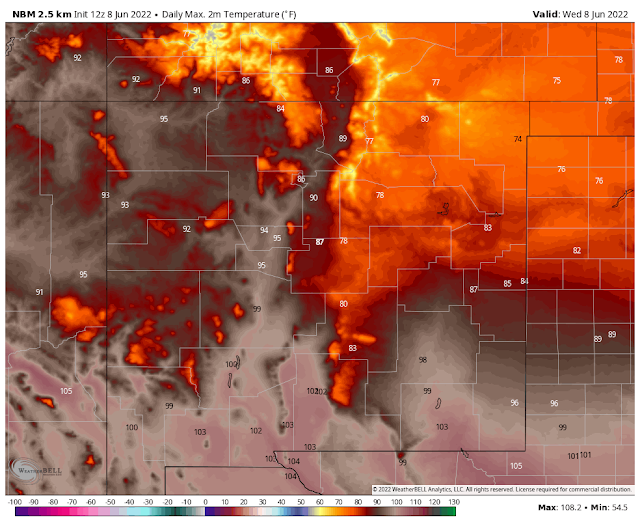
Today.
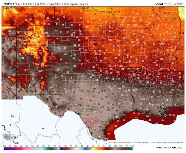
Thursday.
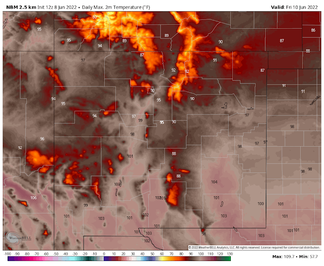
Saturday.
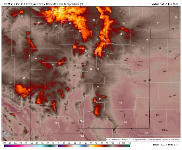
Sunday.
Monday.
At 6 PM MDT Wednesday.
Today Through 6 AM MDT Saturday.
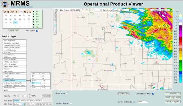
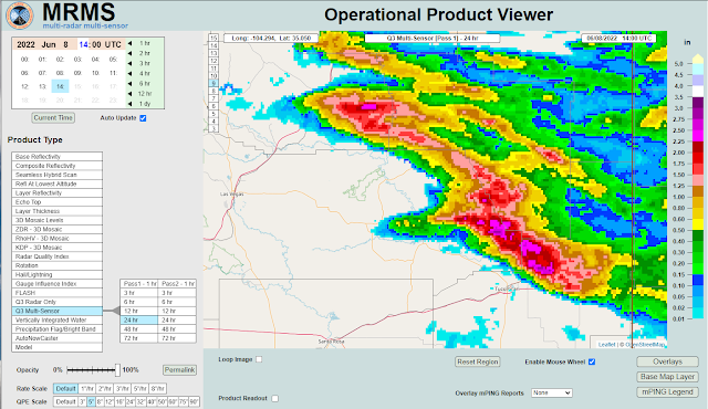
A stationary front was once again draped across Southeastern New Mexico and West Texas this Wednesday morning. Ahead of the front widely scattered thunderstorms develop Tuesday afternoon over Northeastern and Eastern New Mexico. Locally heavy rain fell across parts of that area Tuesday afternoon and evening. Radar estimates of 2"-3" are noted northeast of Las Vegas and north of Tucumcari.
(As of 6 AM MDT Wednesday Morning).
Another round of widely scattered to scattered thunderstorms is forecast this afternoon and evening across the eastern two-thirds of New Mexico roughly from the Rio Grande Valley eastward. These storms will be of the hit-and-miss variety...mostly miss for most, unfortunately.
Locally our chances for measurable rainfall here in Southeastern New Mexico fall into the 20% to 40% category this afternoon and evening.
Across the Sacramento and Capitan Mountains, the chances for measurable rainfall today through this evening are in the 20% to 50% range. You also have a chance for a few severe thunderstorms this afternoon and evening. Chances for rain Thursday through Sunday are around 20% to 30% with scattered thunderstorms.
Across the Sacramento and Capitan Mountains, the chances for measurable rainfall today through this evening are in the 20% to 50% range. You also have a chance for a few severe thunderstorms this afternoon and evening. Chances for rain Thursday through Sunday are around 20% to 30% with scattered thunderstorms.
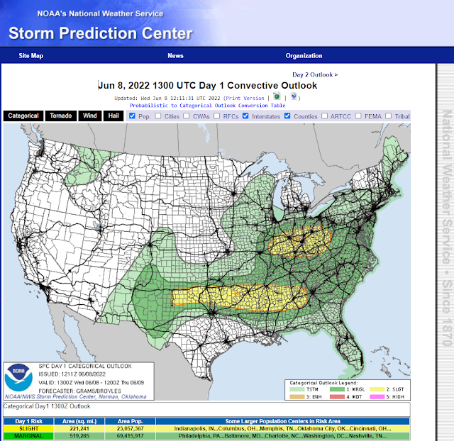
But as has been the pattern of late if you happen to be one of the lucky few who gets a strong or severe thunderstorm then you may also get a decent rain. Not to mention hail and or damaging thunderstorm wind gusts. Marginally severe thunderstorms are forecast over all of the areas mentioned above this afternoon and evening.
Large hail and damaging thunderstorm wind gusts in excess of 58 mph along with deadly cloud-to-ground lightning will be the primary threats. An isolated tornado is not out of the question nor is localized flash flooding. Of particular concern will the Hermits Peak, Calf Canyon, and Cooks Peak burn scar areas. The McBride burn scar in Ruidoso may also be subject to flash flooding.
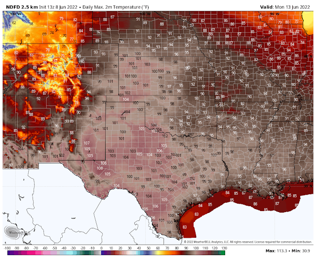
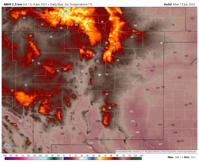
Highs today will be tempered by the cooler air behind the cold front and thunderstorm activity over the eastern one-third of the state. Highs this afternoon in Northeastern and Eastern New Mexico will only be in the 70's and 80's while the far Southeastern Plains once again soar up to around 103. Saturday, Sunday and Monday look to be brutal across the Southeastern Plains with highs ranging from 105 to near 108...maybe a little higher Monday.
There Are None So Blind As Those Who "Will - Not" To See...107.











Comments
Post a Comment
Your comments, questions, and feedback on this post/web page are welcome.