Scattered T-Storms Today Into Tonight - Some Severe!
(6 AM MDT Wednesday Morning).
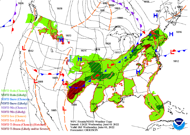
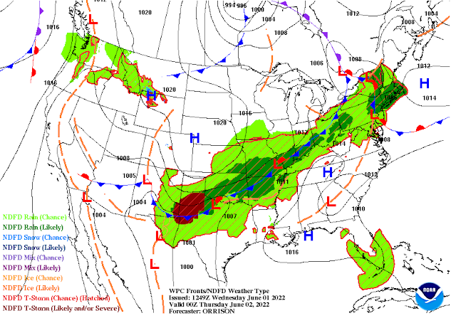
Surface Map Forecast.
Noon MDT Today.
6 PM MDT This Afternoon.
Forecast Storm Total Rainfall Amounts.
(Today Through 6 AM MDT Saturday).
NWS NDFD Forecast.
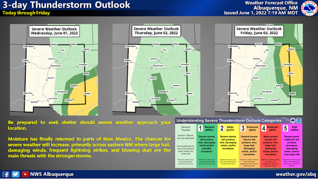
Bad News - Some May Be Severe!
Overnight the dryline backed westward into Southeastern New Mexico and as of 9 AM MDT this Wednesday morning it was located along the east slopes of the Sacramento and Guadalupe Mountains. The Dunken Raws is reporting a dew point temperature of 54 and the Queen Raws 53. Low-level southeasterly upslope flow will continue to import moisture into the area today. And easterly upslope flow behind the cold front will add to the mix.
At sunrise, a stationary front was draped along a line from near Clines Corners to north of Roswell and near Portales. The front will sag southward today providing additional lift and support for thunderstorm activity.
Southeastern New Mexico and nearby West Texas will see the triple point set up today which will also aid in the development of thunderstorms. As will outflow boundaries from last night's thunderstorms.
Overall a fairly decent setup will exist over the area today into tonight for thunderstorm development. Some storms may become severe and produce large to very large hail, damaging thunderstorm wind gusts possibly in the 60-80 mph range, deadly cloud to ground lightning, and localized heavy rainfall which could produce localized flash flooding.
An isolated tornado or two is not out of the question. Remember supercell thunderstorms can and do produce tornadoes.
Yesterday marked the 31st anniversary of the Wagon Wheel F-2 Tornado that touched down south of Carlsbad on May 31st, 1991 at 8:39 PM MDT.
21 people were injured by the tornado. The tornado was exactly 285 yards wide and a mile long. The tornado lifted shortly after it destroyed a garage full of vehicles at the corner of Harkness and Old Cavern Highway. The time that the tornado was on the ground was only minutes according to witnesses.
Thirteen mobile homes were completely destroyed and fifty-seven other homes, barns, sheds, and outbuildings were damaged by the tornado. See my blog post with the photos I took via the link above.
There Are None So Blind As Those Who "Will - Not" To See...107.


Comments
Post a Comment
Your comments, questions, and feedback on this post/web page are welcome.