

I Can See For Miles & Miles On A Clear Winter's Day.

First February Sunrise Over The Guadalupe Mtn's.
Our January Thaw May Be Coming To An End In A Week.
New Mexico On A Clear Winter's Day.


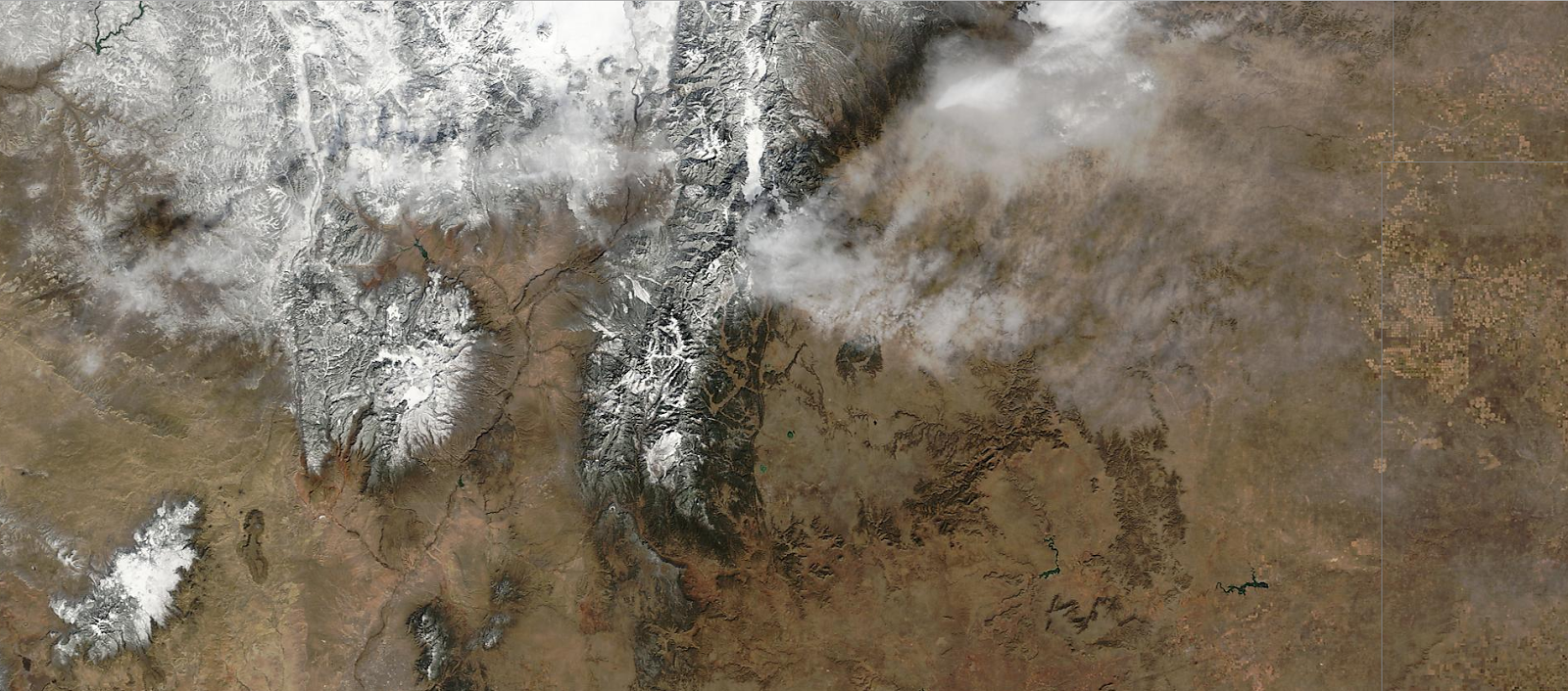
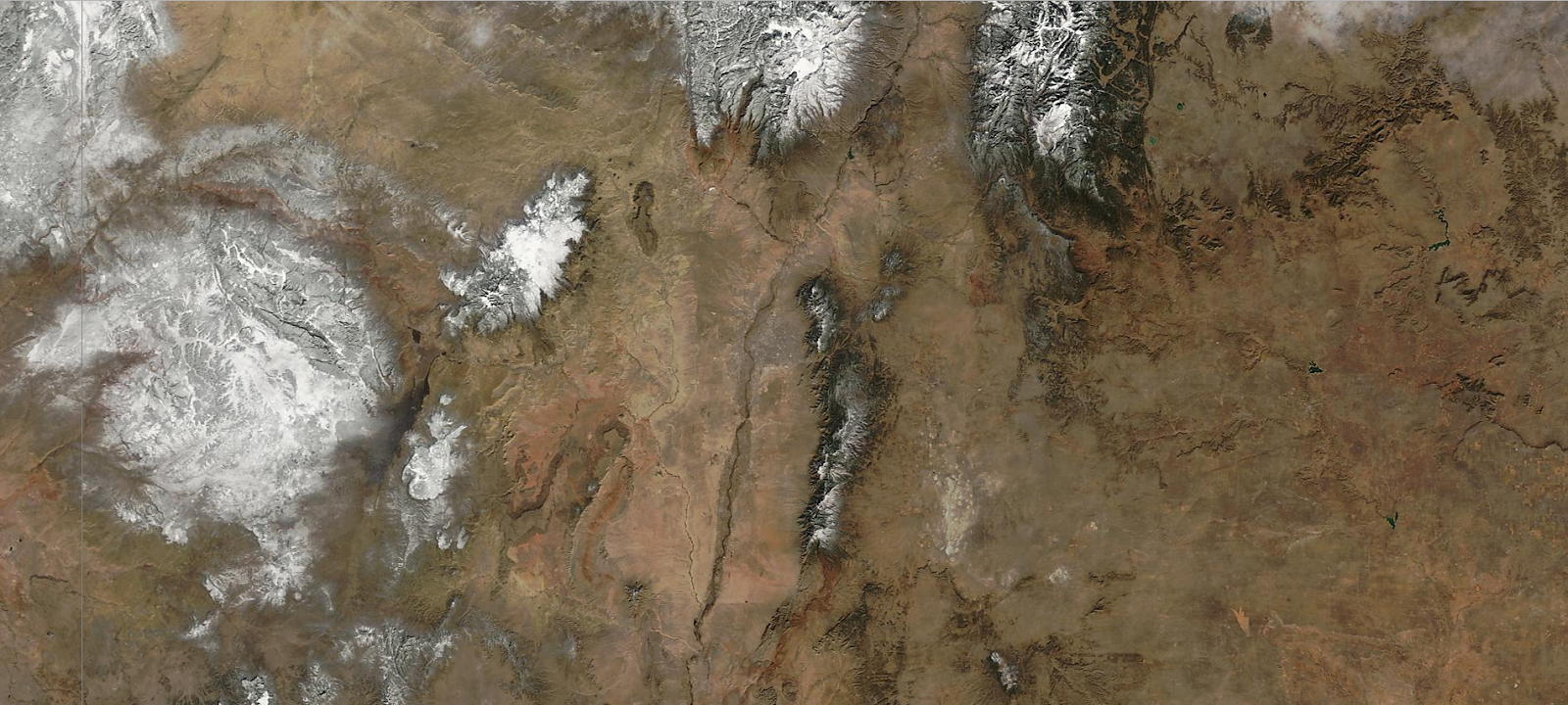


I Can See For Miles And Miles And Miles! This pretty much describes how we started February this year. Its been rather quiet over the state for the past few days and this trend overall will continue for about another week or so. Then another winter storm looms on the forecast models horizon.
So far this winter this winter I've climbed up to or over 75ºF here at our home in Carlsbad, NM on nine different days. More than likely I'll add another couple of days to the count this week.
My Temperature Graph This Winter.
My Temperature Graph This Winter.
(Dec 1st 2016 - Feb4th, 2017).

My Daily High Temps 75ºF Or Higher.
December 11th, 2016 77ºF
December 16th, 2016 77ºF
December 28th, 2016 78ºF
January 9th, 2017 83ºF
January 10th, 2017 77ºF
January 11th, 2017 78ºF
January 12th, 2017 75ºF
January 31st, 2017 76ºF
February 1st, 2017 77ºF
My coldest temperature recorded so far this winter has been 12ºF which occurred on the mornings of December 18th and January 7th. Roswell officially dropped down to 2ºF on January the 7th, Artesia 7ºF also on January 7th, and Carlsbad 10ºF on January 7th. Hobbs recorded a low of 12ºF on January 7th. Cloudcroft dipped to 3ºF on January 28th.
So looking at my temperature graph above its easy to see that we've had some pretty crazy temperature swings this winter. Also of note is how many of my nighttime low temperatures have failed to fall below freezing.
Angel Fire Airport Dips To -35ºF.
(On January 7th, 2017).
(On January 7th, 2017).

Right next door to the Angel Fire Airport is Eagle Nest (8,260'). Typically one of the coldest spots in New Mexico in the winter. On January 6th, 1971 they officially recorded a low temperature of -47ºF, which was tied again on January 11th, 1962. New Mexico's coldest temperature was recorded at Gavilan on February 1st, 1951 when their thermometer bottomed out at -50ºF. Unofficially and widely reported by the press at the time the tiny community of Ciniza recorded a low of -57ºF on January 13th, 1963.
Monday Likely Warmest Day Of Week.
U.S. GFS Surface Temperature Anomaly Forecast.
(Temperature Departures From Normal).

Valid @ 5 PM MST Monday, Feb 6, 2017.

European (ECMWF) 500 MB Forecast.

Valid @ 5 PM MST Sunday, Feb 12, 2017.
Canadian (GEM) 500 MB Forecast.

Valid @ 5 PM MST Sunday, Feb 12, 2017.
U.S. GFS 500 MB Forecast.

Valid @ 5 PM MST Sunday, Feb 12, 2017.
Canadian (GEM) Snowfall Forecast.

Valid @ 5 AM MST Monday, Feb 13, 2017.
U.S. GFS Snowfall Forecast.

Valid @ 5 AM MST Monday, Feb 13, 2017.
U.S. GFS Rainfall Forecast.

So don't give up on winter just yet. In about a week it appears that our January thaw may be coming to an end.
The Truth Is Stranger Than Fiction!


Comments
Post a Comment
Your comments, questions, and feedback on this post/web page are welcome.