

Forecast Models Are Struggling With Our Thanksgiving Storm.
Valid At 5 PM MST Thanksgiving Day.
German (ICON) 500 Millibar (18,000') Forecast.

Valid At 5 PM MST Thanksgiving Day.
Japanese (JMA) 500 Millibar (18,000') Forecast.

Valid At 5 PM MST Thanksgiving Day.
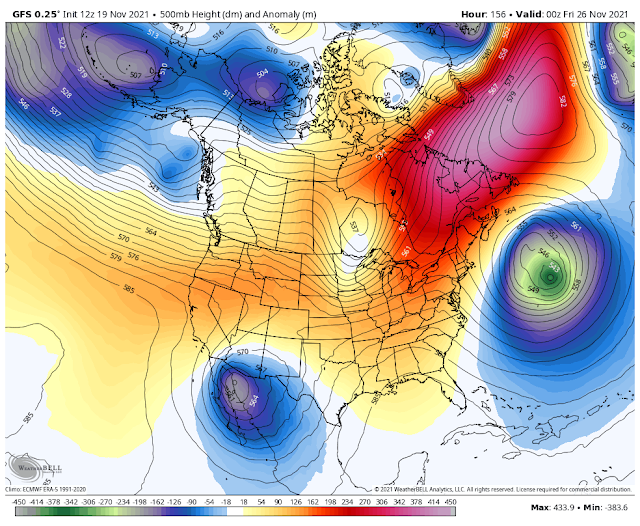
European (ECMWF) 500 Millibar (18,000') Forecast.

Canadian (GEM) 500 Millibar (18,000') Forecast.

Forecast Models Are Struggling With Our Thanksgiving Storm.
Disagreement in the computer model forecasts remains today's theme. This morning's run of the US GFS and German ICON forecast models are calling for the best chances of seeing meaningful precipitation from next week's potential winter storm. Both of these models develop a closed low over northwestern Mexico Thanksgiving at sunset. The GFS remains the wettest with its forecasts and is calling (at this time anyway) for decent rainfall totals at the lower elevations of the area and modest snowfall totals in the mountains.

Valid At 5 PM MST Thanksgiving Day.
GFS Storm Total Precipitation Amounts.

Valid At 5 PM MST Thanksgiving Day.
GFS Storm Total Snowfall Amounts.

Valid At 5 AM MST Saturday Morning, November 27, 2021.
Still Early To Know For Sure.
We are still six days out from our first potential winter storm to affect the area starting Thanksgiving Day if not sooner. As you can guess this means that confidence in what this storm will or will not produce is still low this far out in time from the event. We may see our first soaking rains across the valleys and moderate snowfall in the mountains next week. And then again we may not. As always what happens or not is highly dependent upon the exact track and strength of the storm. As well as how much subtropical moisture it is able to import into the area and how cold of a storm it will be. I'll keep you updated with the latest.
The Truth Is Stranger Than Fiction!


Comments
Post a Comment
Your comments, questions, and feedback on this post/web page are welcome.