


Winter Storm Just In Time For Thanksgiving?
November 5, 2021.
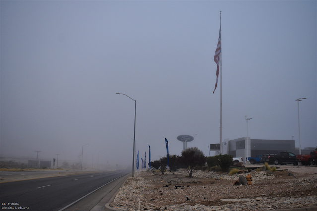
Carlsbad, New Mexico.
(As Of 7:30 AM MST).


A cold front moved south through the area yesterday into last night bringing colder temperatures with it. After seeing high temps hitting record levels the past few days today's readings will be slightly below normal for the date. At sunrise this morning reported low temperatures across the area were chilly with a few single digit readings in the higher mountain valleys of northern New Mexico. Some of the coldest low temperatures of the season are occurring this morning.
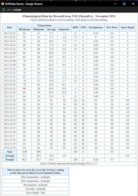
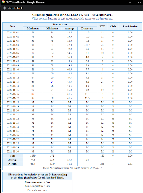
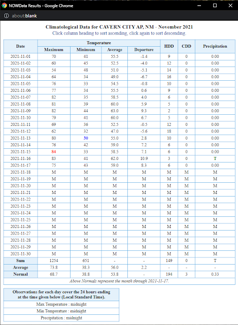
November Climate Data.

Like October's readings, November has started off warmer than normal thus far. This may change beginning late next week, however.

Seasonal Snowfall To-Date.

Winter Storm Just In Time For Thanksgiving?

GFS Precipitation Type Forecast.

All three of the computer forecast models (GFS, ECMWF, GEM) are pointing to a potential winter storm developing over the area late next week around Thanksgiving. That said that's about the only thing that they are in agreement on at this early stage. Last night's midnight run of the GFS model is the most ambitious and tries to develop a closed low over the southern half of the state by Thanksgiving night into next Friday.
Last night's run of the Canadian GEM has the same idea but forecasts a closed low to develop well south of San Diego Thanksgiving night. The European model has a large elongated trough from the northern plains southwestward into northern Mexico Thanksgiving night.
As is usually the case this far out in time it's just way too early to try and pin this storm down with any details. However, long-range forecasts have been picking up on this change for a while now. So hope is in the air for badly needed precipitation including snow. I've now gone 48 days without measurable precipitation being recorded at our home in Carlsbad.
NWS NDFD Forecast High/Low Temperatures.
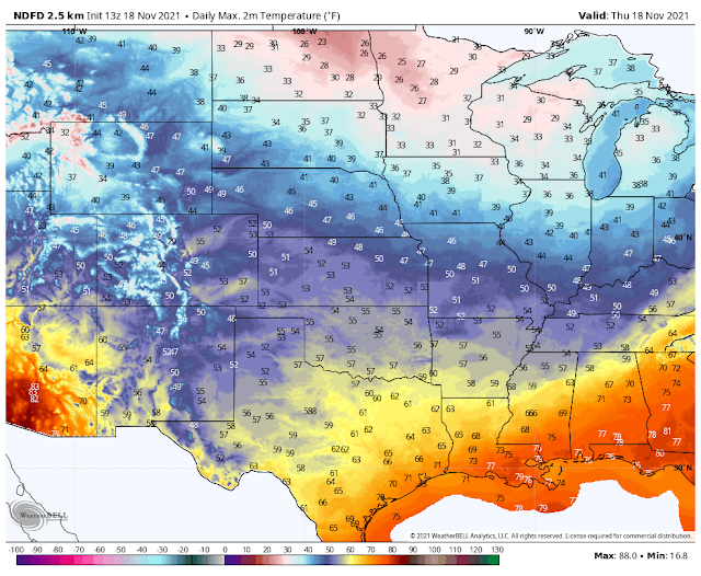
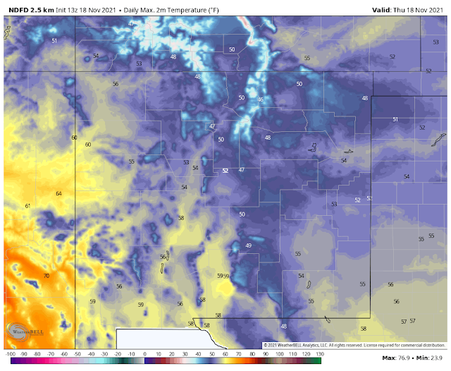
Today's afternoon high temperatures will be about ten degrees normal for the date with the mid 50's forecast for the Southeastern Plains and West Texas.
Tonight's Forecast Lows.


Friday's Forecast Highs.


The Truth Is Stranger Than Fiction!


.png)


Comments
Post a Comment
Your comments, questions, and feedback on this post/web page are welcome.